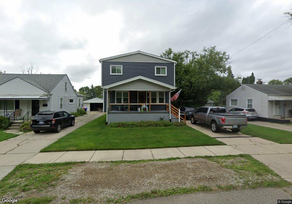
33556 Duncan Fraser, MI 48026
Estimated Value: $173,000 - $207,000
4
Beds
2
Baths
1,620
Sq Ft
$120/Sq Ft
Est. Value
About This Home
This home is located at 33556 Duncan, Fraser, MI 48026 and is currently estimated at $195,173, approximately $120 per square foot. 33556 Duncan is a home located in Macomb County with nearby schools including Thomas A. Edison Elementary School, Richards Middle School, and Fraser High School.
Ownership History
Date
Name
Owned For
Owner Type
Purchase Details
Closed on
Jan 8, 2020
Sold by
Davey Tricia A and Johnson Angela D
Bought by
Davey Joshua M and Davey Carly J
Current Estimated Value
Home Financials for this Owner
Home Financials are based on the most recent Mortgage that was taken out on this home.
Original Mortgage
$131,233
Outstanding Balance
$116,283
Interest Rate
3.75%
Mortgage Type
FHA
Estimated Equity
$78,890
Purchase Details
Closed on
Nov 14, 2017
Sold by
Johnston Sharon K
Bought by
Johnston Sharon K and Johnston Angela D
Create a Home Valuation Report for This Property
The Home Valuation Report is an in-depth analysis detailing your home's value as well as a comparison with similar homes in the area
Home Values in the Area
Average Home Value in this Area
Purchase History
| Date | Buyer | Sale Price | Title Company |
|---|---|---|---|
| Davey Joshua M | $100,000 | Sterling Title Agency | |
| Johnston Sharon K | -- | None Available |
Source: Public Records
Mortgage History
| Date | Status | Borrower | Loan Amount |
|---|---|---|---|
| Open | Davey Joshua M | $131,233 |
Source: Public Records
Tax History
| Year | Tax Paid | Tax Assessment Tax Assessment Total Assessment is a certain percentage of the fair market value that is determined by local assessors to be the total taxable value of land and additions on the property. | Land | Improvement |
|---|---|---|---|---|
| 2025 | $2,548 | $98,000 | $0 | $0 |
| 2024 | $25 | $97,200 | $0 | $0 |
| 2023 | $2,382 | $86,100 | $0 | $0 |
| 2022 | $2,342 | $71,500 | $0 | $0 |
| 2021 | $2,317 | $66,900 | $0 | $0 |
| 2020 | $2,234 | $57,300 | $0 | $0 |
| 2019 | $2,584 | $51,500 | $0 | $0 |
| 2018 | $2,584 | $46,900 | $0 | $0 |
| 2017 | $2,218 | $43,047 | $9,435 | $33,612 |
| 2016 | $2,119 | $43,031 | $0 | $0 |
| 2015 | -- | $51,890 | $0 | $0 |
| 2013 | $1,984 | $45,813 | $0 | $0 |
| 2011 | -- | $50,708 | $10,081 | $40,627 |
Source: Public Records
Map
Nearby Homes
- 33530 Utica Rd Unit 9
- 33420 Utica Rd
- 33710 Mulvey
- 34231 Garfield Cir
- 34273 Garfield Cir Unit 5
- 0 14 Mile Rd
- 34446 Sycamore Dr Unit 9
- 16572 Rosemary
- 17548 Adolph
- 34644 Mercer Unit 92
- 15743 Greenview
- 34673 Clarkson Dr E Unit 78
- 34650 Clarkson Dr W Unit 43
- 34868 Mercer Unit 4
- 15801 Toulouse Unit 6
- 16143 Clarkson Dr Unit 2
- 15715 Exeter Ct
- 16131 Blue Spruce Ln Unit 12
- 31745 Schoolcraft
- 16845 Tremlett Dr
Your Personal Tour Guide
Ask me questions while you tour the home.