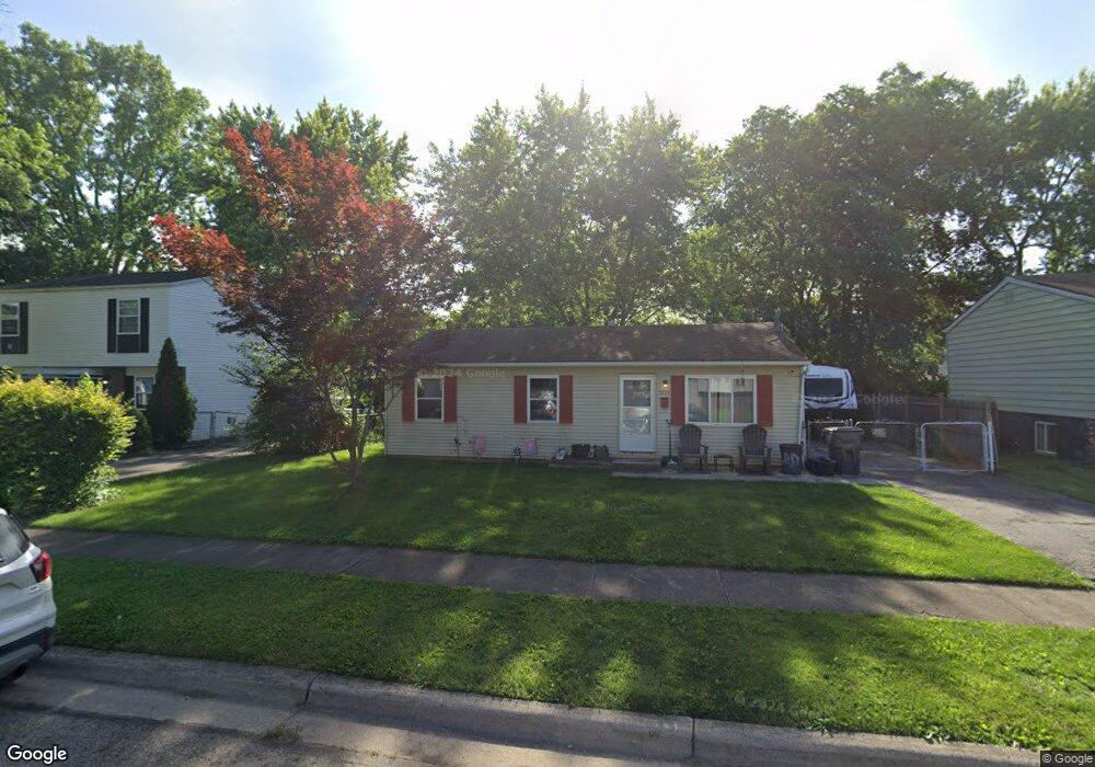
3359 Everson Rd E Columbus, OH 43232
East Columbus-White Ash NeighborhoodEstimated Value: $216,909 - $236,000
3
Beds
2
Baths
1,191
Sq Ft
$191/Sq Ft
Est. Value
About This Home
This home is located at 3359 Everson Rd E, Columbus, OH 43232 and is currently estimated at $226,977, approximately $190 per square foot. 3359 Everson Rd E is a home located in Franklin County with nearby schools including Groveport Madison High School, A+ Arts Academy, and Brice Christian Academy Elementary School.
Ownership History
Date
Name
Owned For
Owner Type
Purchase Details
Closed on
Sep 18, 2024
Sold by
Carrell Jean M and Reef Jean M
Bought by
Reef Jean M and Naegele Electa M
Current Estimated Value
Purchase Details
Closed on
Apr 25, 2002
Sold by
Bird Stephen Anthony and Bird Constance Ann
Bought by
Carrell Jean M
Home Financials for this Owner
Home Financials are based on the most recent Mortgage that was taken out on this home.
Original Mortgage
$86,541
Interest Rate
7.16%
Mortgage Type
FHA
Purchase Details
Closed on
Sep 7, 1977
Bought by
Bird Stephen A
Create a Home Valuation Report for This Property
The Home Valuation Report is an in-depth analysis detailing your home's value as well as a comparison with similar homes in the area
Home Values in the Area
Average Home Value in this Area
Purchase History
| Date | Buyer | Sale Price | Title Company |
|---|---|---|---|
| Reef Jean M | -- | None Listed On Document | |
| Carrell Jean M | $87,900 | Connor Title Co | |
| Bird Stephen A | -- | -- |
Source: Public Records
Mortgage History
| Date | Status | Borrower | Loan Amount |
|---|---|---|---|
| Previous Owner | Carrell Jean M | $86,541 |
Source: Public Records
Tax History
| Year | Tax Paid | Tax Assessment Tax Assessment Total Assessment is a certain percentage of the fair market value that is determined by local assessors to be the total taxable value of land and additions on the property. | Land | Improvement |
|---|---|---|---|---|
| 2025 | $3,064 | $63,320 | $16,280 | $47,040 |
| 2024 | $3,064 | $63,320 | $16,280 | $47,040 |
| 2023 | $3,043 | $63,320 | $16,280 | $47,040 |
| 2022 | $2,093 | $34,550 | $6,060 | $28,490 |
| 2021 | $2,137 | $34,550 | $6,060 | $28,490 |
| 2020 | $2,141 | $34,550 | $6,060 | $28,490 |
| 2019 | $2,111 | $29,960 | $5,250 | $24,710 |
| 2018 | $2,171 | $29,960 | $5,250 | $24,710 |
| 2017 | $2,134 | $29,960 | $5,250 | $24,710 |
| 2016 | $2,216 | $28,250 | $3,920 | $24,330 |
| 2015 | $2,220 | $28,250 | $3,920 | $24,330 |
| 2014 | $2,045 | $28,250 | $3,920 | $24,330 |
| 2013 | $987 | $31,360 | $4,340 | $27,020 |
Source: Public Records
Map
Nearby Homes
- 3302 Everson Rd E
- 5422 Everson Rd N
- 3246 Latonia Rd
- 5323 Sundale Place S
- 5361 Parkline Dr
- 3333 Latonia Ct
- 5143 Rutledge Dr N
- 3434 Latonia Rd
- 3275 Faycrest Rd
- 2998 Osgood Rd E
- 5290 Quincy Dr
- 5373 Spire Ln
- 3455 Tremaine Rd
- 5691 Matuka Dr
- 3493 Tremaine Rd
- 4878 Amber Crossing Dr
- 5189 Zimmer Dr
- 5414 Paladim Rd
- 2900 Gentry Ln
- 4942 Talbert Dr
- 3347 Everson Rd E
- 3367 Everson Rd E
- 3352 Everson Rd W
- 3377 Everson Rd E
- 3343 Everson Rd E
- 3344 Everson Rd W
- 3360 Everson Rd W
- 3364 Everson Rd E
- 3336 Everson Rd W
- 3368 Everson Rd W
- 3356 Everson Rd E
- 3335 Everson Rd E
- 3389 Everson Rd E
- 3346 Everson Rd E
- 3376 Everson Rd E
- 3338 Everson Rd W
- 3330 Everson Rd W
- 3376 Everson Rd W
- 3338 Everson Rd E
- 3325 Everson Rd E
Your Personal Tour Guide
Ask me questions while you tour the home.