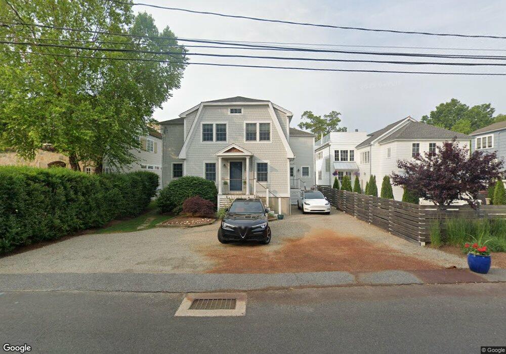
336 Compo Rd S Westport, CT 06880
Compo NeighborhoodEstimated Value: $1,793,000 - $2,789,134
4
Beds
3
Baths
2,488
Sq Ft
$982/Sq Ft
Est. Value
About This Home
This home is located at 336 Compo Rd S, Westport, CT 06880 and is currently estimated at $2,442,284, approximately $981 per square foot. 336 Compo Rd S is a home located in Fairfield County with nearby schools including Green's Farms School, Bedford Middle School, and Staples High School.
Ownership History
Date
Name
Owned For
Owner Type
Purchase Details
Closed on
Jun 30, 1995
Sold by
Zegras Peter
Bought by
Seidman Myles and Seidman Jennifer
Current Estimated Value
Purchase Details
Closed on
Jun 24, 1987
Sold by
Mantel Arlene
Bought by
Zegras Peter
Create a Home Valuation Report for This Property
The Home Valuation Report is an in-depth analysis detailing your home's value as well as a comparison with similar homes in the area
Home Values in the Area
Average Home Value in this Area
Purchase History
| Date | Buyer | Sale Price | Title Company |
|---|---|---|---|
| Seidman Myles | $385,000 | -- | |
| Seidman Myles | $385,000 | -- | |
| Zegras Peter | $455,000 | -- |
Source: Public Records
Mortgage History
| Date | Status | Borrower | Loan Amount |
|---|---|---|---|
| Open | Zegras Peter | $275,000 | |
| Open | Zegras Peter | $560,000 | |
| Closed | Zegras Peter | $302,000 |
Source: Public Records
Tax History Compared to Growth
Tax History
| Year | Tax Paid | Tax Assessment Tax Assessment Total Assessment is a certain percentage of the fair market value that is determined by local assessors to be the total taxable value of land and additions on the property. | Land | Improvement |
|---|---|---|---|---|
| 2025 | $15,805 | $838,000 | $600,700 | $237,300 |
| 2024 | $15,604 | $838,000 | $600,700 | $237,300 |
| 2023 | $15,357 | $836,900 | $600,700 | $236,200 |
| 2022 | $15,123 | $836,900 | $600,700 | $236,200 |
| 2021 | $15,123 | $836,900 | $600,700 | $236,200 |
| 2020 | $14,344 | $858,400 | $609,100 | $249,300 |
| 2019 | $14,473 | $858,400 | $609,100 | $249,300 |
| 2018 | $8,969 | $842,800 | $609,100 | $233,700 |
| 2017 | $8,803 | $842,800 | $609,100 | $233,700 |
| 2016 | $14,210 | $842,800 | $609,100 | $233,700 |
| 2015 | $12,095 | $668,600 | $447,700 | $220,900 |
| 2014 | $11,995 | $668,600 | $447,700 | $220,900 |
Source: Public Records
Map
Nearby Homes
- 260 Hillspoint Rd
- 5 Hidden Hill Rd
- 11 Sterling Dr
- 216 Hillspoint Rd
- 195 Hillspoint Rd
- 48 Compo Mill Cove
- 14 Owenoke Park
- 39 Compo Pkwy
- 46 Compo Mill Cove
- 46 Compo Mill Cove
- 33 Burnham Hill
- 32 Edgewater Hillside
- 11 Edgewater Hillside
- 61 Edgewater Commons Ln
- 11 Manitou Ct
- 109 Greens Farms Rd
- 171 & 169 Compo Rd S
- 123 Greens Farms Rd
- 6 Stony Point Rd
- 11 Wake Robin Rd
- 340 Compo Rd S
- 338 Compo Rd S
- 334 Compo Rd S
- 332 Compo Rd S
- 2 Bluewater Hill S
- 346 Compo Rd S
- 330 Compo Rd S
- 1 Bluewater Hill S
- 12 Fairfield Ave
- 14 Fairfield Ave
- 4 Bluewater Ln
- 16 Fairfield Ave
- 326 Compo Rd S
- 18 Fairfield Ave
- 33 Soundview Dr
- 39 Soundview Dr
- 10 Fairfield Ave
- 20 Fairfield Ave
- 3 Bluewater Hill
- 37 Soundview Dr