Estimated Value: $136,000 - $160,667
--
Bed
--
Bath
1,216
Sq Ft
$120/Sq Ft
Est. Value
About This Home
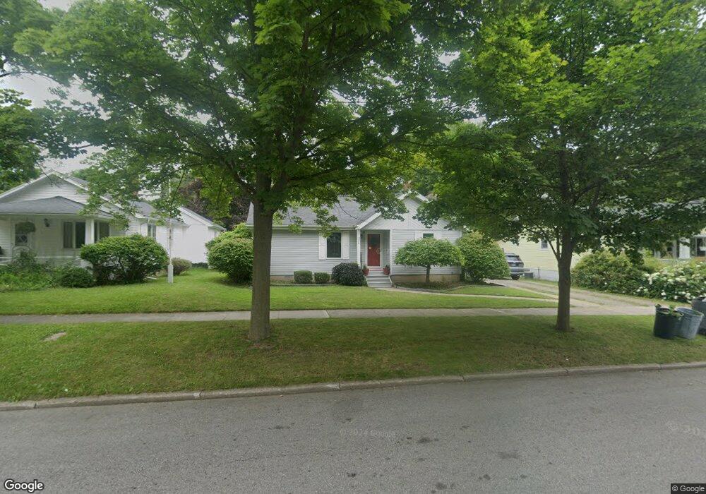
This home is located at 336 W Grant St, Caro, MI 48723 and is currently estimated at $145,667, approximately $119 per square foot. 336 W Grant St is a home with nearby schools including McComb Elementary School, Schall Elementary School, and Caro Middle School.
Ownership History
Date
Name
Owned For
Owner Type
Purchase Details
Closed on
Aug 20, 2021
Sold by
Baranski Susan
Bought by
Norris Laura
Current Estimated Value
Home Financials for this Owner
Home Financials are based on the most recent Mortgage that was taken out on this home.
Original Mortgage
$93,000
Outstanding Balance
$70,509
Interest Rate
2.1%
Mortgage Type
New Conventional
Estimated Equity
$75,158
Purchase Details
Closed on
Aug 15, 2016
Sold by
Reid Ruby L and Reid Donald C
Bought by
Baranski Susan L
Create a Home Valuation Report for This Property
The Home Valuation Report is an in-depth analysis detailing your home's value as well as a comparison with similar homes in the area
Home Values in the Area
Average Home Value in this Area
Purchase History
| Date | Buyer | Sale Price | Title Company |
|---|---|---|---|
| Norris Laura | $99,500 | Michigan Trusted Title Agcy | |
| Baranski Susan L | $74,500 | None Available |
Source: Public Records
Mortgage History
| Date | Status | Borrower | Loan Amount |
|---|---|---|---|
| Open | Norris Laura | $93,000 |
Source: Public Records
Tax History Compared to Growth
Tax History
| Year | Tax Paid | Tax Assessment Tax Assessment Total Assessment is a certain percentage of the fair market value that is determined by local assessors to be the total taxable value of land and additions on the property. | Land | Improvement |
|---|---|---|---|---|
| 2025 | $2,604 | $81,400 | $0 | $0 |
| 2024 | $2,604 | $77,900 | $0 | $0 |
| 2023 | $2,482 | $71,600 | $0 | $0 |
| 2022 | $2,366 | $62,100 | $0 | $0 |
| 2021 | $2,291 | $54,200 | $0 | $0 |
| 2020 | $2,259 | $51,000 | $0 | $0 |
| 2019 | $2,123 | $48,300 | $0 | $0 |
| 2018 | $2,080 | $49,400 | $0 | $0 |
| 2017 | $2,038 | $45,900 | $0 | $0 |
| 2016 | $1,860 | $44,500 | $0 | $0 |
| 2015 | $9 | $43,100 | $0 | $0 |
| 2014 | $9 | $43,400 | $0 | $0 |
| 2013 | $7 | $42,700 | $0 | $0 |
Source: Public Records
Map
Nearby Homes
- 91 W Gilford Rd
- 621 Meek St
- 112 Alexander St
- 120 W Adams St
- 1164 Mary Jane Ct
- 1081 Cleaver Rd
- 323 Green St
- 17 N Hooper St
- 1565 Parkway Dr
- 0000 E Dayton Rd
- 1303 Sugar Tree Ct Unit 141
- 140 2nd St
- 1333 E Caro Rd
- 0 Weeden Rd
- 1429 E Caro Rd
- 1600 E Dayton Rd
- 1685 E Dayton Rd
- 1548 E Caro Rd
- 1616 Willow Creek Dr
- 1871 E Deckerville Rd
- 342 W Grant St
- 328 W Grant St
- 341 W Grant St
- 339 W Bush St
- 335 W Grant St
- 356 W Grant St
- 327 W Grant St
- 331 W Bush St
- 316 W Grant St
- 321 W Grant St
- 428 N Almer St
- 323 W Bush St
- 315 W Grant St
- 306 W Grant St
- 0000 Luder Rd
- 0 Luder Rd Unit 217017646
- 0 Luder Rd Unit R214085465
- 0 Luder Rd Unit R215018019
- 0 Luder Rd Unit G21221010
- 0 Luder Rd Unit G21220757