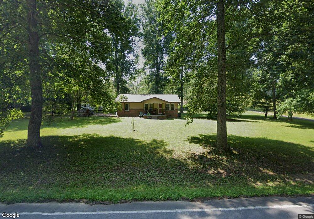
3361 S Main St Tennessee Ridge, TN 37178
Estimated Value: $105,000 - $208,000
--
Bed
1
Bath
1,216
Sq Ft
$127/Sq Ft
Est. Value
About This Home
This home is located at 3361 S Main St, Tennessee Ridge, TN 37178 and is currently estimated at $154,847, approximately $127 per square foot. 3361 S Main St is a home located in Houston County.
Ownership History
Date
Name
Owned For
Owner Type
Purchase Details
Closed on
Oct 16, 2017
Sold by
Tanner Artie R
Bought by
Workman Terry Michael
Current Estimated Value
Purchase Details
Closed on
Sep 9, 2011
Sold by
Mtchell Thomas W
Bought by
Tanner Artie R and Mitchum Wesley
Purchase Details
Closed on
Sep 6, 2002
Bought by
Tuberville Ty R
Purchase Details
Closed on
Jul 12, 1993
Bought by
Tuberville Audrey D
Purchase Details
Closed on
Mar 30, 1971
Bought by
Moravick Hilda A
Create a Home Valuation Report for This Property
The Home Valuation Report is an in-depth analysis detailing your home's value as well as a comparison with similar homes in the area
Home Values in the Area
Average Home Value in this Area
Purchase History
| Date | Buyer | Sale Price | Title Company |
|---|---|---|---|
| Workman Terry Michael | $35,000 | -- | |
| Tanner Artie R | $27,000 | -- | |
| Tuberville Ty R | -- | -- | |
| Tuberville Audrey D | $30,400 | -- | |
| Moravick Hilda A | -- | -- |
Source: Public Records
Tax History Compared to Growth
Tax History
| Year | Tax Paid | Tax Assessment Tax Assessment Total Assessment is a certain percentage of the fair market value that is determined by local assessors to be the total taxable value of land and additions on the property. | Land | Improvement |
|---|---|---|---|---|
| 2024 | -- | $27,400 | $3,650 | $23,750 |
| 2023 | $615 | $27,400 | $3,650 | $23,750 |
| 2022 | $561 | $15,700 | $2,500 | $13,200 |
| 2021 | $553 | $15,700 | $2,500 | $13,200 |
| 2020 | $402 | $15,700 | $2,500 | $13,200 |
| 2019 | $402 | $10,075 | $2,200 | $7,875 |
| 2018 | $397 | $10,075 | $2,200 | $7,875 |
| 2017 | $397 | $10,075 | $2,200 | $7,875 |
| 2016 | $397 | $10,075 | $2,200 | $7,875 |
| 2015 | $397 | $10,075 | $2,200 | $7,875 |
| 2014 | -- | $10,063 | $0 | $0 |
Source: Public Records
Map
Nearby Homes
- 1950 Old Stewart Rd
- 0 Carl Taylor Rd
- 110 Peachtree St
- 0 Taylor St Unit RTC2764411
- 0 Taylor St Unit RTC2764420
- 0 Taylor St Unit RTC2764418
- 0 Taylor St Unit RTC2764423
- 0 Taylor St Unit RTC2764415
- 155 Rolling Hills Dr
- 0 Old Lockhart Rd
- 745 Moore Hollow Rd
- 0 Main St N Unit RTC2988796
- 0 Main St N Unit RTC3003416
- 0 Main St N Unit RTC2987692
- 0 Main St N Unit RTC2988794
- 0 Main St N Unit RTC2988130
- 0 Main St N Unit RTC2988128
- 0 Main St N Unit RTC2987687
- 0 Main St N Unit RTC2988129
- 0 Main St N Unit RTC2988126
- 3259 S Main St
- 3241 S Main St
- 3393 S Main St
- 3478 S Main St
- 310 Stevenson Cir
- 3137 S Main St
- 3574 S Main St
- 3132 S Main St
- 350 Stevenson Cir
- 240 Stevenson Cir
- 355 Stevenson Cir
- 1175 Old Stewart Rd
- 241 Stevenson Cir
- 359 Mule Ln
- 415 Stevenson Cir
- 185 Stevenson Cir
- 445 Stevenson Cir
- 220 Jan Cir
- 2917 S Main St
- 2978 S Main St