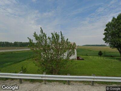
3364 State Route 590 N Lindsey, OH 43442
Estimated Value: $89,382 - $159,000
3
Beds
1
Bath
1,164
Sq Ft
$103/Sq Ft
Est. Value
About This Home
This home is located at 3364 State Route 590 N, Lindsey, OH 43442 and is currently estimated at $120,346, approximately $103 per square foot. 3364 State Route 590 N is a home located in Sandusky County with nearby schools including Fremont Ross High School.
Ownership History
Date
Name
Owned For
Owner Type
Purchase Details
Closed on
Oct 18, 2005
Sold by
Garner Neil R and Garner Lois A
Bought by
Johnson Brandon
Current Estimated Value
Home Financials for this Owner
Home Financials are based on the most recent Mortgage that was taken out on this home.
Original Mortgage
$47,500
Outstanding Balance
$26,738
Interest Rate
5.82%
Mortgage Type
Fannie Mae Freddie Mac
Estimated Equity
$96,369
Create a Home Valuation Report for This Property
The Home Valuation Report is an in-depth analysis detailing your home's value as well as a comparison with similar homes in the area
Home Values in the Area
Average Home Value in this Area
Purchase History
| Date | Buyer | Sale Price | Title Company |
|---|---|---|---|
| Johnson Brandon | -- | Port Lawrence Title |
Source: Public Records
Mortgage History
| Date | Status | Borrower | Loan Amount |
|---|---|---|---|
| Open | Johnson Brandon | $47,500 |
Source: Public Records
Tax History Compared to Growth
Tax History
| Year | Tax Paid | Tax Assessment Tax Assessment Total Assessment is a certain percentage of the fair market value that is determined by local assessors to be the total taxable value of land and additions on the property. | Land | Improvement |
|---|---|---|---|---|
| 2024 | $912 | $23,560 | $9,700 | $13,860 |
| 2023 | $912 | $18,980 | $7,810 | $11,170 |
| 2022 | $782 | $18,980 | $7,810 | $11,170 |
| 2021 | $806 | $18,980 | $7,810 | $11,170 |
| 2020 | $730 | $16,880 | $7,810 | $9,070 |
| 2019 | $730 | $16,880 | $7,810 | $9,070 |
| 2018 | $721 | $16,880 | $7,810 | $9,070 |
| 2017 | $711 | $16,460 | $7,810 | $8,650 |
| 2016 | $627 | $16,460 | $7,810 | $8,650 |
| 2015 | $601 | $16,460 | $7,810 | $8,650 |
| 2014 | $673 | $17,540 | $7,770 | $9,770 |
| 2013 | $659 | $17,540 | $7,770 | $9,770 |
Source: Public Records
Map
Nearby Homes
- 128 W Elm St
- 114 W Lincoln St
- 3881 County Road 82
- 3881 Cr 82
- 3264 Us Highway 20 W
- 3264 U S 20
- 3655 County Road 87
- 3590 County Road 660
- 17770 W Riverside Dr
- 18225 W Portage River Rd S
- 361 Lincoln St
- 17087 W State Route 105
- 3221 Ohio 19
- 102 County Road 155
- 621 Rice St
- 0 County Road 59
- 12342 W State Route 105
- 0 Stephanie Ln
- 2424 Stephanie Ln
- 1990 County Road 62
- 3364 State Route 590 N
- 3387 State Route 590 N
- 3434 State Route 590 N
- 3238 State Route 590 N
- 2640 Knipp Rd
- 3496 State Route 590 N
- 2596 County Road 127
- 2845 Knipp Rd
- 2400 County Road 127
- 3677 State Route 590 N
- 2730 County Road 141
- 2770 County Road 141
- 272 N Main St
- 256 N Main St
- 2391 County Road 127
- 2391 County Road 127
- 247 N Main St
- 106 C R
- 229 N Main St
- 2906 County Road 141