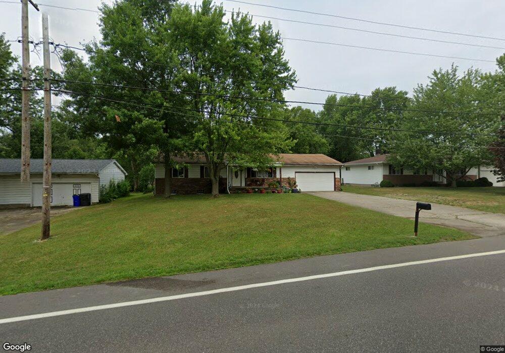
3365 State Route 44 Rootstown, OH 44272
Estimated Value: $209,730 - $250,000
3
Beds
2
Baths
1,320
Sq Ft
$181/Sq Ft
Est. Value
About This Home
This home is located at 3365 State Route 44, Rootstown, OH 44272 and is currently estimated at $238,433, approximately $180 per square foot. 3365 State Route 44 is a home located in Portage County with nearby schools including Rootstown Middle School - Schnee Building and Rootstown High School.
Ownership History
Date
Name
Owned For
Owner Type
Purchase Details
Closed on
Jun 6, 2002
Sold by
Smith Kenneth A and Smith Martha J
Bought by
King Michael T and King Rechel D
Current Estimated Value
Home Financials for this Owner
Home Financials are based on the most recent Mortgage that was taken out on this home.
Original Mortgage
$92,900
Outstanding Balance
$37,109
Interest Rate
6.87%
Estimated Equity
$201,324
Purchase Details
Closed on
Jun 29, 1993
Bought by
Smith Kenneth A and Smith Martha
Create a Home Valuation Report for This Property
The Home Valuation Report is an in-depth analysis detailing your home's value as well as a comparison with similar homes in the area
Purchase History
| Date | Buyer | Sale Price | Title Company |
|---|---|---|---|
| King Michael T | $121,400 | -- | |
| Smith Kenneth A | $75,000 | -- |
Source: Public Records
Mortgage History
| Date | Status | Borrower | Loan Amount |
|---|---|---|---|
| Open | King Michael T | $92,900 |
Source: Public Records
Tax History
| Year | Tax Paid | Tax Assessment Tax Assessment Total Assessment is a certain percentage of the fair market value that is determined by local assessors to be the total taxable value of land and additions on the property. | Land | Improvement |
|---|---|---|---|---|
| 2025 | $2,798 | $67,030 | $7,210 | $59,820 |
| 2024 | $2,689 | $67,030 | $7,210 | $59,820 |
| 2023 | $2,188 | $48,510 | $6,300 | $42,210 |
| 2022 | $2,161 | $48,510 | $6,300 | $42,210 |
| 2021 | $2,159 | $48,510 | $6,300 | $42,210 |
| 2020 | $1,931 | $41,760 | $5,990 | $35,770 |
| 2019 | $1,938 | $41,760 | $5,990 | $35,770 |
| 2018 | $1,930 | $36,620 | $8,580 | $28,040 |
| 2017 | $1,790 | $36,620 | $8,580 | $28,040 |
| 2016 | $1,756 | $36,620 | $8,580 | $28,040 |
| 2015 | $1,776 | $36,620 | $8,580 | $28,040 |
| 2014 | $1,809 | $36,620 | $8,580 | $28,040 |
| 2013 | $1,796 | $36,620 | $8,580 | $28,040 |
Source: Public Records
Map
Nearby Homes
- 3701 State Route 44
- 3689 Cherry Hill
- 3637 Old Forge Rd
- 3021 Hartville Rd
- 4079 Siefer Dr
- 3981 March Creek Ln Unit 37
- V/L 2 Lynn Rd
- V/L Lynn Rd
- 4200 Hattrick Rd
- 3080 Saxe Rd
- 4958 Bassett Rd
- 4415 Farmette Dr
- 3583 Randolph Rd
- 4556 Rootstown Rd
- sub lot Lane Ave
- 4324 Abbey Ln
- 4140 Sandy Lake Rd
- 0 Waterloo Rd
- 1583 Ohio 44
- 4184 Hunters Ridge Dr
- 3357 State Route 44
- 3373 State Route 44
- 3341 State Route 44
- 3383 State Route 44
- 3391 State Route 44
- 3360 State Route 44
- 3399 State Route 44
- 3390 State Route 44
- 3407 State Route 44
- 3415 State Route 44
- 3415 Ohio 44
- 3322 State Route 44
- 3425 State Route 44
- 3312 State Route 44
- 3296 State Route 44
- 3297 State Route 44
- 3443 State Route 44
- 3265 State Route 44
- 3270 State Route 44
- 3454 State Route 44
Your Personal Tour Guide
Ask me questions while you tour the home.