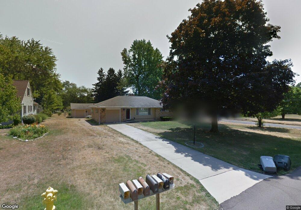
337 Dunham Dr Battle Creek, MI 49015
Minges Brook Riverside NeighborhoodEstimated Value: $225,000 - $248,068
3
Beds
2
Baths
2,018
Sq Ft
$116/Sq Ft
Est. Value
About This Home
This home is located at 337 Dunham Dr, Battle Creek, MI 49015 and is currently estimated at $233,517, approximately $115 per square foot. 337 Dunham Dr is a home located in Calhoun County with nearby schools including Lakeview Middle School, Lakeview High School, and Crosscreek Christian School.
Ownership History
Date
Name
Owned For
Owner Type
Purchase Details
Closed on
Aug 31, 2007
Sold by
Boes Paul C and Boes Darla
Bought by
Yon Linda L
Current Estimated Value
Home Financials for this Owner
Home Financials are based on the most recent Mortgage that was taken out on this home.
Original Mortgage
$116,100
Outstanding Balance
$73,732
Interest Rate
6.63%
Mortgage Type
Purchase Money Mortgage
Estimated Equity
$159,785
Purchase Details
Closed on
Sep 6, 2002
Sold by
Boes Paul C
Bought by
Boes Paul C and Boes Darla
Create a Home Valuation Report for This Property
The Home Valuation Report is an in-depth analysis detailing your home's value as well as a comparison with similar homes in the area
Home Values in the Area
Average Home Value in this Area
Purchase History
| Date | Buyer | Sale Price | Title Company |
|---|---|---|---|
| Yon Linda L | $129,000 | Chicago Title | |
| Boes Paul C | -- | -- |
Source: Public Records
Mortgage History
| Date | Status | Borrower | Loan Amount |
|---|---|---|---|
| Open | Yon Linda L | $116,100 |
Source: Public Records
Tax History Compared to Growth
Tax History
| Year | Tax Paid | Tax Assessment Tax Assessment Total Assessment is a certain percentage of the fair market value that is determined by local assessors to be the total taxable value of land and additions on the property. | Land | Improvement |
|---|---|---|---|---|
| 2025 | -- | $107,600 | $0 | $0 |
| 2024 | $2,697 | $100,213 | $0 | $0 |
| 2023 | $3,071 | $87,740 | $0 | $0 |
| 2022 | $2,436 | $77,317 | $0 | $0 |
| 2021 | $2,991 | $72,115 | $0 | $0 |
| 2020 | $2,814 | $70,731 | $0 | $0 |
| 2019 | $2,802 | $68,690 | $0 | $0 |
| 2018 | $2,802 | $70,905 | $5,331 | $65,574 |
| 2017 | $2,717 | $68,788 | $0 | $0 |
| 2016 | $2,712 | $62,890 | $0 | $0 |
| 2015 | $2,523 | $58,746 | $7,205 | $51,541 |
| 2014 | $2,523 | $56,414 | $7,205 | $49,209 |
Source: Public Records
Map
Nearby Homes
- 292 W Hamilton Ln
- 29 Langley Rd E
- 15 Timothy Ln
- 33 Langley Rd E
- 219 W Hamilton Ln
- 118 Flora Ln
- 211 Beckwith Dr
- 215 Beckwith Dr
- 15 Birch Hill Dr
- 148 Wahwahtaysee Way
- 68 Birch Hill Dr
- 117 Pheasant Run
- 4281 Watkins Rd
- 4275 Watkins Rd
- 12800 Minges Rd S
- 220 Deer Path Ln
- 4293 Beckley Rd
- 66 Wealthy
- 244 Deer Path Ln
- 348 S Hills Dr
- 333 Dunham Dr
- 339 Dunham Dr
- 343 Dunham Dr
- 329 Dunham Dr
- 2496 Capital Ave SW
- 2502 Capital Ave SW
- 2510 Capital Ave SW
- 334 Dunham Dr
- 338 Dunham Dr
- 330 Dunham Dr
- 342 Dunham Dr
- 326 Dunham Dr
- 348 Dunham Dr
- 2518 Capital Ave SW Unit 4
- 2518 Capital Ave SW Unit 1B
- 2518 Capital Ave SW Unit 3
- 19 Adams Rd
- 2494 Capital Ave SW
- 21 Adams Rd
- 15 Adams Rd