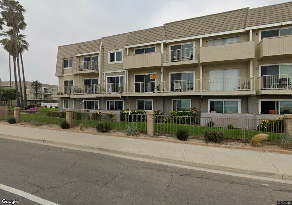
337 E Surfside Dr Port Hueneme, CA 93041
Estimated Value: $480,500 - $556,000
2
Beds
2
Baths
933
Sq Ft
$565/Sq Ft
Est. Value
About This Home
This home is located at 337 E Surfside Dr, Port Hueneme, CA 93041 and is currently estimated at $527,125, approximately $564 per square foot. 337 E Surfside Dr is a home located in Ventura County with nearby schools including Hueneme Elementary and Hueneme High School.
Ownership History
Date
Name
Owned For
Owner Type
Purchase Details
Closed on
Mar 13, 2014
Sold by
Fontaine Marianne
Bought by
Pomponi Jeffrey J and Pomponi Christine O
Current Estimated Value
Purchase Details
Closed on
Oct 30, 2002
Sold by
Fontaine Marianne
Bought by
Fontaine Marianne
Purchase Details
Closed on
Sep 6, 2000
Sold by
Harvey Mcshaffrey
Bought by
Fontaine Andre and Fontaine Marianne
Create a Home Valuation Report for This Property
The Home Valuation Report is an in-depth analysis detailing your home's value as well as a comparison with similar homes in the area
Home Values in the Area
Average Home Value in this Area
Purchase History
| Date | Buyer | Sale Price | Title Company |
|---|---|---|---|
| Pomponi Jeffrey J | $310,000 | First American Title Company | |
| Fontaine Marianne | -- | -- | |
| Fontaine Andre | $185,000 | First American Title Co |
Source: Public Records
Tax History
| Year | Tax Paid | Tax Assessment Tax Assessment Total Assessment is a certain percentage of the fair market value that is determined by local assessors to be the total taxable value of land and additions on the property. | Land | Improvement |
|---|---|---|---|---|
| 2025 | $4,571 | $380,006 | $247,007 | $132,999 |
| 2024 | $4,571 | $372,555 | $242,163 | $130,392 |
| 2023 | $4,348 | $365,250 | $237,414 | $127,836 |
| 2022 | $4,230 | $358,089 | $232,759 | $125,330 |
| 2021 | $4,228 | $351,068 | $228,195 | $122,873 |
| 2020 | $4,179 | $347,470 | $225,856 | $121,614 |
| 2019 | $4,122 | $340,658 | $221,428 | $119,230 |
| 2018 | $3,987 | $333,980 | $217,087 | $116,893 |
| 2017 | $3,845 | $327,432 | $212,831 | $114,601 |
| 2016 | $3,732 | $321,012 | $208,658 | $112,354 |
| 2015 | $3,643 | $316,192 | $205,525 | $110,667 |
| 2014 | $1,020 | $86,883 | $29,973 | $56,910 |
Source: Public Records
Map
Nearby Homes
- 275 E Surfside Dr
- 218 E Surfside Dr
- 225 S Ventura Rd Unit 102
- 201 S Ventura Rd Unit 15
- 209 S Ventura Rd Unit 18
- 209 S Ventura Rd Unit 31
- 618 Island View Cir Unit 618
- 754 Island View Cir
- 102 San Nicolas Cir
- 681 Ocean View Dr Unit 681A
- 705 Ocean View Dr Unit 705A
- 574 Ebbtide Cir
- 656 Sunfish Way
- 660 Sunfish Way
- 846 Bluewater Way
- 218 Morning Breeze Ln
- 916 Lighthouse Way
- 535 Starboard Ln
- 117 Ann Ave
- 433 Jerry Dr
- 337 E Surfside Dr Unit 138
- 335 E Surfside Dr
- 336 E Surfside Dr
- 332 E Surfside Dr
- 334 E Surfside Dr
- 333 E Surfside Dr
- 329 E Surfside Dr
- 331 E Surfside Dr Unit 132
- 331 E Surfside Dr
- 330 E Surfside Dr
- 338 E Surfside Dr
- 339 E Surfside Dr
- 340 E Surfside Dr
- 343 E Surfside Dr
- 342 E Surfside Dr
- 326 E Surfside Dr
- 327 E Surfside Dr
- 328 E Surfside Dr
- 341 E Surfside Dr
- 344 E Surfside Dr
Your Personal Tour Guide
Ask me questions while you tour the home.