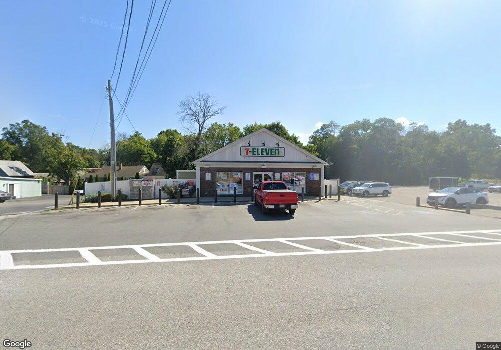
337 Gannett Rd Scituate, MA 02066
--
Bed
1
Bath
5,000
Sq Ft
9,932
Sq Ft Lot
About This Home
This home is located at 337 Gannett Rd, Scituate, MA 02066. 337 Gannett Rd is a home located in Plymouth County with nearby schools including Hatherly Elementary School, Lester J. Gates Middle School, and Scituate High School.
Ownership History
Date
Name
Owned For
Owner Type
Purchase Details
Closed on
Nov 8, 2016
Sold by
Tfs Newco Llc
Bought by
7-11 Inc
Purchase Details
Closed on
Sep 21, 2015
Sold by
Kt Newco Llc
Bought by
Tfs Newco Llc
Purchase Details
Closed on
Aug 31, 2015
Sold by
Kt Associates Llc
Bought by
Kt Newco Llc
Purchase Details
Closed on
Dec 2, 2004
Sold by
South Shore Llc
Bought by
K T Assos Llc
Home Financials for this Owner
Home Financials are based on the most recent Mortgage that was taken out on this home.
Original Mortgage
$2,400,000
Interest Rate
5.69%
Mortgage Type
Commercial
Create a Home Valuation Report for This Property
The Home Valuation Report is an in-depth analysis detailing your home's value as well as a comparison with similar homes in the area
Home Values in the Area
Average Home Value in this Area
Purchase History
| Date | Buyer | Sale Price | Title Company |
|---|---|---|---|
| 7-11 Inc | -- | -- | |
| Tfs Newco Llc | -- | -- | |
| Kt Newco Llc | -- | -- | |
| K T Assos Llc | $481,600 | -- |
Source: Public Records
Mortgage History
| Date | Status | Borrower | Loan Amount |
|---|---|---|---|
| Previous Owner | K T Assos Llc | $2,400,000 |
Source: Public Records
Tax History Compared to Growth
Tax History
| Year | Tax Paid | Tax Assessment Tax Assessment Total Assessment is a certain percentage of the fair market value that is determined by local assessors to be the total taxable value of land and additions on the property. | Land | Improvement |
|---|---|---|---|---|
| 2025 | $8,293 | $830,100 | $215,300 | $614,800 |
| 2024 | $8,419 | $812,600 | $209,000 | $603,600 |
| 2023 | $8,558 | $776,200 | $200,000 | $576,200 |
| 2022 | $8,558 | $678,100 | $175,500 | $502,600 |
| 2021 | $8,798 | $660,000 | $167,100 | $492,900 |
| 2020 | $8,851 | $655,600 | $167,100 | $488,500 |
| 2019 | $8,651 | $629,600 | $157,200 | $472,400 |
| 2018 | $8,131 | $582,900 | $143,800 | $439,100 |
| 2017 | $7,554 | $536,100 | $143,800 | $392,300 |
| 2016 | $7,580 | $536,100 | $143,800 | $392,300 |
| 2015 | $7,023 | $536,100 | $143,800 | $392,300 |
Source: Public Records
Map
Nearby Homes
- 26 Mordecai Lincoln Rd
- 817 Country Way
- 16 3 Ring Rd
- 392 S Main St
- 84 Booth Hill Rd
- 11 Forest Ln
- 9 Forest Ln Unit 9
- 8 Trudys Ln
- 112 Hollett St
- 7 Border St
- 40 Brewster Rd
- 309 S Main St
- 9 Kyle Path
- 70 Black Horse Ln
- 68 Black Horse Ln
- 212 S Main St
- 29 Country Club Cir
- 98 Black Horse Ln
- 100 Pond St Unit 10
- 14 Aberdeen Dr
- 335 Gannett Rd
- 999 Main Thoroughfare
- 340 Gannett Rd
- 334 Gannett Rd
- 325 Gannett Rd
- 323 Gannett Rd
- 66 Chief Cushing Hwy
- 26 Wade St Unit 2
- 26 Wade St
- 24 Wade St
- 326 Gannett Rd
- 10 Mordecai Lincoln Rd
- 10 Mordecai Lincoln Rd Unit 1
- 25 Wade St
- 754 Country Way
- 317 Gannett Rd
- 330 Gannett Rd
- 330 Gannett Rd Unit 1
- 330 Gannett Rd Unit n/a
- 750 Country Way