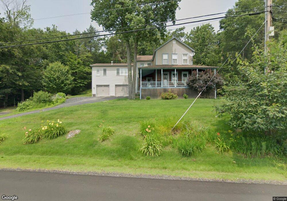
337 N Shore Rd Spofford, NH 03462
Estimated Value: $539,703 - $642,000
3
Beds
3
Baths
3,333
Sq Ft
$178/Sq Ft
Est. Value
About This Home
This home is located at 337 N Shore Rd, Spofford, NH 03462 and is currently estimated at $593,926, approximately $178 per square foot. 337 N Shore Rd is a home with nearby schools including Chesterfield Central School, Mayland Early College High School, and Keene High School.
Ownership History
Date
Name
Owned For
Owner Type
Purchase Details
Closed on
Mar 20, 2023
Sold by
Patenaude Dianne S
Bought by
Dianne S Patenaude Ret
Current Estimated Value
Create a Home Valuation Report for This Property
The Home Valuation Report is an in-depth analysis detailing your home's value as well as a comparison with similar homes in the area
Home Values in the Area
Average Home Value in this Area
Purchase History
| Date | Buyer | Sale Price | Title Company |
|---|---|---|---|
| Dianne S Patenaude Ret | -- | None Available |
Source: Public Records
Tax History Compared to Growth
Tax History
| Year | Tax Paid | Tax Assessment Tax Assessment Total Assessment is a certain percentage of the fair market value that is determined by local assessors to be the total taxable value of land and additions on the property. | Land | Improvement |
|---|---|---|---|---|
| 2024 | $7,309 | $361,100 | $125,700 | $235,400 |
| 2023 | $7,157 | $361,100 | $125,700 | $235,400 |
| 2022 | $7,013 | $361,100 | $125,700 | $235,400 |
| 2021 | $6,865 | $361,100 | $125,700 | $235,400 |
| 2020 | $7,061 | $312,300 | $86,200 | $226,100 |
| 2019 | $6,732 | $301,600 | $86,200 | $215,400 |
| 2018 | $6,080 | $301,600 | $86,200 | $215,400 |
| 2016 | $5,753 | $270,600 | $71,800 | $198,800 |
| 2014 | $6,010 | $270,600 | $71,800 | $198,800 |
Source: Public Records
Map
Nearby Homes
- 36 Canal St
- 43 Westmoreland Rd
- 563 N Shore Rd
- 48 Church St
- 85 Foley Rd
- 21 Valley Park Dr
- 123 Poocham Rd
- 821 Route 9
- 0 Stow Dr Unit 4929741
- 484 Old Swanzey Rd
- 00 Orchard Rd Unit 1
- 000 S Village Rd Unit 13
- 136 Cross Rd
- 30 Farr Rd
- Lot 20 -20.3 Farr Rd
- 1123 River Rd
- 601 River Rd S
- 15 Stearns Rd
- 14 Hurricane Rd
- 28 Owens Dr Unit 92
- 337 N Shore Rd
- 433B N Shore Rd
- 433A N Shore Rd
- 0 N Shore Rd
- 0 N Shore Rd
- 0 N Shore Rd
- 0 N Shore Rd Unit 4036746
- 10 Namaschaug Landing
- 22 Namaschaug Landing
- 22 Namaschaug Landing
- 14 Namaschaug Landing
- 14 Windsurfer Ln
- 6 Namaschaug Landing
- 346-A N Shore Rd
- 346-B N Shore Rd
- 345 North Shore
- 345 N Shore Rd
- 15 Windsurfer Ln
- 2 Namaschaug Landing
- 351 North Shore