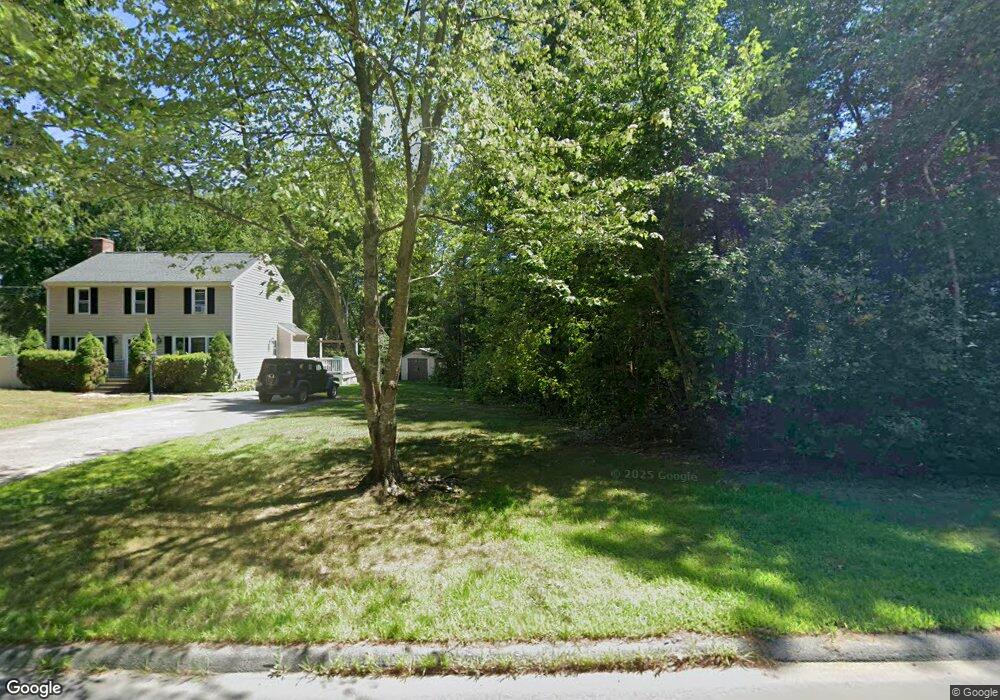
337 Richardson Ave Attleboro, MA 02703
Estimated Value: $850,000 - $1,194,000
4
Beds
4
Baths
3,262
Sq Ft
$309/Sq Ft
Est. Value
About This Home
This home is located at 337 Richardson Ave, Attleboro, MA 02703 and is currently estimated at $1,009,473, approximately $309 per square foot. 337 Richardson Ave is a home located in Bristol County with nearby schools including Thomas E. Willett School, Cyril K. Brennan Middle School, and Attleboro High School.
Ownership History
Date
Name
Owned For
Owner Type
Purchase Details
Closed on
Apr 29, 2011
Sold by
Dimarzio Jeffrey A and Dimarsio Lisa K
Bought by
Dimarzio Jeffrey A
Current Estimated Value
Home Financials for this Owner
Home Financials are based on the most recent Mortgage that was taken out on this home.
Original Mortgage
$200,000
Outstanding Balance
$138,220
Interest Rate
4.76%
Mortgage Type
Purchase Money Mortgage
Estimated Equity
$871,253
Purchase Details
Closed on
Oct 17, 1994
Sold by
Semple Alan R
Bought by
Dimarzio Jeffrey A and Dimarzio Lisa K
Home Financials for this Owner
Home Financials are based on the most recent Mortgage that was taken out on this home.
Original Mortgage
$30,000
Interest Rate
8.43%
Mortgage Type
Purchase Money Mortgage
Create a Home Valuation Report for This Property
The Home Valuation Report is an in-depth analysis detailing your home's value as well as a comparison with similar homes in the area
Home Values in the Area
Average Home Value in this Area
Purchase History
| Date | Buyer | Sale Price | Title Company |
|---|---|---|---|
| Dimarzio Jeffrey A | -- | -- | |
| Dimarzio Jeffrey A | $50,000 | -- |
Source: Public Records
Mortgage History
| Date | Status | Borrower | Loan Amount |
|---|---|---|---|
| Open | Dimarzio Jeffrey A | $200,000 | |
| Closed | Dimarzio Jeffrey A | $100,000 | |
| Previous Owner | Dimarzio Jeffrey A | $120,000 | |
| Previous Owner | Dimarzio Jeffrey A | $30,000 |
Source: Public Records
Tax History Compared to Growth
Tax History
| Year | Tax Paid | Tax Assessment Tax Assessment Total Assessment is a certain percentage of the fair market value that is determined by local assessors to be the total taxable value of land and additions on the property. | Land | Improvement |
|---|---|---|---|---|
| 2025 | $11,679 | $930,600 | $160,500 | $770,100 |
| 2024 | $11,345 | $891,200 | $160,500 | $730,700 |
| 2023 | $10,366 | $757,200 | $147,300 | $609,900 |
| 2022 | $9,943 | $688,100 | $141,100 | $547,000 |
| 2021 | $9,567 | $646,400 | $136,300 | $510,100 |
| 2020 | $9,202 | $632,000 | $132,700 | $499,300 |
| 2019 | $8,987 | $634,700 | $130,500 | $504,200 |
| 2018 | $8,713 | $587,900 | $127,100 | $460,800 |
| 2017 | $8,557 | $588,100 | $127,100 | $461,000 |
| 2016 | $7,748 | $522,800 | $125,700 | $397,100 |
| 2015 | $7,536 | $512,300 | $125,700 | $386,600 |
| 2014 | $7,468 | $502,900 | $119,700 | $383,200 |
Source: Public Records
Map
Nearby Homes
- 6 Cedar Creek Dr
- 17 Karen St
- 613 Lindsey St
- 933 Pleasant St
- 4 Village Way Unit F
- 122 N Worcester St
- 451R Gilbert St
- 97 N Worcester St
- 9 Larson Farm Dr
- 6 Colts Way
- 180 Pike Ave
- 378 Old Colony Rd
- 37 Oakleaf Dr
- 13 Crowe Farm Ln
- 2 Top Flight Dr Unit B
- 21 Shady Ln
- 60 Upland Rd
- 19 Cherry Tree Ln
- 0 Sunflower Dr
- 20 Sperry Ln
- 329 Richardson Ave
- 345 Richardson Ave
- 353 Richardson Ave
- 323 Richardson Ave
- 3 Plain St
- 9 Frontier Dr
- 15 Frontier Dr
- 361 Richardson Ave
- 21 Frontier Dr
- 5 Plain St
- 309 Richardson Ave
- 309 Richardson Ave Unit 1
- 3 Frontier Dr
- 313 Richardson Ave
- 27 Frontier Dr
- 30 Frontier Dr
- 397 Richardson Ave
- 369 Richardson Ave
- 389 Richardson Ave
- 389 Richardson Ave Unit House