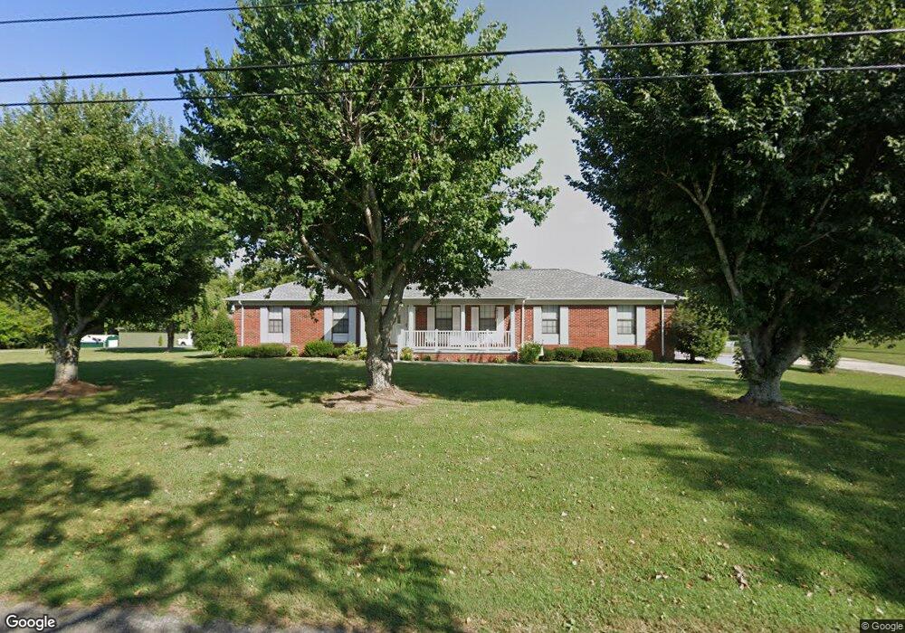
337 Walnut Grove Rd Sparta, TN 38583
Estimated Value: $244,961 - $353,000
--
Bed
3
Baths
1,508
Sq Ft
$208/Sq Ft
Est. Value
About This Home
This home is located at 337 Walnut Grove Rd, Sparta, TN 38583 and is currently estimated at $313,740, approximately $208 per square foot. 337 Walnut Grove Rd is a home located in White County with nearby schools including Northfield Elementary School, White County Middle School, and White County High School.
Ownership History
Date
Name
Owned For
Owner Type
Purchase Details
Closed on
Apr 30, 2015
Sold by
Givens Paula Shearer
Bought by
Walker Denny E and Walker Robbie A
Current Estimated Value
Home Financials for this Owner
Home Financials are based on the most recent Mortgage that was taken out on this home.
Original Mortgage
$110,500
Outstanding Balance
$85,494
Interest Rate
3.8%
Mortgage Type
New Conventional
Estimated Equity
$228,246
Purchase Details
Closed on
Dec 16, 2005
Bought by
Cyr Sanders Doris
Purchase Details
Closed on
May 1, 1987
Bought by
Sanders Doris Cys
Purchase Details
Closed on
Jan 28, 1986
Purchase Details
Closed on
Jan 1, 1985
Create a Home Valuation Report for This Property
The Home Valuation Report is an in-depth analysis detailing your home's value as well as a comparison with similar homes in the area
Home Values in the Area
Average Home Value in this Area
Purchase History
| Date | Buyer | Sale Price | Title Company |
|---|---|---|---|
| Walker Denny E | $130,000 | -- | |
| Cyr Sanders Doris | -- | -- | |
| Sanders Doris Cys | -- | -- | |
| -- | $7,500 | -- | |
| -- | $4,400 | -- |
Source: Public Records
Mortgage History
| Date | Status | Borrower | Loan Amount |
|---|---|---|---|
| Open | Walker Denny E | $110,500 |
Source: Public Records
Tax History Compared to Growth
Tax History
| Year | Tax Paid | Tax Assessment Tax Assessment Total Assessment is a certain percentage of the fair market value that is determined by local assessors to be the total taxable value of land and additions on the property. | Land | Improvement |
|---|---|---|---|---|
| 2024 | $791 | $38,575 | $4,700 | $33,875 |
| 2023 | $791 | $38,575 | $4,700 | $33,875 |
| 2022 | $791 | $38,575 | $4,700 | $33,875 |
| 2021 | $791 | $38,575 | $4,700 | $33,875 |
| 2020 | $791 | $38,575 | $4,700 | $33,875 |
| 2019 | $650 | $31,725 | $4,500 | $27,225 |
| 2018 | $650 | $31,725 | $4,500 | $27,225 |
| 2017 | $650 | $31,725 | $4,500 | $27,225 |
| 2016 | $650 | $31,725 | $4,500 | $27,225 |
| 2015 | $587 | $31,725 | $4,500 | $27,225 |
| 2014 | -- | $31,725 | $4,500 | $27,225 |
| 2013 | -- | $32,125 | $4,500 | $27,625 |
Source: Public Records
Map
Nearby Homes
- 221 Magnolia Rd
- 147 Bob White Dr
- lot 7 James Holman Rd
- lot 6 James Holman Rd
- 130 Mallard Dr
- 761 Walter Stone Rd
- 191 Rustling Oaks Dr
- 1045 Mullican Rd
- 159 Rustling Oaks Dr
- 0 Saylor Rd
- 00 Saylor Rd
- 366 S Bunker Hill Rd
- 00 Oakcrest Dr
- 00 Milk Plant Rd
- 1236 Swamp Rd
- 355 Dillon Gribble Rd
- 156 Horseshoe Dr
- 141 Ray Cemetery Rd
- 470 Black Oak Rd
- 154 Hawthorne Rd
- 141 Hawthorne Rd
- 376 Walnut Grove Rd
- 373 Walnut Grove Rd
- 320 Walnut Grove Rd
- 171 Hawthorne Rd
- 275 Walnut Grove Rd
- 300 Walnut Grove Rd
- 202 Hawthorne Rd
- 415 Walnut Grove Rd
- 288 Walnut Grove Rd
- 245 Walnut Grove Rd
- 207 Hawthorne Rd
- 222 Hawthorne Rd
- 249 Hawthorne Rd
- 222 Walnut Grove Rd
- 555 Scott Cemetery Rd
- 239 Magnolia Rd
- 280 Hawthorne Rd
- 535 Scott Cemetery Rd