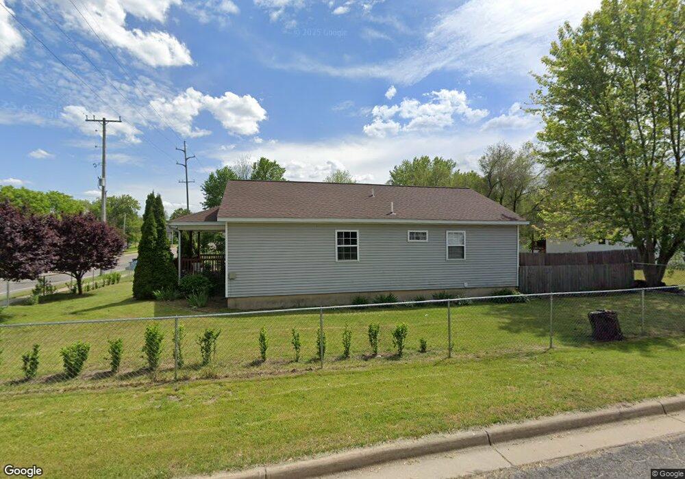
337 Washington Ave N Battle Creek, MI 49037
North Central NeighborhoodEstimated Value: $120,785 - $132,000
4
Beds
1
Bath
1,148
Sq Ft
$110/Sq Ft
Est. Value
About This Home
This home is located at 337 Washington Ave N, Battle Creek, MI 49037 and is currently estimated at $126,446, approximately $110 per square foot. 337 Washington Ave N is a home located in Calhoun County with nearby schools including Dudley School, Northwestern Middle School, and Battle Creek Central High School.
Ownership History
Date
Name
Owned For
Owner Type
Purchase Details
Closed on
Aug 23, 2005
Sold by
Battle Creek Area Habitat For Humanity
Bought by
Liborio Mario L and Aragon Carmen
Current Estimated Value
Home Financials for this Owner
Home Financials are based on the most recent Mortgage that was taken out on this home.
Original Mortgage
$67,980
Interest Rate
5.89%
Mortgage Type
Seller Take Back
Purchase Details
Closed on
Dec 20, 2002
Bought by
B C Area Habitat For Humanity
Create a Home Valuation Report for This Property
The Home Valuation Report is an in-depth analysis detailing your home's value as well as a comparison with similar homes in the area
Home Values in the Area
Average Home Value in this Area
Purchase History
| Date | Buyer | Sale Price | Title Company |
|---|---|---|---|
| Liborio Mario L | $65,000 | Chicago Title | |
| B C Area Habitat For Humanity | $22,500 | -- |
Source: Public Records
Mortgage History
| Date | Status | Borrower | Loan Amount |
|---|---|---|---|
| Closed | Liborio Mario L | $67,980 |
Source: Public Records
Tax History Compared to Growth
Tax History
| Year | Tax Paid | Tax Assessment Tax Assessment Total Assessment is a certain percentage of the fair market value that is determined by local assessors to be the total taxable value of land and additions on the property. | Land | Improvement |
|---|---|---|---|---|
| 2025 | -- | $46,000 | $0 | $0 |
| 2024 | $1,110 | $38,135 | $0 | $0 |
| 2023 | $1,268 | $32,781 | $0 | $0 |
| 2022 | $1,002 | $30,306 | $0 | $0 |
| 2021 | $1,197 | $28,461 | $0 | $0 |
| 2020 | $1,184 | $25,978 | $0 | $0 |
| 2019 | $1,121 | $25,200 | $0 | $0 |
| 2018 | $1,121 | $26,968 | $710 | $26,258 |
| 2017 | $1,087 | $26,110 | $0 | $0 |
| 2016 | $1,085 | $23,501 | $0 | $0 |
| 2015 | $1,450 | $28,420 | $0 | $0 |
| 2014 | $1,450 | $31,461 | $0 | $0 |
Source: Public Records
Map
Nearby Homes
- 52 Roseneath Ave
- 46 Walter Ave
- 216 Kendall St N
- 5 Beglin Ct
- 188 Roseneath Ave
- 125 Oaklawn Ave
- 435 Kendall St N
- 224 Hubbard St
- 167 Hubbard St
- 253 Greenwood Ave
- 161 Wilds Ave
- 266 North Ave
- 35 Hubbard St
- 60 Graves Ave
- 69 Jordan St
- 0 W Vanburen 032 St Unit 22040288
- 562 Van Buren St W
- V/L W Michigan 055 Ave
- 0 W Vanburen 025 St Unit 22040286
- 0 W Vanburen 027 St Unit 22040287
- 331 Washington Ave N
- 17 Helen M Montgomery Ave
- 349 Washington Ave N
- 21 Helen M Montgomery Ave
- 325 Washington Ave N
- 12 Helen M Montgomery Ave
- 16 Helen M Montgomery Ave
- 355 Washington Ave N
- 319 Washington Ave N
- 25 Helen M Montgomery Ave
- 313 Washington Ave N
- 365 Washington Ave N
- 28 Helen M Montgomery Ave
- 33 Helen M Montgomery Ave
- 368 Washington Ave N
- 34 Helen M Montgomery Ave
- 39 Helen M Montgomery Ave
- 307 Washington Ave N
- 366 Washington Ave N
- 35 Northside Dr W