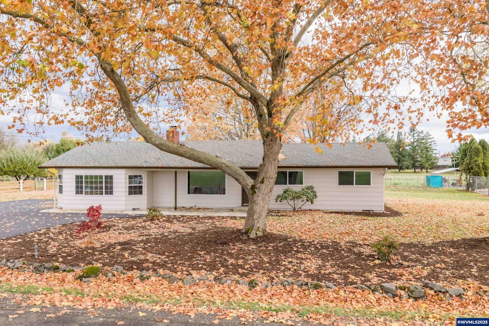
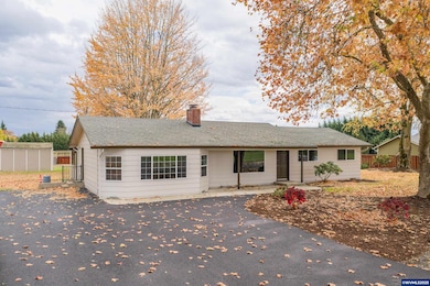
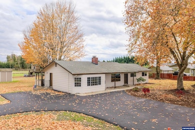
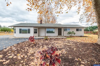
33745 Mcfarland Rd Tangent, OR 97389
Estimated payment $2,882/month
Highlights
- Hot Property
- Territorial View
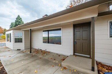
- Covered Patio or Porch
- RV Access or Parking
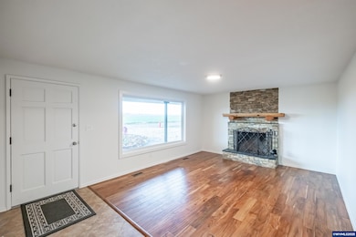
- Wood Flooring
- Breakfast Area or Nook
About This Home
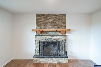
Rural charm meets convenience! Fresh paint inside & out, newer windows, and a brand-new driveway and sidewalk welcome you home to this .69-acre gem. Enjoy wood and high-end laminate floors in most areas. Cozy wood burning fireplace, stylish sunroom ceilings, and rustic farm kitchen with newer appliances await you. Relax under the covered patio, fenced garden area, and room to dream up your future shop.? With fresh air, open space, and quick access to town—you’ll love this slice of Willamette Valley living!
Listing Agent
KELLER WILLIAMS REALTY MID WILLAMETTE License #201223307 Listed on: 11/10/2025

Home Details
Home Type
- Single Family
Est. Annual Taxes
- $3,271
Year Built
- Built in 1968
Lot Details
- 0.69 Acre Lot
- Partially Fenced Property
- Landscaped
- Irregular Lot
- Property is zoned Tangent-RM-6
Parking
- RV Access or Parking
Home Design
- Composition Roof
- Lap Siding
Interior Spaces
- 1,836 Sq Ft Home
- 1-Story Property
- Wood Burning Fireplace
- Family Room with Fireplace
- Territorial Views
Kitchen
- Breakfast Area or Nook
- Electric Range
- Dishwasher
Flooring
- Wood
- Laminate
- Tile
Bedrooms and Bathrooms
- 3 Bedrooms
- 2 Full Bathrooms
Outdoor Features
- Covered Patio or Porch
- Shed
Schools
- Tangent Elementary School
- Memorial Middle School
- West Albany High School
Utilities
- Forced Air Heating System
- Heating System Uses Gas
- Well
- Gas Water Heater
- High Speed Internet
Listing and Financial Details
- Tax Block 1032
Map
Home Values in the Area
Average Home Value in this Area
Tax History
| Year | Tax Paid | Tax Assessment Tax Assessment Total Assessment is a certain percentage of the fair market value that is determined by local assessors to be the total taxable value of land and additions on the property. | Land | Improvement |
|---|---|---|---|---|
| 2025 | $3,271 | $222,970 | -- | -- |
| 2024 | $3,177 | $216,480 | -- | -- |
| 2023 | $3,087 | $210,180 | $0 | $0 |
| 2022 | $3,053 | $204,060 | $0 | $0 |
| 2021 | $2,840 | $198,120 | $0 | $0 |
| 2020 | $2,814 | $192,350 | $0 | $0 |
| 2019 | $2,753 | $186,750 | $0 | $0 |
| 2018 | $2,686 | $181,320 | $0 | $0 |
| 2017 | $2,606 | $176,040 | $0 | $0 |
| 2016 | $2,393 | $170,920 | $0 | $0 |
| 2015 | $2,332 | $165,950 | $0 | $0 |
| 2014 | $2,228 | $161,120 | $0 | $0 |
Property History
| Date | Event | Price | List to Sale | Price per Sq Ft |
|---|---|---|---|---|
| 11/10/2025 11/10/25 | For Sale | $495,000 | -- | $270 / Sq Ft |
Purchase History
| Date | Type | Sale Price | Title Company |
|---|---|---|---|
| Interfamily Deed Transfer | -- | None Available | |
| Warranty Deed | $350,000 | First American | |
| Interfamily Deed Transfer | -- | Lawyers Title Insurance Corp | |
| Interfamily Deed Transfer | -- | Lawyers Title Ins |
Mortgage History
| Date | Status | Loan Amount | Loan Type |
|---|---|---|---|
| Previous Owner | $218,500 | New Conventional | |
| Previous Owner | $150,000 | New Conventional |
Source: Willamette Valley MLS
MLS Number: 835094
APN: 0226072
Disclaimer: Certain information contained herein is derived from information provided by parties other than Homes.com. All information provided is deemed reliable, but is not guaranteed to be accurate and should be independently verified.
![]() Based on information from Willamette Valley Multiple Listing Service, which neither guarantees nor is in any way responsible for its accuracy. All data is provided ‘AS IS’ and with all faults. Data maintained by Willamette Valley Multiple Listing Service may not reflect all real estate activity in the market. WVMLS Member Broker: Arlene Richardson
Based on information from Willamette Valley Multiple Listing Service, which neither guarantees nor is in any way responsible for its accuracy. All data is provided ‘AS IS’ and with all faults. Data maintained by Willamette Valley Multiple Listing Service may not reflect all real estate activity in the market. WVMLS Member Broker: Arlene Richardson
- 32320 Oregon 34
- 33270 Highway 99e
- 31919 N Lake Creek (Unit 35 ) Dr
- 31843 Meadowlark Loop
- 31922 Meadowlark Loop
- 32072 Birdfoot Dr
- 32300 Old Oak Dr
- 31405 Allen Ln
- 6259 Chapman Place SW
- 312 Rd SE
- 1132 Ellingson Rd
- 1252 Ellingson Rd SE
- Helena Plan at Curry Meadows
- Auburn Plan at Curry Meadows
- Casey Plan at Curry Meadows
- 1132 Ellingson Rd SE
- 1562 Beaver Ct SW
- 6653 Columbus St SE
- 1697 Stasny Ave SE
- 1664 Elk Cir SW
- 6208-6293 SE Wilford Ct
- 3724 Tudor Way SE Unit 3724
- 3517 Hill St SE
- 3238 Lyon St SE Unit 3238
- 509 29th Ave SE
- 1755 Geary St SE
- 1605 Oak St SE
- 731 Elm St SW Unit Upstairs Apartment
- 1525 7th Ave SW Unit 1
- 533 4th Ave SW Unit 201
- 3856 Oranda St SE
- 2762 SE 7th Ave Unit 2766-1
- 595 Geary St NE
- 4250 NE Hwy 20
- 3835 Knox Butte Rd E
- 225 Timber Ridge St NE
- 150 Timber Ridge St NE
- 213 NE Conifer Blvd
- 350 Timber Ridge St NE
- 1652 SE Crystal Lake Dr