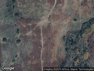
33748 Us Highway 270 Mutual, OK 73853
Estimated Value: $298,000 - $477,095
3
Beds
2
Baths
3,059
Sq Ft
$123/Sq Ft
Est. Value
About This Home
This home is located at 33748 Us Highway 270, Mutual, OK 73853 and is currently estimated at $376,365, approximately $123 per square foot. 33748 Us Highway 270 is a home located in Woodward County with nearby schools including Sharon-Mutual Elementary School and Sharon-Mutual High School.
Ownership History
Date
Name
Owned For
Owner Type
Purchase Details
Closed on
Sep 20, 1996
Bought by
Taylor Larry C
Current Estimated Value
Purchase Details
Closed on
Sep 12, 1996
Bought by
Taylor Larry C
Purchase Details
Closed on
Aug 19, 1994
Bought by
Apache Management Trust
Create a Home Valuation Report for This Property
The Home Valuation Report is an in-depth analysis detailing your home's value as well as a comparison with similar homes in the area
Home Values in the Area
Average Home Value in this Area
Purchase History
| Date | Buyer | Sale Price | Title Company |
|---|---|---|---|
| Taylor Larry C | -- | -- | |
| Taylor Larry C | $187,500 | -- | |
| Apache Management Trust | $105,000 | -- |
Source: Public Records
Mortgage History
| Date | Status | Borrower | Loan Amount |
|---|---|---|---|
| Closed | Taylor Larry C | $36,000 |
Source: Public Records
Tax History Compared to Growth
Tax History
| Year | Tax Paid | Tax Assessment Tax Assessment Total Assessment is a certain percentage of the fair market value that is determined by local assessors to be the total taxable value of land and additions on the property. | Land | Improvement |
|---|---|---|---|---|
| 2023 | $1,482 | $17,347 | $1,644 | $15,703 |
| 2022 | $1,461 | $16,841 | $1,612 | $15,229 |
| 2021 | $1,462 | $16,841 | $1,612 | $15,229 |
| 2020 | $1,457 | $16,841 | $1,612 | $15,229 |
| 2019 | $1,417 | $16,351 | $1,551 | $14,800 |
| 2018 | $1,404 | $15,875 | $1,482 | $14,393 |
| 2017 | $1,408 | $15,413 | $1,286 | $14,127 |
| 2016 | $1,196 | $14,964 | $1,872 | $13,092 |
| 2015 | $1,180 | $14,964 | $1,872 | $13,092 |
| 2014 | $1,143 | $14,529 | $1,928 | $12,601 |
Source: Public Records
Map
Nearby Homes
- 387 S D St
- 0 E County Road 54 & N County Road 216 Unit 11493041
- 59489 Rd
- N N 2220 Rd
- 45213 S County Road 215
- 715 N Main
- 410 E First St
- 61995 S County Road 203
- 111 W Second St
- 621 W Broadway St
- E County Roa 46 N County Road 209
- 22157 State Highway 34
- 115 S Main St
- 205826 E County Road 49
- 203315 E County Road 53
- NS 203 & 54
- 0 N2030 Rd
- 236198 E County Road 58
- 54184 Sand Hill Dr
- 1008 Meyer Dr
- 30704 State Highway 50
- 33748 Us Highway 270
- 31466 State Highway 50
- 47471 S County Road 211
- 30760 State Highway 50
- 140 N Maple St
- 180 N Maple
- 167 N Walnut
- 148 W Main St
- 48729 S County Road 212
- 44672 S County Road 211
- 44454 S Cr 211
- 44454 S County Road 211
- 287 S Broadway St
- 30932 State Highway 50
- 408 Broadway St
- 259 S D St
- 259 B St
- 378 S Broadway St
- 43A Rr 1
