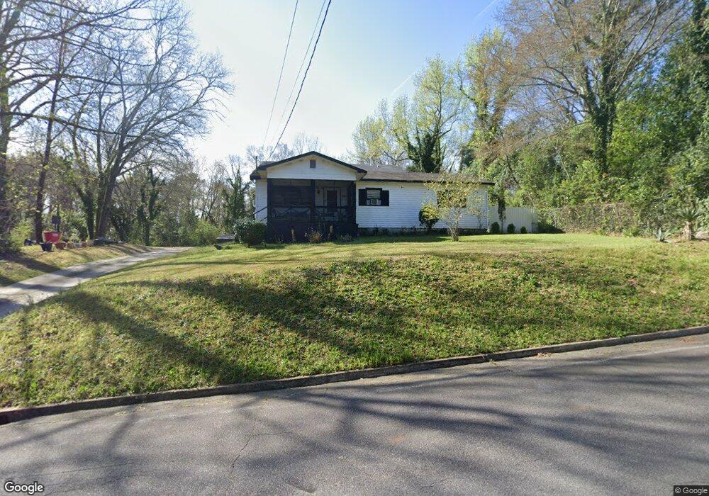
3378 Brooklyn Ave Macon, GA 31204
Ingleside Historic District NeighborhoodEstimated Value: $141,519 - $264,000
3
Beds
2
Baths
1,440
Sq Ft
$131/Sq Ft
Est. Value
About This Home
This home is located at 3378 Brooklyn Ave, Macon, GA 31204 and is currently estimated at $188,380, approximately $130 per square foot. 3378 Brooklyn Ave is a home located in Bibb County with nearby schools including Rosa Taylor Elementary School, Miller Fine Arts Magnet Middle School, and Central High School.
Ownership History
Date
Name
Owned For
Owner Type
Purchase Details
Closed on
Jun 10, 2009
Sold by
Wiley Louise Arnold
Bought by
Willey Louise A and Willey Elmore
Current Estimated Value
Home Financials for this Owner
Home Financials are based on the most recent Mortgage that was taken out on this home.
Original Mortgage
$39,200
Interest Rate
4.77%
Mortgage Type
New Conventional
Purchase Details
Closed on
Mar 13, 2009
Sold by
Arnold Joseph and Moore Lela M
Bought by
Wiley Louise Arnold and Shaw Louise A
Create a Home Valuation Report for This Property
The Home Valuation Report is an in-depth analysis detailing your home's value as well as a comparison with similar homes in the area
Home Values in the Area
Average Home Value in this Area
Purchase History
| Date | Buyer | Sale Price | Title Company |
|---|---|---|---|
| Willey Louise A | $100 | -- | |
| Wiley Louise A | -- | None Available | |
| Wiley Louise Arnold | -- | None Available |
Source: Public Records
Mortgage History
| Date | Status | Borrower | Loan Amount |
|---|---|---|---|
| Closed | Wiley Louise A | $39,200 |
Source: Public Records
Tax History
| Year | Tax Paid | Tax Assessment Tax Assessment Total Assessment is a certain percentage of the fair market value that is determined by local assessors to be the total taxable value of land and additions on the property. | Land | Improvement |
|---|---|---|---|---|
| 2025 | $683 | $34,811 | $3,360 | $31,451 |
| 2024 | $706 | $34,811 | $3,360 | $31,451 |
| 2023 | $249 | $34,811 | $3,360 | $31,451 |
| 2022 | $838 | $31,193 | $3,833 | $27,360 |
| 2021 | $919 | $31,193 | $3,833 | $27,360 |
| 2020 | $939 | $31,193 | $3,833 | $27,360 |
| 2019 | $947 | $31,193 | $3,833 | $27,360 |
| 2018 | $1,552 | $29,882 | $3,833 | $26,049 |
| 2017 | $857 | $29,882 | $3,833 | $26,049 |
| 2016 | $792 | $29,882 | $3,833 | $26,049 |
| 2015 | $1,121 | $29,882 | $3,833 | $26,049 |
| 2014 | $407 | $27,762 | $3,833 | $23,930 |
Source: Public Records
Map
Nearby Homes
- 562 Marjorie Place
- 3280 Vista Cir
- 3687 Overlook Ave
- 3325 Ingleside Ave
- 3341 Stinsonville Rd
- 3341 Ridge Ave
- 3280 Ingleside Ave
- 3687 Overlook Dr
- 3175 Stinsonville Rd
- 515 Sugarloaf Dr
- 3061 General Lee Rd
- 2939 General Lee Rd
- 3452 Brookdale Ave
- 2783 S Hillandale Cir
- 3837 Blossfield Ave
- 2956 Malvern Hill Dr
- 3540 Brookdale Ave
- 3817 Lake St
- 146 Comer Terrace
- 3057 Ridge Ave
- 3379 Brooklyn Ave
- 3328 Brooklyn Ave
- 3438 Brooklyn Ave Unit et al
- 590 Inglewood Place
- 590 Inglewood Place Unit 14
- 586 Inglewood Place
- 3321 Brooklyn Ave
- 3473 Brooklyn Ave
- 578 Inglewood Place
- 3347 Brooklyn Ave
- 516 Grant Ave N
- 527 Grant Ave N
- 624 Grant Ave N
- 526 Grant Ave N
- 636 Adamson St
- 595 Inglewood Place
- 570 Inglewood Place
- 174 Sugarloaf Cir
- 581 Inglewood Place
- 170 Sugarloaf Cir
Your Personal Tour Guide
Ask me questions while you tour the home.