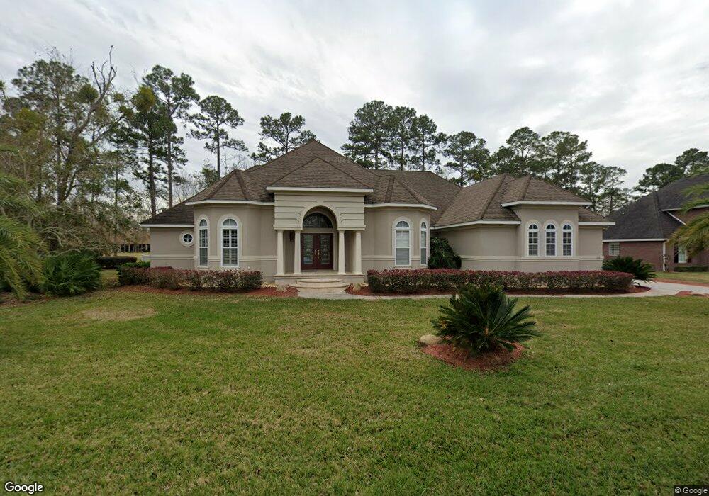
338 Osprey Cir Saint Marys, GA 31558
Estimated Value: $618,000 - $667,000
3
Beds
3
Baths
2,706
Sq Ft
$235/Sq Ft
Est. Value
About This Home
This home is located at 338 Osprey Cir, Saint Marys, GA 31558 and is currently estimated at $634,594, approximately $234 per square foot. 338 Osprey Cir is a home located in Camden County with nearby schools including Mary Lee Clark Elementary School, Saint Marys Middle School, and Camden County High School.
Ownership History
Date
Name
Owned For
Owner Type
Purchase Details
Closed on
Aug 8, 2006
Sold by
Not Provided
Bought by
Ward Thomas L and Ward Janet R
Current Estimated Value
Purchase Details
Closed on
Apr 28, 2006
Sold by
Not Provided
Bought by
Ward Thomas L and Ward Janet R
Home Financials for this Owner
Home Financials are based on the most recent Mortgage that was taken out on this home.
Original Mortgage
$434,925
Interest Rate
6.63%
Mortgage Type
New Conventional
Create a Home Valuation Report for This Property
The Home Valuation Report is an in-depth analysis detailing your home's value as well as a comparison with similar homes in the area
Home Values in the Area
Average Home Value in this Area
Purchase History
| Date | Buyer | Sale Price | Title Company |
|---|---|---|---|
| Ward Thomas L | -- | -- | |
| Ward Thomas L | $579,900 | -- |
Source: Public Records
Mortgage History
| Date | Status | Borrower | Loan Amount |
|---|---|---|---|
| Previous Owner | Ward Thomas L | $434,925 | |
| Previous Owner | Ward Thomas L | $86,985 | |
| Previous Owner | Ward Thomas L | $57,737 |
Source: Public Records
Tax History Compared to Growth
Tax History
| Year | Tax Paid | Tax Assessment Tax Assessment Total Assessment is a certain percentage of the fair market value that is determined by local assessors to be the total taxable value of land and additions on the property. | Land | Improvement |
|---|---|---|---|---|
| 2024 | $4,633 | $211,208 | $24,000 | $187,208 |
| 2023 | $4,603 | $183,608 | $24,000 | $159,608 |
| 2022 | $3,466 | $180,849 | $24,000 | $156,849 |
| 2021 | $3,664 | $161,695 | $24,000 | $137,695 |
| 2020 | $3,767 | $153,267 | $24,000 | $129,267 |
| 2019 | $3,767 | $153,267 | $24,000 | $129,267 |
| 2018 | $1,022 | $157,267 | $28,000 | $129,267 |
| 2017 | $3,547 | $143,982 | $24,000 | $119,982 |
| 2016 | $3,547 | $143,483 | $24,000 | $119,483 |
| 2015 | $4,044 | $143,482 | $24,000 | $119,483 |
| 2014 | $4,141 | $143,483 | $24,000 | $119,483 |
Source: Public Records
Map
Nearby Homes
- 604 Red Cedar Ln
- 602 Red Cedar Ln
- 221 Osprey Cir
- 163 Osprey Dr
- V/L 433 Osprey Cir
- LOT 377 Osprey Cir
- 297 Osprey Cir
- 1064 Greenwillow Dr
- 377 Osprey Cir
- 240 Osprey Cir
- 239 Osprey Circle St
- 251 Osprey Cir
- 278 Osprey Cir
- 310 Osprey Cir
- 1015 Greenwillow Dr
- 1018 Greenwillow Dr
- 1040 Greenwillow Dr
- 1038 Greenwillow Dr
- 336 Osprey Cir
- 340 Osprey Cir
- 1101 Birdsong Trail Unit 281
- 1101 Birdsong Trail Unit 10
- 1101 Birdsong Trail
- 342 Osprey Cir
- 329 Osprey Cir Unit 297
- 329 Osprey Cir
- 331 Osprey Cir
- 612 Red Cedar Ln Unit 394
- 612 Red Cedar Ln
- 327 Osprey Cir
- 611 Red Cedar Ln
- 344 Osprey Cir
- 0 RED CEDAR Red Cedar Ln
- 610 Red Cedar Ln
- 1111 Birdsong Trail
- 1104 Birdsong Trail
- 325 Osprey Cir Unit 63
- 325 Osprey Cir