
Seller's Agent in 2026
Madison (Maddey) Vaughn
Century 21 Landmark Realty
(615) 879-1130
8 in this area
91 Total Sales
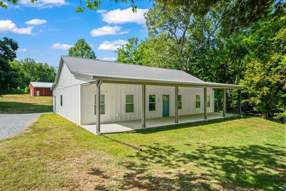
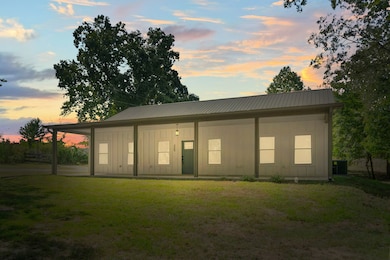
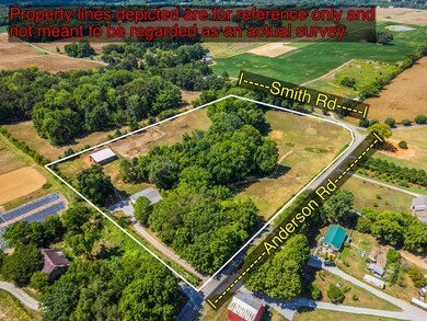
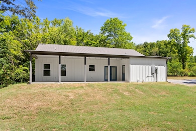
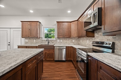
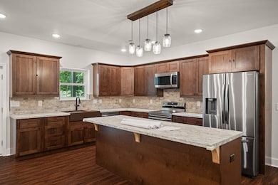
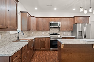
Beautiful custom home on 8.9 acres! Fenced and cross fenced for horses/livestock, long road frontage on two roads, 50x30 barn with 500 sq ft shed. House features 9' ceilings, very open, split floor plan; kitchen with custom cabinets and stone back splash; primary suite with his/her walk-ins, shower with tile and stone floor, custom shower door and separate soaking tub; other two bedrooms are very spacious! Huge utility room and walk in pantry with white birch shelving, closets have wrought iron hanging rails. This home also features a metal roof, board and batten Smart siding, 33x10 covered back porch and 50x10 covered front porch! Cumberland Connect high speed internet! Property can’t be subdivided.
Last Agent to Sell the Property
Century 21 Landmark Realty Brokerage Phone: 6155126811 License #256707 Listed on: 08/27/2025
| Date | Type | Sale Price | Title Company |
|---|---|---|---|
| Deed | $650,000 | None Listed On Document | |
| Deed | $30,000 | -- | |
| Deed | -- | -- |
| Date | Status | Loan Amount | Loan Type |
|---|---|---|---|
| Open | $350,000 | New Conventional | |
| Previous Owner | $32,026 | No Value Available |
| Date | Event | Price | List to Sale | Price per Sq Ft |
|---|---|---|---|---|
| 01/07/2026 01/07/26 | Sold | $642,750 | -1.1% | $344 / Sq Ft |
| 09/18/2025 09/18/25 | Price Changed | $650,000 | -6.5% | $348 / Sq Ft |
| 08/27/2025 08/27/25 | For Sale | $695,000 | -- | $372 / Sq Ft |
| Year | Tax Paid | Tax Assessment Tax Assessment Total Assessment is a certain percentage of the fair market value that is determined by local assessors to be the total taxable value of land and additions on the property. | Land | Improvement |
|---|---|---|---|---|
| 2025 | $1,921 | $106,700 | $26,750 | $79,950 |
| 2024 | $1,921 | $106,700 | $26,750 | $79,950 |
| 2023 | $511 | $28,375 | $26,750 | $1,625 |
| 2022 | $377 | $14,625 | $13,375 | $1,250 |
| 2021 | $377 | $14,625 | $13,375 | $1,250 |
| 2020 | $377 | $14,625 | $13,375 | $1,250 |
| 2019 | $377 | $14,625 | $13,375 | $1,250 |
| 2018 | $377 | $14,625 | $13,375 | $1,250 |
| 2017 | $366 | $11,850 | $10,550 | $1,300 |
| 2016 | $366 | $11,850 | $10,550 | $1,300 |
| 2015 | $351 | $11,850 | $10,550 | $1,300 |
| 2014 | $351 | $11,850 | $10,550 | $1,300 |
Seller's Agent in 2026
Madison (Maddey) Vaughn
Century 21 Landmark Realty
(615) 879-1130
8 in this area
91 Total Sales
Source: Realtracs
MLS Number: 2981896
APN: 017-016.00
Disclaimer: Certain information contained herein is derived from information provided by parties other than Homes.com. All information provided is deemed reliable, but is not guaranteed to be accurate and should be independently verified.
![]() Based on information submitted to the MLS GRID. All data is obtained from various sources and may not have been verified by broker or MLS GRID. Supplied Open House Information is subject to change without notice. All information should be independently reviewed and verified for accuracy. Properties may or may not be listed by the office/agent presenting the information. Some IDX listings have been excluded from this website.
Based on information submitted to the MLS GRID. All data is obtained from various sources and may not have been verified by broker or MLS GRID. Supplied Open House Information is subject to change without notice. All information should be independently reviewed and verified for accuracy. Properties may or may not be listed by the office/agent presenting the information. Some IDX listings have been excluded from this website.
Based on information submitted to the MLS GRID
Ask me questions while you tour the home.