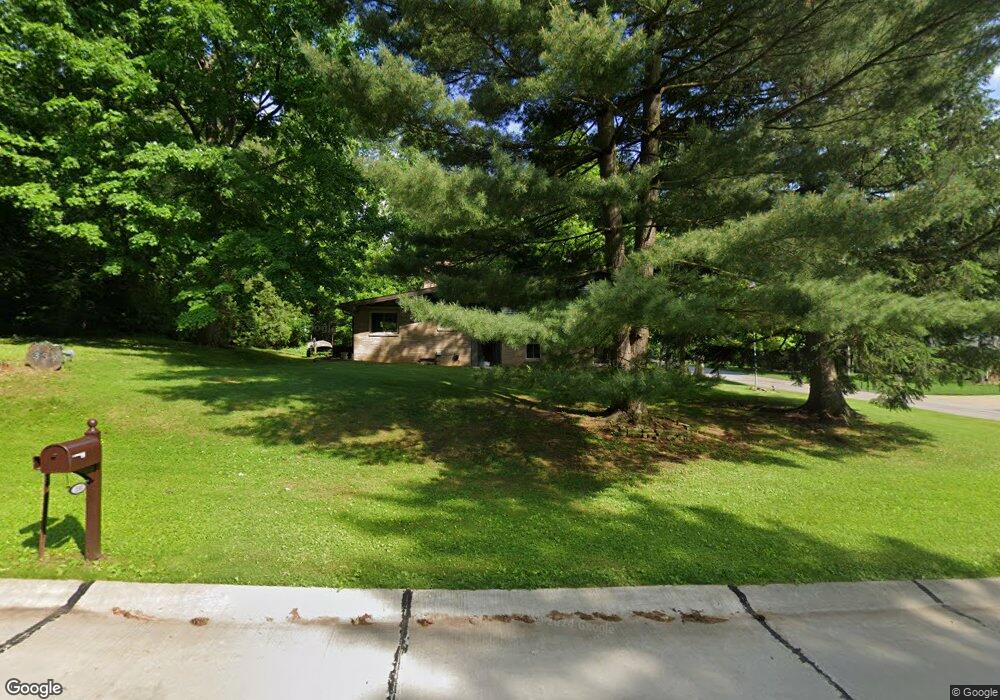
339 Asbury Rd Fairlawn, OH 44333
Estimated Value: $286,241 - $349,000
3
Beds
3
Baths
1,500
Sq Ft
$208/Sq Ft
Est. Value
About This Home
This home is located at 339 Asbury Rd, Fairlawn, OH 44333 and is currently estimated at $311,810, approximately $207 per square foot. 339 Asbury Rd is a home located in Summit County with nearby schools including Copley-Fairlawn Middle School, Copley High School, and Fairlawn Lutheran School.
Ownership History
Date
Name
Owned For
Owner Type
Purchase Details
Closed on
Jun 5, 2012
Sold by
Conley Denise A and Hall Denise A
Bought by
Conley John C and Conley Denise A
Current Estimated Value
Purchase Details
Closed on
Jun 6, 2001
Sold by
Becker Karen Jessie
Bought by
Hall Denise A
Home Financials for this Owner
Home Financials are based on the most recent Mortgage that was taken out on this home.
Original Mortgage
$70,000
Outstanding Balance
$26,742
Interest Rate
7.18%
Estimated Equity
$285,068
Create a Home Valuation Report for This Property
The Home Valuation Report is an in-depth analysis detailing your home's value as well as a comparison with similar homes in the area
Home Values in the Area
Average Home Value in this Area
Purchase History
| Date | Buyer | Sale Price | Title Company |
|---|---|---|---|
| Conley John C | -- | Attorney | |
| Hall Denise A | $152,500 | Midland Commerce Group |
Source: Public Records
Mortgage History
| Date | Status | Borrower | Loan Amount |
|---|---|---|---|
| Open | Hall Denise A | $70,000 |
Source: Public Records
Tax History Compared to Growth
Tax History
| Year | Tax Paid | Tax Assessment Tax Assessment Total Assessment is a certain percentage of the fair market value that is determined by local assessors to be the total taxable value of land and additions on the property. | Land | Improvement |
|---|---|---|---|---|
| 2025 | $3,164 | $79,304 | $19,723 | $59,581 |
| 2024 | $3,164 | $79,304 | $19,723 | $59,581 |
| 2023 | $3,164 | $79,304 | $19,723 | $59,581 |
| 2022 | $2,907 | $60,204 | $14,830 | $45,374 |
| 2021 | $2,732 | $60,204 | $14,830 | $45,374 |
| 2020 | $2,671 | $60,200 | $14,830 | $45,370 |
| 2019 | $2,695 | $54,390 | $14,830 | $39,560 |
| 2018 | $2,641 | $54,390 | $14,830 | $39,560 |
| 2017 | $2,618 | $54,390 | $14,830 | $39,560 |
| 2016 | $2,618 | $50,520 | $14,830 | $35,690 |
| 2015 | $2,618 | $50,520 | $14,830 | $35,690 |
| 2014 | $2,609 | $50,520 | $14,830 | $35,690 |
| 2013 | $2,457 | $47,630 | $14,830 | $32,800 |
Source: Public Records
Map
Nearby Homes
- 3143 Morewood Rd
- 360 Marviel Dr
- 3354 Bancroft Rd
- 3404 S Smith Rd
- 3317 Morewood Rd
- 1012 Bunker Dr Unit 304
- 3340 Willow Ln
- 462 Gresham Dr
- 278 Chestnut Ln
- 482 Gresham Dr
- 3475 Bancroft Rd
- 3451 Stanley Rd
- 600 White Tail Ridge Dr
- 288 Kenridge Rd
- 242 Elm Ln
- 3430 Links Dr
- V/L White Tail Ridge Dr
- 0 Brunsdorph Rd
- 342 S Miller Rd
- 786 Brunsdorph Rd
- 327 Asbury Rd
- 3151 Bancroft Rd
- 3170 Bancroft Rd
- 322 Trunko Rd
- 338 Asbury Rd
- 317 Asbury Rd
- 3158 Bancroft Rd
- 3179 Bancroft Rd
- 326 Asbury Rd
- 312 Trunko Rd
- 3184 Bancroft Rd
- 356 Trunko Rd
- 3168 Stanley Rd
- 316 Asbury Rd
- 3191 Bancroft Rd
- 3135 Bancroft Rd
- 3150 Stanley Rd
- 368 Trunko Rd
- 3190 Stanley Rd
- 3194 Bancroft Rd