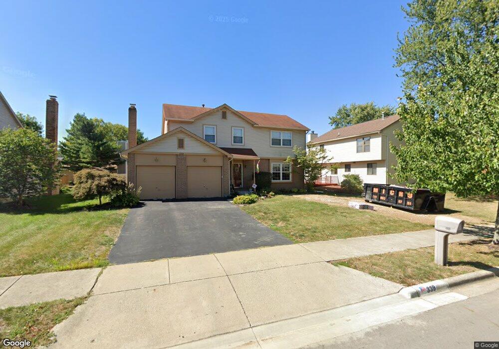
339 Burns Dr N Westerville, OH 43082
Genoa NeighborhoodEstimated Value: $437,729 - $455,000
4
Beds
3
Baths
2,010
Sq Ft
$223/Sq Ft
Est. Value
About This Home
This home is located at 339 Burns Dr N, Westerville, OH 43082 and is currently estimated at $447,432, approximately $222 per square foot. 339 Burns Dr N is a home located in Delaware County with nearby schools including Robert Frost Elementary School, Heritage Middle School, and Westerville-North High School.
Ownership History
Date
Name
Owned For
Owner Type
Purchase Details
Closed on
Dec 21, 2010
Sold by
Morelli Anthony P and Morelli Linda R
Bought by
Morelli Anthony P and Morelli Linda R
Current Estimated Value
Purchase Details
Closed on
Aug 11, 2010
Sold by
Morelli Anthony P and Morelli Linda R
Bought by
Morelli Anthony P and Morelli Linda R
Home Financials for this Owner
Home Financials are based on the most recent Mortgage that was taken out on this home.
Original Mortgage
$86,700
Interest Rate
4.58%
Mortgage Type
New Conventional
Purchase Details
Closed on
Apr 8, 2005
Sold by
Morelli Anthony P and Morelli Linda R
Bought by
Morelli Anthony P and Morelli Linda R
Purchase Details
Closed on
Mar 29, 1996
Sold by
Port Lawrence Title T C
Bought by
Morelli Anthony P and Morelli Linda R
Home Financials for this Owner
Home Financials are based on the most recent Mortgage that was taken out on this home.
Original Mortgage
$133,000
Interest Rate
7.38%
Mortgage Type
New Conventional
Purchase Details
Closed on
Jan 23, 1996
Sold by
Bernholtz Jeffrey A
Bought by
Port Lawrence Title & Trust Co Trustee
Purchase Details
Closed on
Sep 5, 1995
Sold by
Bracey Michael H
Bought by
Bernholz Jeffrey A
Home Financials for this Owner
Home Financials are based on the most recent Mortgage that was taken out on this home.
Original Mortgage
$114,000
Interest Rate
7.55%
Mortgage Type
New Conventional
Create a Home Valuation Report for This Property
The Home Valuation Report is an in-depth analysis detailing your home's value as well as a comparison with similar homes in the area
Home Values in the Area
Average Home Value in this Area
Purchase History
| Date | Buyer | Sale Price | Title Company |
|---|---|---|---|
| Morelli Anthony P | -- | Attorney | |
| Morelli Anthony P | -- | Stella Title | |
| Morelli Anthony P | -- | -- | |
| Morelli Anthony P | $142,000 | -- | |
| Port Lawrence Title & Trust Co Trustee | $143,000 | -- | |
| Bernholz Jeffrey A | $142,500 | -- |
Source: Public Records
Mortgage History
| Date | Status | Borrower | Loan Amount |
|---|---|---|---|
| Closed | Morelli Anthony P | $86,700 | |
| Closed | Morelli Anthony P | $133,000 | |
| Previous Owner | Bernholz Jeffrey A | $114,000 |
Source: Public Records
Tax History Compared to Growth
Tax History
| Year | Tax Paid | Tax Assessment Tax Assessment Total Assessment is a certain percentage of the fair market value that is determined by local assessors to be the total taxable value of land and additions on the property. | Land | Improvement |
|---|---|---|---|---|
| 2024 | $5,223 | $122,120 | $29,400 | $92,720 |
| 2023 | $5,228 | $122,120 | $29,400 | $92,720 |
| 2022 | $5,268 | $89,680 | $20,130 | $69,550 |
| 2021 | $5,314 | $89,680 | $20,130 | $69,550 |
| 2020 | $5,927 | $89,680 | $20,130 | $69,550 |
| 2019 | $4,797 | $69,340 | $17,500 | $51,840 |
| 2018 | $4,716 | $69,340 | $17,500 | $51,840 |
| 2017 | $4,687 | $66,150 | $12,740 | $53,410 |
| 2016 | $4,909 | $66,150 | $12,740 | $53,410 |
| 2015 | $4,696 | $66,150 | $12,740 | $53,410 |
| 2014 | $4,743 | $66,150 | $12,740 | $53,410 |
| 2013 | $4,529 | $63,140 | $12,740 | $50,400 |
Source: Public Records
Map
Nearby Homes
- 718 Sugar Ct
- 547 County Line Rd
- 656 Olde Mill Dr
- 150 Matthew Ave
- 175 Nottingham Ct
- 754 Kingsmead Rd Unit 18754
- 912 Lakeway Ct E
- 267 Windemere Place
- 589 E College Ave
- 974 Lakeland Dr
- 368 E College Ave
- 364 E College Ave
- 223 Dogwood Ln
- 768 Collingwood Dr
- 348 Buck Run Trail
- 137 Abbeycross Ln
- 192 Buckeye Ct
- 114 Canterbrick Dr
- 199 E College Ave
- 182 Hillcrest Dr
- 607 Apple St
- 331 Burns Dr N
- 598 Mulberry Way S
- 595 Apple St
- 338 Burns Dr N
- 588 Mulberry Way S
- 346 Burns Dr N
- 332 Burns Dr N
- 587 Apple St
- 361 Burns Dr N
- 352 Burns Dr N
- 326 Burns Dr N
- 603 Mulberry Way S
- 315 Burns Dr N
- 597 Mulberry Way S
- 580 Mulberry Way S
- 360 Burns Dr N
- 320 Burns Dr N
- 590 Apple St
- 579 Apple St