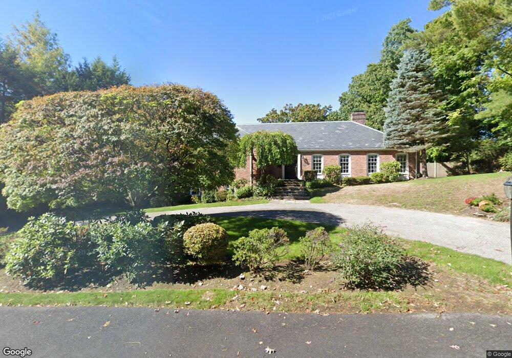
339 Chestnut St West Newton, MA 02465
West Newton NeighborhoodEstimated Value: $2,417,000 - $3,543,000
4
Beds
5
Baths
4,830
Sq Ft
$617/Sq Ft
Est. Value
About This Home
This home is located at 339 Chestnut St, West Newton, MA 02465 and is currently estimated at $2,979,071, approximately $616 per square foot. 339 Chestnut St is a home located in Middlesex County with nearby schools including Peirce Elementary School, F.A. Day Middle School, and Newton North High School.
Ownership History
Date
Name
Owned For
Owner Type
Purchase Details
Closed on
Sep 15, 2009
Sold by
Romm Eugenia
Bought by
Nour Nawal M
Current Estimated Value
Home Financials for this Owner
Home Financials are based on the most recent Mortgage that was taken out on this home.
Original Mortgage
$1,100,000
Interest Rate
5.36%
Mortgage Type
Purchase Money Mortgage
Purchase Details
Closed on
Oct 4, 2005
Sold by
Carey Deborah A
Bought by
Holden Keith A and Holden Patricia R
Purchase Details
Closed on
Oct 27, 1989
Sold by
Romm Eugenia
Bought by
Chase Manhattan Fin
Purchase Details
Closed on
Aug 20, 1987
Sold by
Vonk Erik
Bought by
Romm Lev
Create a Home Valuation Report for This Property
The Home Valuation Report is an in-depth analysis detailing your home's value as well as a comparison with similar homes in the area
Home Values in the Area
Average Home Value in this Area
Purchase History
| Date | Buyer | Sale Price | Title Company |
|---|---|---|---|
| Nour Nawal M | $1,526,000 | -- | |
| Holden Keith A | $530,000 | -- | |
| Chase Manhattan Fin | $275,000 | -- | |
| Romm Lev | $550,000 | -- |
Source: Public Records
Mortgage History
| Date | Status | Borrower | Loan Amount |
|---|---|---|---|
| Open | Romm Lev | $1,000,000 | |
| Closed | Nour Nawal M | $1,100,000 | |
| Previous Owner | Romm Lev | $436,000 |
Source: Public Records
Tax History Compared to Growth
Tax History
| Year | Tax Paid | Tax Assessment Tax Assessment Total Assessment is a certain percentage of the fair market value that is determined by local assessors to be the total taxable value of land and additions on the property. | Land | Improvement |
|---|---|---|---|---|
| 2025 | $24,839 | $2,534,600 | $1,405,400 | $1,129,200 |
| 2024 | $24,017 | $2,460,800 | $1,364,500 | $1,096,300 |
| 2023 | $23,060 | $2,265,200 | $1,087,300 | $1,177,900 |
| 2022 | $22,065 | $2,097,400 | $1,006,800 | $1,090,600 |
| 2021 | $21,291 | $1,978,700 | $949,800 | $1,028,900 |
| 2020 | $20,658 | $1,978,700 | $949,800 | $1,028,900 |
| 2019 | $20,075 | $1,921,100 | $922,100 | $999,000 |
| 2018 | $19,633 | $1,814,500 | $820,200 | $994,300 |
| 2017 | $19,035 | $1,711,800 | $773,800 | $938,000 |
| 2016 | $18,206 | $1,599,800 | $723,200 | $876,600 |
| 2015 | $18,478 | $1,591,600 | $675,900 | $915,700 |
Source: Public Records
Map
Nearby Homes
- 222 Prince St
- 39 Valentine Park
- 308 Prince St
- 36 Troy Ln
- 10 Ruane Rd
- 1230 Commonwealth Ave
- 18 Sewall St
- 40 Sewall St
- 513 Chestnut St
- 1430 Beacon St
- 12 Inis Cir
- 115 Windsor Rd
- 25 Allen Ave
- 79 Chestnut St Unit 2
- 1488 Washington St Unit 1488
- 318 Austin St Unit A
- 154 Beaumont Ave
- 80 Pine Ridge Rd
- 61 Lakeview Ave
- 1639 Washington St
- 1415 Commonwealth Ave
- 1429 Commonwealth Ave
- 1395 Commonwealth Ave
- 340 Chestnut St
- 26 Dartmouth St
- 320 Chestnut St
- 311 Chestnut St
- 350 Chestnut St
- 185 Prince St
- 1445 Commonwealth Ave
- 195 Prince St
- 221 Prince St
- 10 Dartmouth St
- 45 Bristol Rd
- 1404 Commonwealth Ave
- 1428 Commonwealth Ave
- 1418 Commonwealth Ave
- 35 Dartmouth St
- 1408 Commonwealth Ave Unit 1
- 1408 Commonwealth Ave