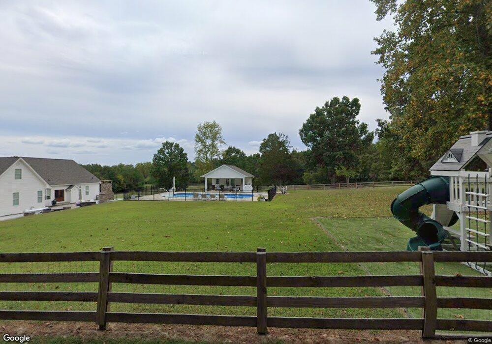
339 Rockman Way Dalton, GA 30721
Estimated Value: $667,000 - $802,000
4
Beds
4
Baths
3,697
Sq Ft
$192/Sq Ft
Est. Value
About This Home
This home is located at 339 Rockman Way, Dalton, GA 30721 and is currently estimated at $708,527, approximately $191 per square foot. 339 Rockman Way is a home located in Whitfield County with nearby schools including Dawnville Elementary School and Coahulla Creek High School.
Ownership History
Date
Name
Owned For
Owner Type
Purchase Details
Closed on
Aug 21, 2020
Sold by
Miller Travis G
Bought by
Wolf Eric M and Wolf Samantha H
Current Estimated Value
Home Financials for this Owner
Home Financials are based on the most recent Mortgage that was taken out on this home.
Original Mortgage
$399,920
Outstanding Balance
$354,757
Interest Rate
3%
Mortgage Type
New Conventional
Estimated Equity
$353,770
Purchase Details
Closed on
Nov 12, 2009
Sold by
Miller Travis
Bought by
Friend David J R
Purchase Details
Closed on
Sep 1, 1993
Bought by
Miller Travis G and Miller Kimberly
Create a Home Valuation Report for This Property
The Home Valuation Report is an in-depth analysis detailing your home's value as well as a comparison with similar homes in the area
Home Values in the Area
Average Home Value in this Area
Purchase History
| Date | Buyer | Sale Price | Title Company |
|---|---|---|---|
| Wolf Eric M | $499,900 | -- | |
| Friend David J R | $27,000 | -- | |
| Miller Travis G | -- | -- |
Source: Public Records
Mortgage History
| Date | Status | Borrower | Loan Amount |
|---|---|---|---|
| Open | Wolf Eric M | $399,920 |
Source: Public Records
Tax History Compared to Growth
Tax History
| Year | Tax Paid | Tax Assessment Tax Assessment Total Assessment is a certain percentage of the fair market value that is determined by local assessors to be the total taxable value of land and additions on the property. | Land | Improvement |
|---|---|---|---|---|
| 2024 | $5,505 | $250,816 | $25,345 | $225,471 |
| 2023 | $5,362 | $190,345 | $17,204 | $173,141 |
| 2022 | $4,316 | $154,879 | $14,502 | $140,377 |
| 2021 | $4,341 | $155,683 | $14,502 | $141,181 |
| 2020 | $3,831 | $134,524 | $12,405 | $122,119 |
| 2019 | $3,889 | $134,524 | $12,405 | $122,119 |
| 2018 | $3,893 | $132,854 | $10,735 | $122,119 |
| 2017 | $3,895 | $132,854 | $10,735 | $122,119 |
| 2016 | $3,459 | $122,969 | $10,735 | $112,234 |
| 2014 | $2,823 | $112,254 | $9,979 | $102,274 |
| 2013 | -- | $112,253 | $9,979 | $102,274 |
Source: Public Records
Map
Nearby Homes
- 1070 Dawnville Rd NE
- 1914 Bowers Rd
- 4363 Bass Dr NE
- 1304 E Bowers Rd
- 620 Lower Dawnville Rd NE
- 4371 Bass McHan Dr NE
- 1507 Lynnwood Dr NE
- 502 Richardson Rd NE
- 2217 Mccamish Rd NE
- 1379 Presley Rd NE
- 685 Goswick Rd
- 1158 Holly Grove Cir NE
- 2250 Dawnville Beaverdale Rd NE
- 4685 Mitchell Bridge Rd NE
- 4960 Mark Brown Rd NE
- 114 Cliffs Dr
- 3871 Miller Dr NE
- 2281 Bowers Rd NE
- 1222 Beaverdale Cutoff Rd NE
- 909 Beaverdale Rd NE
- 344 Rockman Way
- 235 Rockman Way
- 0 Rockman Way
- 1101 Mount Zion Rd NE
- 1131 Mount Zion Rd NE
- 147 Rockman Way
- 134 Rockman Way
- 1143 Mount Zion Rd
- 1025 Mount Zion Rd NE
- 1128 Mount Zion Rd NE
- 2042 Renfroe Rd NE
- 1106 Mount Zion Rd NE
- 2000 Smokerise Dr
- 1958 Renfroe Rd NE
- 2005 Smokerise Dr
- 1173 Mount Zion Rd NE
- 1625 Dawnville Bvrdale Rd NE
- 2015 Smokerise Dr Unit 5
- 1098 Mount Zion Rd NE
- 1979 Renfroe Rd NE