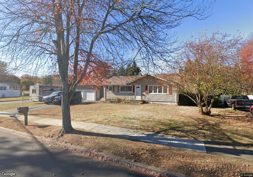
339 W Rutland Rd Milford, CT 06461
Parkway/Wheelers Farm Road NeighborhoodEstimated Value: $422,526 - $529,000
3
Beds
1
Bath
1,000
Sq Ft
$481/Sq Ft
Est. Value
About This Home
This home is located at 339 W Rutland Rd, Milford, CT 06461 and is currently estimated at $481,382, approximately $481 per square foot. 339 W Rutland Rd is a home located in New Haven County with nearby schools including Mathewson School, West Shore Middle School, and Jonathan Law High School.
Ownership History
Date
Name
Owned For
Owner Type
Purchase Details
Closed on
Mar 31, 1998
Sold by
Rivera Arcadio
Bought by
Yazdzik Michael and Bishop Michelle L
Current Estimated Value
Home Financials for this Owner
Home Financials are based on the most recent Mortgage that was taken out on this home.
Original Mortgage
$160,532
Interest Rate
6.96%
Mortgage Type
Unknown
Purchase Details
Closed on
Jan 18, 1994
Sold by
Horodysky Peter and Horodysky Joanne L
Bought by
Rivera Arcadio
Create a Home Valuation Report for This Property
The Home Valuation Report is an in-depth analysis detailing your home's value as well as a comparison with similar homes in the area
Home Values in the Area
Average Home Value in this Area
Purchase History
| Date | Buyer | Sale Price | Title Company |
|---|---|---|---|
| Yazdzik Michael | $164,500 | -- | |
| Yazdzik Michael | $164,500 | -- | |
| Rivera Arcadio | $150,000 | -- | |
| Rivera Arcadio | $150,000 | -- |
Source: Public Records
Mortgage History
| Date | Status | Borrower | Loan Amount |
|---|---|---|---|
| Open | Rivera Arcadio | $18,700 | |
| Open | Rivera Arcadio | $202,000 | |
| Closed | Rivera Arcadio | $160,532 |
Source: Public Records
Tax History Compared to Growth
Tax History
| Year | Tax Paid | Tax Assessment Tax Assessment Total Assessment is a certain percentage of the fair market value that is determined by local assessors to be the total taxable value of land and additions on the property. | Land | Improvement |
|---|---|---|---|---|
| 2025 | $6,263 | $211,930 | $107,100 | $104,830 |
| 2024 | $6,176 | $211,930 | $107,100 | $104,830 |
| 2023 | $5,758 | $211,930 | $107,100 | $104,830 |
| 2022 | $5,648 | $211,930 | $107,100 | $104,830 |
| 2021 | $5,098 | $184,370 | $84,670 | $99,700 |
| 2020 | $5,103 | $184,370 | $84,670 | $99,700 |
| 2019 | $5,109 | $184,370 | $84,670 | $99,700 |
| 2018 | $5,114 | $184,370 | $84,670 | $99,700 |
| 2017 | $5,124 | $184,370 | $84,670 | $99,700 |
| 2016 | $5,214 | $187,280 | $84,670 | $102,610 |
| 2015 | $5,221 | $187,280 | $84,670 | $102,610 |
| 2014 | $5,098 | $187,280 | $84,670 | $102,610 |
Source: Public Records
Map
Nearby Homes
- 29 Benjamin Heights Dr
- 1299 Naugatuck Ave
- 116 Cornfield Rd
- 10 Lucius Ct Unit 10
- 333 West Ave Unit 13
- 0 Caswell Cove Unit B-8
- 663 West Ave Unit A21
- 88 Boston Post Rd
- 184 West Ave
- 43 Innsbruck St
- 18 Greenview Ln
- 50 Washington St
- 40 Washington St
- 49 Finch St
- 299 W Main St
- 27 Peck St
- 0 Thornton St
- 23 Utica St
- 450 River Rd
- 26 Jasmine Cir
- 333 W Rutland Rd
- 15 Benneville Rd
- 325 W Rutland Rd
- 353 W Rutland Rd
- 336 W Rutland Rd
- 122 Beaverbrook Rd
- 344 W Rutland Rd
- 25 Benneville Rd
- 319 W Rutland Rd
- 352 W Rutland Rd
- 363 W Rutland Rd
- 125 Beaverbrook Rd
- 106 Beaverbrook Rd
- 98 Beaverbrook Rd
- 35 Benneville Rd
- 311 W Rutland Rd
- 360 W Rutland Rd
- 90 Beaverbrook Rd
- 314 W Rutland Rd
- 82 Beaverbrook Rd