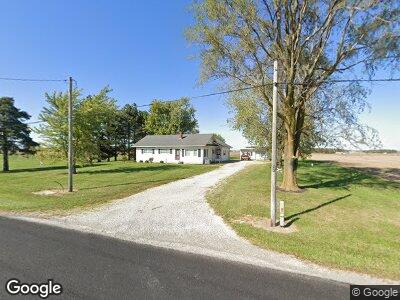
3399 Mercer Darke Co Line Rd Fort Recovery, OH 45846
Estimated Value: $212,000 - $275,000
3
Beds
1
Bath
1,520
Sq Ft
$162/Sq Ft
Est. Value
About This Home
This home is located at 3399 Mercer Darke Co Line Rd, Fort Recovery, OH 45846 and is currently estimated at $245,846, approximately $161 per square foot. 3399 Mercer Darke Co Line Rd is a home located in Mercer County with nearby schools including Fort Recovery Elementary School, Fort Recovery Middle School, and Fort Recovery High School.
Ownership History
Date
Name
Owned For
Owner Type
Purchase Details
Closed on
Jul 11, 2022
Sold by
Clune Michael A
Bought by
Clune Michael A
Current Estimated Value
Purchase Details
Closed on
May 18, 2011
Sold by
Moeller Nicholas J and Moeller Elizabeth A
Bought by
Clune Michael A and Clune Rebecca J
Home Financials for this Owner
Home Financials are based on the most recent Mortgage that was taken out on this home.
Original Mortgage
$155,000
Interest Rate
5.5%
Mortgage Type
New Conventional
Create a Home Valuation Report for This Property
The Home Valuation Report is an in-depth analysis detailing your home's value as well as a comparison with similar homes in the area
Home Values in the Area
Average Home Value in this Area
Purchase History
| Date | Buyer | Sale Price | Title Company |
|---|---|---|---|
| Clune Michael A | $155,000 | Attorney |
Source: Public Records
Mortgage History
| Date | Status | Borrower | Loan Amount |
|---|---|---|---|
| Previous Owner | Clune Michael A | $155,000 | |
| Previous Owner | Moeller Nicholas J | $98,500 | |
| Previous Owner | Moeller Nicholas J | $106,400 |
Source: Public Records
Tax History Compared to Growth
Tax History
| Year | Tax Paid | Tax Assessment Tax Assessment Total Assessment is a certain percentage of the fair market value that is determined by local assessors to be the total taxable value of land and additions on the property. | Land | Improvement |
|---|---|---|---|---|
| 2024 | $2,325 | $67,690 | $14,630 | $53,060 |
| 2023 | $2,325 | $67,690 | $14,630 | $53,060 |
| 2022 | $1,983 | $52,150 | $9,660 | $42,490 |
| 2021 | $2,020 | $52,150 | $9,660 | $42,490 |
| 2020 | $1,005 | $52,150 | $9,660 | $42,490 |
| 2019 | $1,686 | $42,950 | $8,540 | $34,410 |
| 2018 | $1,760 | $42,950 | $8,540 | $34,410 |
| 2017 | $1,772 | $42,950 | $8,540 | $34,410 |
| 2016 | $1,533 | $36,680 | $8,750 | $27,930 |
| 2015 | $1,491 | $36,680 | $8,750 | $27,930 |
| 2014 | $1,466 | $36,680 | $8,750 | $27,930 |
| 2013 | $1,407 | $33,680 | $8,020 | $25,660 |
Source: Public Records
Map
Nearby Homes
- 4475 Ohio 705
- 13747 State Route 49 N
- 203 High St
- 5220 Philothea Rd
- 7430 Ohio 705
- 160 Mendenhall Rd
- 159 Mendenhall Rd
- 158 Mendenhall Rd
- 157 Mendenhall Rd
- 140 Liberty Dr
- 139 Liberty Dr
- 141 Liberty Dr
- 137 Liberty Dr
- 136 Liberty Dr
- 138 Liberty Dr
- 142 Liberty Dr
- 144 Liberty Dr
- 135 Veterans Dr
- 147 Liberty Dr
- 143 Liberty Dr