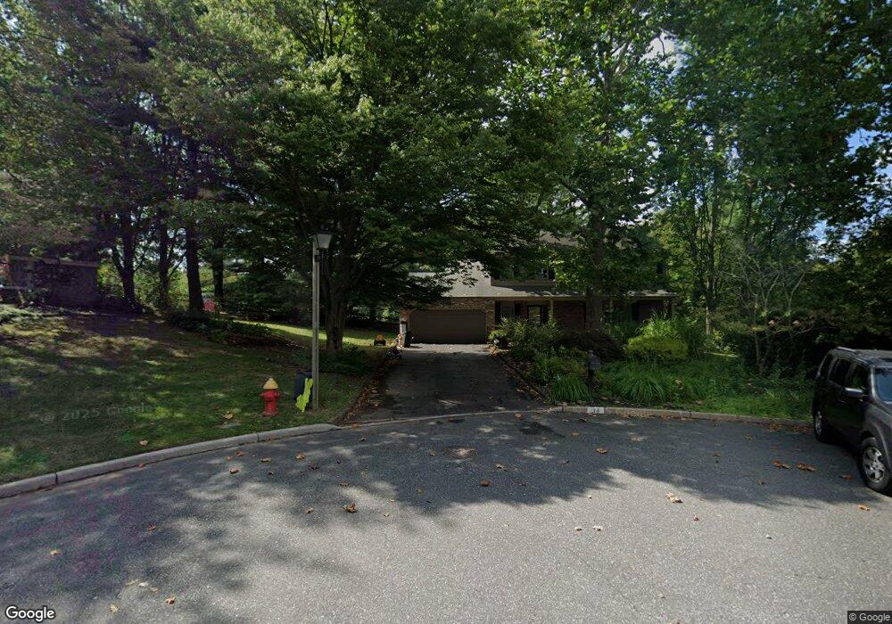
34 Amity Ct Langhorne, PA 19047
Estimated Value: $667,000 - $694,000
4
Beds
3
Baths
2,326
Sq Ft
$294/Sq Ft
Est. Value
About This Home
This home is located at 34 Amity Ct, Langhorne, PA 19047 and is currently estimated at $684,159, approximately $294 per square foot. 34 Amity Ct is a home located in Bucks County with nearby schools including Pearl S. Buck Elementary School, Maple Point Middle School, and Neshaminy High School.
Ownership History
Date
Name
Owned For
Owner Type
Purchase Details
Closed on
Dec 17, 2013
Sold by
Gray Lee J and Sheller Catherine M
Bought by
Gray Lee J and Gray Catherine M
Current Estimated Value
Purchase Details
Closed on
Apr 6, 2009
Sold by
Patrone Ralph C and Patrone Arleen R
Bought by
Gray Lee J and Sheller Catherine M
Home Financials for this Owner
Home Financials are based on the most recent Mortgage that was taken out on this home.
Original Mortgage
$260,000
Outstanding Balance
$164,362
Interest Rate
4.94%
Mortgage Type
Purchase Money Mortgage
Estimated Equity
$519,797
Create a Home Valuation Report for This Property
The Home Valuation Report is an in-depth analysis detailing your home's value as well as a comparison with similar homes in the area
Home Values in the Area
Average Home Value in this Area
Purchase History
| Date | Buyer | Sale Price | Title Company |
|---|---|---|---|
| Gray Lee J | -- | None Available | |
| Gray Lee J | $380,000 | None Available |
Source: Public Records
Mortgage History
| Date | Status | Borrower | Loan Amount |
|---|---|---|---|
| Open | Gray Lee J | $260,000 |
Source: Public Records
Tax History Compared to Growth
Tax History
| Year | Tax Paid | Tax Assessment Tax Assessment Total Assessment is a certain percentage of the fair market value that is determined by local assessors to be the total taxable value of land and additions on the property. | Land | Improvement |
|---|---|---|---|---|
| 2025 | $9,753 | $44,800 | $10,560 | $34,240 |
| 2024 | $9,753 | $44,800 | $10,560 | $34,240 |
| 2023 | $9,598 | $44,800 | $10,560 | $34,240 |
| 2022 | $9,346 | $44,800 | $10,560 | $34,240 |
| 2021 | $9,346 | $44,800 | $10,560 | $34,240 |
| 2020 | $9,234 | $44,800 | $10,560 | $34,240 |
| 2019 | $9,028 | $44,800 | $10,560 | $34,240 |
| 2018 | $8,862 | $44,800 | $10,560 | $34,240 |
| 2017 | $8,636 | $44,800 | $10,560 | $34,240 |
| 2016 | $8,636 | $44,800 | $10,560 | $34,240 |
| 2015 | $8,825 | $44,800 | $10,560 | $34,240 |
| 2014 | $8,825 | $44,800 | $10,560 | $34,240 |
Source: Public Records
Map
Nearby Homes
- 257 Norsam Dr
- 770 Atkinson Ln
- 1102 Waterford Rd Unit 1
- 462 Scott Ct
- 1988 Knight Cir
- 2908 Sterling Rd Unit 175
- 2904 Sterling Rd Unit 179
- 120 Shady Brook Dr Unit 89
- 1707 Lynbrooke Dr Unit 120
- 624 Lollard Ct
- 2703 Lynbrooke Dr Unit 81
- 1948 Satter Ct
- 14303 Cornerstone Dr
- 273 Shady Brook Dr Unit 243
- 175 Shady Brook Dr Unit 122
- 187 Shady Brook Dr Unit 129
- 210 Shady Brook Dr
- 8501 Spruce Mill Dr
- 354 Shady Brook Dr Unit 180
- 7908 Spruce Mill Dr Unit 656
- 18 Amity Ct
- 35 Amity Ct
- 2 Amity Ct
- 19 Amity Ct
- 13 Amity Ct
- 36 Markham Ct
- 20 Markham Ct
- 52 Markham Ct
- 96 Maple Point Dr
- 33 Maple Point Dr
- 17 Maple Point Dr
- 49 Maple Point Dr
- 1 Maple Point Dr
- 65 Maple Point Dr
- 81 Maple Point Dr
- 97 Maple Point Dr
- 21 Markham Ct
- 53 Markham Ct
- 302 Mallard Ln
- 247 Norsam Dr