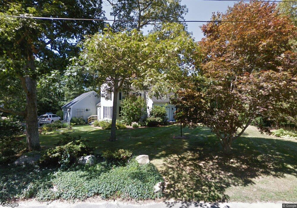
34 Captain Curtis Way Orleans, MA 02653
Estimated Value: $1,206,000 - $1,396,000
3
Beds
2
Baths
1,920
Sq Ft
$679/Sq Ft
Est. Value
About This Home
This home is located at 34 Captain Curtis Way, Orleans, MA 02653 and is currently estimated at $1,303,917, approximately $679 per square foot. 34 Captain Curtis Way is a home located in Barnstable County with nearby schools including Orleans Elementary School, Nauset Regional Middle School, and Nauset Regional High School.
Ownership History
Date
Name
Owned For
Owner Type
Purchase Details
Closed on
Apr 19, 2021
Sold by
Slater Daniel H and Slater Cindi A
Bought by
Daniel E Slater T
Current Estimated Value
Purchase Details
Closed on
Sep 9, 2020
Sold by
D Ann Benton 2020 Lt
Bought by
Slater Daniel H and Slater Cindi A
Home Financials for this Owner
Home Financials are based on the most recent Mortgage that was taken out on this home.
Original Mortgage
$510,400
Interest Rate
2.9%
Mortgage Type
Purchase Money Mortgage
Purchase Details
Closed on
Feb 12, 2020
Sold by
Benton Deborah A
Bought by
Deborah Ann Benton Lt
Purchase Details
Closed on
Apr 4, 2008
Sold by
Smith Bonnie L and Smith Richard E
Bought by
Benton Deborah A
Create a Home Valuation Report for This Property
The Home Valuation Report is an in-depth analysis detailing your home's value as well as a comparison with similar homes in the area
Home Values in the Area
Average Home Value in this Area
Purchase History
| Date | Buyer | Sale Price | Title Company |
|---|---|---|---|
| Daniel E Slater T | -- | None Available | |
| Slater Daniel H | $750,000 | None Available | |
| Deborah Ann Benton Lt | -- | None Available | |
| Benton Deborah A | $575,000 | -- |
Source: Public Records
Mortgage History
| Date | Status | Borrower | Loan Amount |
|---|---|---|---|
| Previous Owner | Slater Daniel H | $510,400 |
Source: Public Records
Tax History Compared to Growth
Tax History
| Year | Tax Paid | Tax Assessment Tax Assessment Total Assessment is a certain percentage of the fair market value that is determined by local assessors to be the total taxable value of land and additions on the property. | Land | Improvement |
|---|---|---|---|---|
| 2025 | $6,498 | $1,041,300 | $313,800 | $727,500 |
| 2024 | $6,214 | $969,500 | $307,600 | $661,900 |
| 2023 | $5,621 | $902,300 | $284,800 | $617,500 |
| 2022 | $5,238 | $727,500 | $258,900 | $468,600 |
| 2021 | $5,100 | $650,500 | $255,200 | $395,300 |
| 2020 | $4,947 | $654,400 | $266,800 | $387,600 |
| 2019 | $4,601 | $621,700 | $236,800 | $384,900 |
| 2018 | $3,918 | $590,900 | $232,200 | $358,700 |
| 2017 | $3,531 | $557,800 | $232,200 | $325,600 |
| 2016 | $3,549 | $549,400 | $230,300 | $319,100 |
| 2015 | $3,396 | $529,000 | $215,000 | $314,000 |
Source: Public Records
Map
Nearby Homes
- 53 Great Oak Rd
- 2 Little Cove Ln
- 3 Bramblewood Ln
- 18 Cole Place
- 2 Seaview Rd
- 216 Main St
- 320 State Hwy
- 6 Snow Way
- 150 Old State Hwy Unit Compound
- 3 Country Crossing
- 20 Kittiwake Ln
- 46 Freeman Ln
- 110 Beach Rd
- 7 Brick Hill Ext Rd
- 7 Brick Hill Rd
- 785 State Hwy Unit 9
- 25 Twin Rocks Dr
- 993 Intonti Way
- 995 Intonti Way
- 30 Cove Rd
- 34 Capt Curtis Way
- 11 Hathorne Ln
- 30 Captain Curtis Way
- 36 Captain Curtis Way
- 35 Captain Curtis Way
- 42 Pine Needle Way
- 29 Captain Curtis Way
- 85 Pineneedle Way
- 49 Pine Needle Way
- 14 Hathorne Ln
- 26 Captain Curtis Way
- 39 Captain Curtis Way
- 25 Captain Curtis Way
- 10 Sand Hill Ln
- 40 Captain Curtis Way
- 7 Hathorne Ln
- 45 Pine Needle Way
- 10 Hathorne Ln
- 41 Captain Curtis Way
- 24 Captain Curtis Way