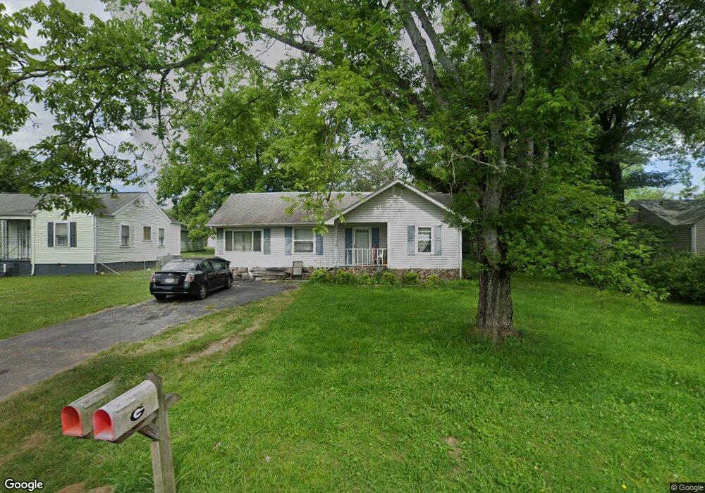
34 Eaton Cir Fort Oglethorpe, GA 30742
Estimated Value: $180,921 - $216,000
--
Bed
1
Bath
1,328
Sq Ft
$149/Sq Ft
Est. Value
About This Home
This home is located at 34 Eaton Cir, Fort Oglethorpe, GA 30742 and is currently estimated at $197,730, approximately $148 per square foot. 34 Eaton Cir is a home located in Catoosa County with nearby schools including Battlefield Primary School, Battlefield Elementary School, and Lakeview Middle School.
Ownership History
Date
Name
Owned For
Owner Type
Purchase Details
Closed on
Aug 16, 2024
Sold by
Lewis Jason R
Bought by
Vann Adam Michael and Vann Candice Daniell
Current Estimated Value
Purchase Details
Closed on
Aug 10, 2024
Sold by
Lewis Jason R
Bought by
Vann Adam Michael and Vann Candice Daniell
Purchase Details
Closed on
Jul 30, 2024
Sold by
Lewis Jason R
Bought by
Vann Candice Daniell
Purchase Details
Closed on
Jul 17, 2002
Bought by
Lewis Jason R
Create a Home Valuation Report for This Property
The Home Valuation Report is an in-depth analysis detailing your home's value as well as a comparison with similar homes in the area
Home Values in the Area
Average Home Value in this Area
Purchase History
| Date | Buyer | Sale Price | Title Company |
|---|---|---|---|
| Vann Adam Michael | -- | -- | |
| Vann Adam Michael | -- | -- | |
| Vann Candice Daniell | -- | -- | |
| Lewis Jason R | $88,500 | -- |
Source: Public Records
Tax History Compared to Growth
Tax History
| Year | Tax Paid | Tax Assessment Tax Assessment Total Assessment is a certain percentage of the fair market value that is determined by local assessors to be the total taxable value of land and additions on the property. | Land | Improvement |
|---|---|---|---|---|
| 2024 | $1,718 | $65,288 | $7,297 | $57,991 |
| 2023 | $1,358 | $48,363 | $7,297 | $41,066 |
| 2022 | $1,079 | $38,425 | $7,297 | $31,128 |
| 2021 | $1,023 | $38,425 | $7,297 | $31,128 |
| 2020 | $973 | $32,944 | $7,297 | $25,647 |
| 2019 | $983 | $32,944 | $7,297 | $25,647 |
| 2018 | $770 | $24,571 | $6,486 | $18,085 |
| 2017 | $764 | $24,374 | $6,486 | $17,888 |
| 2016 | $744 | $22,724 | $6,486 | $16,238 |
| 2015 | -- | $22,724 | $6,486 | $16,238 |
| 2014 | -- | $22,724 | $6,486 | $16,238 |
| 2013 | -- | $22,724 | $6,486 | $16,237 |
Source: Public Records
Map
Nearby Homes
- 15 Walker Ave
- 99 Battlewood Dr
- 84 Elaine Cir
- 38 Phillips Dr
- 64 Stovall St
- 8 Phillips Dr
- 8 Roberts Dr
- 104 Shelby St
- 6 Talley Cir
- 52 S Glade Rd
- 59 Gattis Dr
- 204 Harker Rd
- 218 Robert e Lee St
- 1955 Old Lafayette Rd
- 1305 Park Forrest Dr
- 6 Rocky Ford Rd
- 504 Frieda Dr
- 123 Coffman Dr
- 7 Barnhardt Cir
- 309 Barnhardt Cir