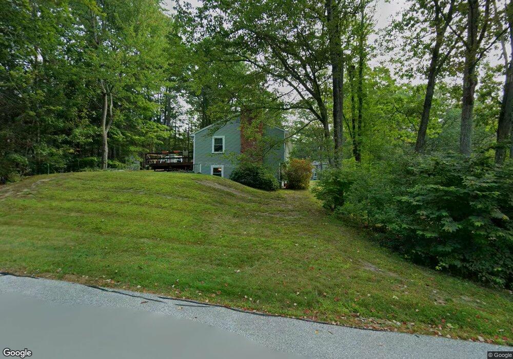
34 Juniper Dr Amherst, NH 03031
Estimated Value: $487,000 - $550,000
3
Beds
2
Baths
1,300
Sq Ft
$398/Sq Ft
Est. Value
About This Home
This home is located at 34 Juniper Dr, Amherst, NH 03031 and is currently estimated at $517,341, approximately $397 per square foot. 34 Juniper Dr is a home with nearby schools including Wilkins Elementary School, Amherst Middle School, and Souhegan Cooperative High School.
Ownership History
Date
Name
Owned For
Owner Type
Purchase Details
Closed on
Sep 10, 2025
Sold by
Sullivan Christine L
Bought by
Christine L Sullivan Ret and Sullivan
Current Estimated Value
Purchase Details
Closed on
Oct 26, 2020
Sold by
Christine L Sullivan Ret and Sullivan
Bought by
Sullivan Christine L
Home Financials for this Owner
Home Financials are based on the most recent Mortgage that was taken out on this home.
Original Mortgage
$165,825
Interest Rate
2.9%
Mortgage Type
VA
Purchase Details
Closed on
May 21, 2020
Sold by
Sullivan Christine L
Bought by
Christine L Sullivan Ret
Create a Home Valuation Report for This Property
The Home Valuation Report is an in-depth analysis detailing your home's value as well as a comparison with similar homes in the area
Home Values in the Area
Average Home Value in this Area
Purchase History
| Date | Buyer | Sale Price | Title Company |
|---|---|---|---|
| Christine L Sullivan Ret | -- | -- | |
| Sullivan Christine L | -- | None Available | |
| Christine L Sullivan Ret | -- | None Available |
Source: Public Records
Mortgage History
| Date | Status | Borrower | Loan Amount |
|---|---|---|---|
| Previous Owner | Sullivan Christine L | $165,825 |
Source: Public Records
Tax History Compared to Growth
Tax History
| Year | Tax Paid | Tax Assessment Tax Assessment Total Assessment is a certain percentage of the fair market value that is determined by local assessors to be the total taxable value of land and additions on the property. | Land | Improvement |
|---|---|---|---|---|
| 2024 | $7,883 | $343,800 | $125,000 | $218,800 |
| 2023 | $7,522 | $343,800 | $125,000 | $218,800 |
| 2022 | $7,264 | $343,800 | $125,000 | $218,800 |
| 2021 | $7,326 | $343,800 | $125,000 | $218,800 |
| 2020 | $6,639 | $233,100 | $100,000 | $133,100 |
| 2019 | $6,284 | $233,100 | $100,000 | $133,100 |
| 2018 | $6,347 | $233,100 | $100,000 | $133,100 |
| 2017 | $6,063 | $233,100 | $100,000 | $133,100 |
| 2016 | $5,851 | $233,100 | $100,000 | $133,100 |
| 2015 | $5,675 | $214,300 | $109,600 | $104,700 |
| 2014 | $5,713 | $214,300 | $109,600 | $104,700 |
| 2013 | $5,615 | $212,300 | $109,600 | $102,700 |
Source: Public Records
Map
Nearby Homes
- 7 Miles Rd
- 40 North St
- 57 Patch Hill Ln
- 18 Adams St
- 25 Atherton Ln
- 135 Amherst St Unit 28
- 0 Claude Rd
- 30 Perkins St Unit 1
- 64 Lyndeborough Rd
- 6 Whittemore Ln
- 229 Mont Vernon Rd
- 7 Fox Run Rd
- 3 Abby Ln Unit 2
- 67 Christian Hill Rd
- 4 Bloody Brook Rd
- 377 Nashua St
- 80 Christian Hill Rd
- 23 Bloody Brook Rd
- 26 Oak St
- 7 Corduroy Rd Unit 20