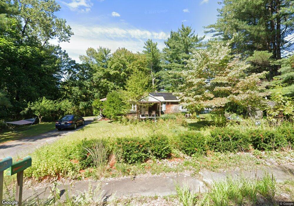
34 Logtown Rd Amherst, MA 01002
Estimated Value: $403,000 - $472,000
3
Beds
1
Bath
1,448
Sq Ft
$305/Sq Ft
Est. Value
About This Home
This home is located at 34 Logtown Rd, Amherst, MA 01002 and is currently estimated at $441,486, approximately $304 per square foot. 34 Logtown Rd is a home located in Hampshire County with nearby schools including Fort River Elementary School, Amherst Regional Middle School, and Amherst Regional High School.
Ownership History
Date
Name
Owned For
Owner Type
Purchase Details
Closed on
Jun 26, 2000
Sold by
Stclair-Lewis Lisa
Bought by
Levy Jay S and Levy Louise H
Current Estimated Value
Home Financials for this Owner
Home Financials are based on the most recent Mortgage that was taken out on this home.
Original Mortgage
$116,850
Interest Rate
8.48%
Mortgage Type
Purchase Money Mortgage
Purchase Details
Closed on
Jun 20, 1997
Sold by
Wood Christopher K and Wood Joan C
Bought by
Lewis Lisa St Clair
Home Financials for this Owner
Home Financials are based on the most recent Mortgage that was taken out on this home.
Original Mortgage
$75,000
Interest Rate
7.87%
Mortgage Type
Purchase Money Mortgage
Create a Home Valuation Report for This Property
The Home Valuation Report is an in-depth analysis detailing your home's value as well as a comparison with similar homes in the area
Home Values in the Area
Average Home Value in this Area
Purchase History
| Date | Buyer | Sale Price | Title Company |
|---|---|---|---|
| Levy Jay S | $123,000 | -- | |
| Lewis Lisa St Clair | $105,000 | -- |
Source: Public Records
Mortgage History
| Date | Status | Borrower | Loan Amount |
|---|---|---|---|
| Open | Lewis Lisa St Clair | $150,000 | |
| Closed | Lewis Lisa St Clair | $177,000 | |
| Closed | Lewis Lisa St Clair | $116,850 | |
| Previous Owner | Lewis Lisa St Clair | $75,000 |
Source: Public Records
Tax History
| Year | Tax Paid | Tax Assessment Tax Assessment Total Assessment is a certain percentage of the fair market value that is determined by local assessors to be the total taxable value of land and additions on the property. | Land | Improvement |
|---|---|---|---|---|
| 2025 | $65 | $360,100 | $161,100 | $199,000 |
| 2024 | $6,301 | $340,400 | $152,100 | $188,300 |
| 2023 | $6,048 | $300,900 | $138,500 | $162,400 |
| 2022 | $5,779 | $271,700 | $125,800 | $145,900 |
| 2021 | $5,494 | $251,800 | $116,600 | $135,200 |
| 2020 | $5,368 | $251,800 | $116,600 | $135,200 |
| 2019 | $5,219 | $239,400 | $116,600 | $122,800 |
| 2018 | $5,061 | $239,400 | $116,600 | $122,800 |
| 2017 | $4,851 | $222,200 | $111,200 | $111,000 |
| 2016 | $4,715 | $222,200 | $111,200 | $111,000 |
| 2015 | $4,564 | $222,200 | $111,200 | $111,000 |
Source: Public Records
Map
Nearby Homes
- 36 Trillium Way
- 156 Aubinwood Rd
- 148 Aubinwood Rd
- 100 Larkspur Dr
- 130 Linden Ridge Rd
- 0 Heatherstone Rd
- 61 S Valley Rd
- 23 Alyssum Dr
- 494 Station Rd
- 20 Station Rd
- 0 Amherst Rd
- 9 Harkness Rd
- 916 S East St
- 6 Eveningstar Dr
- 390 Shays St
- 104 Spring St
- LOT 3 Harkness Rd
- 0 Red Gate Ln Unit 73348273
- 170 E Hadley Rd Unit 42
- 0 Main St
- 64 Logtown Rd
- 48 Curtis Place
- 66 Curtis Place
- 35 Logtown Rd
- 65 Logtown Rd
- 17 Logtown Rd
- 72 Curtis Place
- 17 Curtis Place
- 17 Curtis Place Unit 1
- 87 Logtown Rd
- 41 Curtis Place
- 82 Curtis Place
- 17 Edge Hill Rd
- 63 Curtis Place
- 73 Curtis Place
- 13 Edge Hill Rd
- 97 Logtown Rd
- 21 Edge Hill Rd
- 13 Edgehill Place
- 529 Belchertown Rd
Your Personal Tour Guide
Ask me questions while you tour the home.