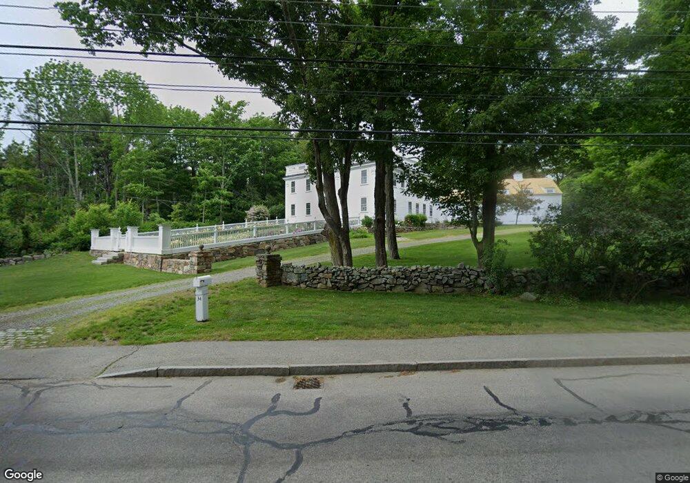
34 Long Sands Rd York, ME 03909
York Harbor NeighborhoodEstimated Value: $1,635,000 - $2,135,000
5
Beds
5
Baths
5,380
Sq Ft
$341/Sq Ft
Est. Value
About This Home
This home is located at 34 Long Sands Rd, York, ME 03909 and is currently estimated at $1,833,370, approximately $340 per square foot. 34 Long Sands Rd is a home located in York County with nearby schools including Village Elementary School, Coastal Ridge Elementary School, and York Middle School.
Ownership History
Date
Name
Owned For
Owner Type
Purchase Details
Closed on
Aug 20, 2023
Sold by
Murphy Melissa A and Colglazier Kevin S
Bought by
Colglazier Ft and Murphy
Current Estimated Value
Purchase Details
Closed on
Apr 27, 2007
Sold by
Stack Lucille B and Stack Reginald M
Bought by
Colglazier Kevin S and Murphy Melissa A
Create a Home Valuation Report for This Property
The Home Valuation Report is an in-depth analysis detailing your home's value as well as a comparison with similar homes in the area
Home Values in the Area
Average Home Value in this Area
Purchase History
| Date | Buyer | Sale Price | Title Company |
|---|---|---|---|
| Colglazier Ft | -- | None Available | |
| Colglazier Ft | -- | None Available | |
| Colglazier Kevin S | -- | -- | |
| Colglazier Kevin S | -- | -- |
Source: Public Records
Tax History Compared to Growth
Tax History
| Year | Tax Paid | Tax Assessment Tax Assessment Total Assessment is a certain percentage of the fair market value that is determined by local assessors to be the total taxable value of land and additions on the property. | Land | Improvement |
|---|---|---|---|---|
| 2024 | $13,095 | $1,558,900 | $365,600 | $1,193,300 |
| 2023 | $12,672 | $1,499,700 | $306,400 | $1,193,300 |
| 2022 | $12,255 | $1,433,300 | $263,400 | $1,169,900 |
| 2021 | $12,360 | $1,242,200 | $236,600 | $1,005,600 |
| 2020 | $11,723 | $1,056,100 | $231,200 | $824,900 |
| 2019 | $3,065 | $1,050,700 | $225,800 | $824,900 |
| 2018 | $11,413 | $1,023,600 | $198,800 | $824,800 |
| 2017 | $10,974 | $1,002,200 | $177,400 | $824,800 |
| 2016 | $11,175 | $1,002,200 | $177,400 | $824,800 |
| 2015 | $11,024 | $1,002,200 | $177,400 | $824,800 |
| 2014 | $10,724 | $1,002,200 | $177,400 | $824,800 |
| 2013 | $10,173 | $975,400 | $150,600 | $824,800 |
Source: Public Records
Map
Nearby Homes
- 281 York St
- 294 York St Unit 1
- 294 York St Unit 2
- 294 York St Unit 3
- 60 Barrell Ln Unit 3
- 60 Barrell Ln Unit 1
- 208 Long Sands Rd
- 425 York St
- 419 & 425 York St
- 23 Harmon Park Rd
- 3 Sentry Hill Rd
- 8 Ash Ln
- 589 York St Unit 11
- 21 Starboard Ln
- 2 Roaring Rock Rd
- 8 Old Seabury Rd
- 8 Roaring Rock Rd
- 12 Norwood Farms Rd Unit 1
- 357 Southside Rd
- 11 Chestnut Ln
- 50 Long Sands Rd
- 28 Long Sands Rd
- 45 Long Sands Rd
- 47 Long Sands Rd
- 49 Long Sands Rd
- 22 Long Sands Rd Unit t-22
- 31 Long Sands Rd
- 53 Long Sands Rd
- 57 Long Sands Rd
- 9 Elm Dr
- 26 Long Sands Rd
- 4 Elm Dr
- 2 Emerson Ln
- 18 Avon Ave
- 2-4 Emerson Ln
- 61 Long Sands Rd
- 12 Ocean Edge Ln
- 18 Ocean Circuit Dr
- 0 Ocean Circuit Dr Unit 1038254
- 0 Ocean Circuit Dr Unit 1059035