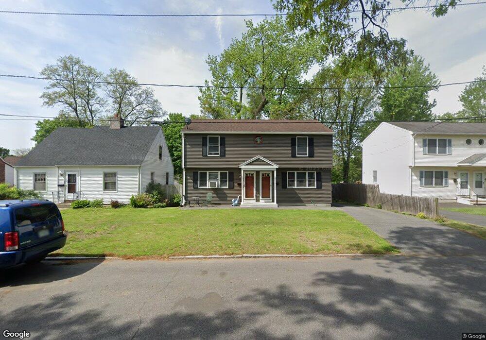
34 Mayfair Ave Springfield, MA 01104
Liberty Heights NeighborhoodEstimated Value: $300,000 - $384,000
4
Beds
4
Baths
1,764
Sq Ft
$190/Sq Ft
Est. Value
About This Home
This home is located at 34 Mayfair Ave, Springfield, MA 01104 and is currently estimated at $334,533, approximately $189 per square foot. 34 Mayfair Ave is a home located in Hampden County with nearby schools including Edward P. Boland School, High School Of Commerce, and Springfield High School of Science and Technology.
Ownership History
Date
Name
Owned For
Owner Type
Purchase Details
Closed on
Dec 1, 1997
Sold by
Smolen Robert
Bought by
Ramos Blanca R
Current Estimated Value
Home Financials for this Owner
Home Financials are based on the most recent Mortgage that was taken out on this home.
Original Mortgage
$2,426
Interest Rate
7.14%
Purchase Details
Closed on
May 21, 1993
Sold by
Horowitz Samuel and Horowitz Fay
Bought by
Galarza Mercedes
Purchase Details
Closed on
May 31, 1988
Sold by
Horowitz Samuel
Bought by
Smolen Robert
Create a Home Valuation Report for This Property
The Home Valuation Report is an in-depth analysis detailing your home's value as well as a comparison with similar homes in the area
Home Values in the Area
Average Home Value in this Area
Purchase History
| Date | Buyer | Sale Price | Title Company |
|---|---|---|---|
| Ramos Blanca R | $71,300 | -- | |
| Ramos Blanca R | $71,300 | -- | |
| Galarza Mercedes | $106,000 | -- | |
| Galarza Mercedes | $106,000 | -- | |
| Smolen Robert | $134,500 | -- |
Source: Public Records
Mortgage History
| Date | Status | Borrower | Loan Amount |
|---|---|---|---|
| Open | Smolen Robert | $3,125 | |
| Closed | Smolen Robert | $2,426 | |
| Open | Smolen Robert | $68,920 |
Source: Public Records
Tax History Compared to Growth
Tax History
| Year | Tax Paid | Tax Assessment Tax Assessment Total Assessment is a certain percentage of the fair market value that is determined by local assessors to be the total taxable value of land and additions on the property. | Land | Improvement |
|---|---|---|---|---|
| 2025 | $4,532 | $289,000 | $30,600 | $258,400 |
| 2024 | $4,336 | $270,000 | $30,600 | $239,400 |
| 2023 | $4,121 | $241,700 | $27,800 | $213,900 |
| 2022 | $3,694 | $196,300 | $26,000 | $170,300 |
| 2021 | $3,665 | $193,900 | $23,600 | $170,300 |
| 2020 | $3,549 | $181,700 | $23,600 | $158,100 |
| 2019 | $3,296 | $167,500 | $23,600 | $143,900 |
| 2018 | $3,096 | $157,300 | $23,600 | $133,700 |
| 2017 | $2,857 | $145,300 | $25,100 | $120,200 |
| 2016 | $2,515 | $127,900 | $25,100 | $102,800 |
| 2015 | $2,516 | $127,900 | $25,100 | $102,800 |
Source: Public Records
Map
Nearby Homes
- 57 Narragansett St
- 195-197 Massasoit St
- 60 Montmorenci St
- 196 Massasoit St
- 56 Montmorenci St
- 482 Chestnut St
- 46-48 Wait St
- 55 Governor St
- 62-64 Governor St
- 24 Cunningham St
- 92 Miller St
- 13 Ringgold St
- 49-53 Jefferson Ave
- 708-710 Carew St
- 121 Wait St
- 723-725 Carew St
- 20 Webster St
- 750 Liberty St
- 774-776 Liberty St
- 2942-2946 Main St
- 30 Mayfair Ave
- 40 Mayfair Ave
- 24 Mayfair Ave
- 31 Croyden St
- 25 Croyden St
- 48 Mayfair Ave
- 18 Mayfair Ave
- 191 Lexington St
- 35 Mayfair Ave
- 35 Mayfair Ave Unit 35
- 29 Mayfair Ave
- 41 Mayfair Ave
- 25 Mayfair Ave
- 15 Croyden St
- 14 Mayfair Ave
- 49 Mayfair Ave
- 19 Mayfair Ave
- 34 Croyden Terrace
- 38 Knollwood St Unit 40
- 38-40 Knollwood St