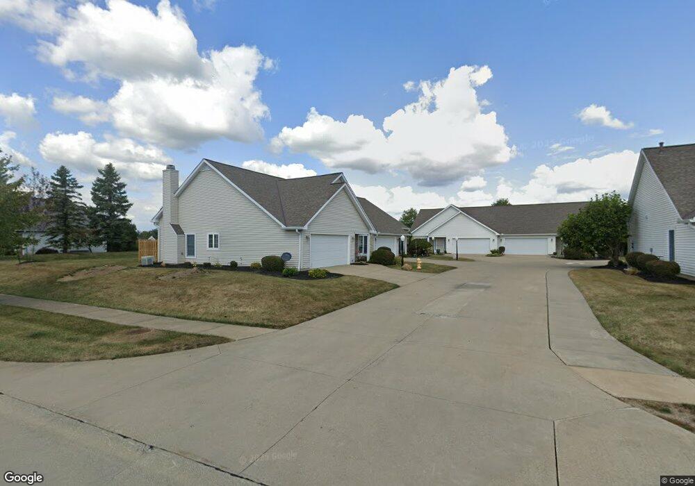
34 Nantucket Cir Unit 7 Oberlin, OH 44074
Estimated Value: $242,090 - $286,000
2
Beds
2
Baths
1,371
Sq Ft
$196/Sq Ft
Est. Value
About This Home
This home is located at 34 Nantucket Cir Unit 7, Oberlin, OH 44074 and is currently estimated at $268,273, approximately $195 per square foot. 34 Nantucket Cir Unit 7 is a home located in Lorain County with nearby schools including Oberlin Elementary School, Prospect Elementary School, and Langston Middle School.
Ownership History
Date
Name
Owned For
Owner Type
Purchase Details
Closed on
Jun 9, 2004
Sold by
White Jane L
Bought by
Gueulette David G and Gueulette Margaret S
Current Estimated Value
Purchase Details
Closed on
Jun 1, 2001
Sold by
Norris Builders Inc
Bought by
White James A and White Janet L
Home Financials for this Owner
Home Financials are based on the most recent Mortgage that was taken out on this home.
Original Mortgage
$147,059
Interest Rate
7.18%
Create a Home Valuation Report for This Property
The Home Valuation Report is an in-depth analysis detailing your home's value as well as a comparison with similar homes in the area
Home Values in the Area
Average Home Value in this Area
Purchase History
| Date | Buyer | Sale Price | Title Company |
|---|---|---|---|
| Gueulette David G | $144,000 | Chicago Title Insurance Co | |
| White James A | $144,500 | Midland Title |
Source: Public Records
Mortgage History
| Date | Status | Borrower | Loan Amount |
|---|---|---|---|
| Previous Owner | White James A | $147,059 |
Source: Public Records
Tax History
| Year | Tax Paid | Tax Assessment Tax Assessment Total Assessment is a certain percentage of the fair market value that is determined by local assessors to be the total taxable value of land and additions on the property. | Land | Improvement |
|---|---|---|---|---|
| 2024 | $2,618 | $52,581 | $15,750 | $36,831 |
| 2023 | $2,385 | $43,005 | $9,083 | $33,922 |
| 2022 | $2,322 | $43,005 | $9,083 | $33,922 |
| 2021 | $2,316 | $43,005 | $9,083 | $33,922 |
| 2020 | $2,365 | $41,430 | $8,750 | $32,680 |
| 2019 | $2,334 | $41,430 | $8,750 | $32,680 |
| 2018 | $2,320 | $41,430 | $8,750 | $32,680 |
| 2017 | $2,289 | $41,720 | $8,160 | $33,560 |
| 2016 | $2,312 | $41,720 | $8,160 | $33,560 |
| 2015 | $2,315 | $41,720 | $8,160 | $33,560 |
| 2014 | $2,238 | $39,350 | $7,700 | $31,650 |
| 2013 | $2,200 | $39,350 | $7,700 | $31,650 |
Source: Public Records
Map
Nearby Homes
- 396 Reserve Ave
- 14409 State Route 58
- VL E Hamilton St
- 246 W Hamilton St
- 32 W Lincoln St
- 168 E Hamilton St
- 182 E Hamilton St
- 147 Morgan St
- 149 Morgan St
- 177 Sumner St
- 47094 Us Highway 20
- 123 S Professor St
- 89 S Professor St
- 0 S Park St
- 340 Edgemeer Place
- Us-20 Unit LotWP001
- 55 E College St Unit 212
- 215 W College St
- 252 W College St
- 95 Shipherd Cir
- 50 Reserve Ave
- 36 Nantucket Cir Unit 8
- 56 Reserve Ave
- 26 Nantucket Cir Unit 5
- 25 Nantucket Cir Unit I9
- 70 Reserve Ave
- 70 Reserve Ave
- 23 Nantucket Cir Unit I10
- 20 Nantucket Cir Unit 14
- 384 Reserve Ave
- 18 Nantucket Cir
- 30 Canterbury Cir Unit 23
- 32 Canterbury Cir Unit 25
- 86 Reserve Ave
- 52-S/L Reserve Ave
- 24 Canterbury Cir
- 12 Nantucket Cir Unit L12
- 22 Canterbury Cir
- 69 Reserve Ave
- 55 Reserve Ave
Your Personal Tour Guide
Ask me questions while you tour the home.