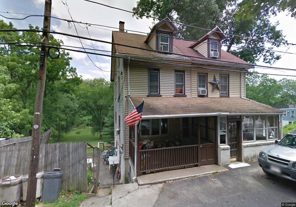
34 New Rd Aston, PA 19014
Estimated Value: $261,000 - $343,268
4
Beds
2
Baths
1,056
Sq Ft
$281/Sq Ft
Est. Value
About This Home
This home is located at 34 New Rd, Aston, PA 19014 and is currently estimated at $296,817, approximately $281 per square foot. 34 New Rd is a home located in Delaware County with nearby schools including St. Thomas Apostle School and The Christian Academy.
Ownership History
Date
Name
Owned For
Owner Type
Purchase Details
Closed on
Feb 28, 2007
Sold by
Ware Eugene M
Bought by
Mcknight Sandy
Current Estimated Value
Home Financials for this Owner
Home Financials are based on the most recent Mortgage that was taken out on this home.
Original Mortgage
$155,900
Outstanding Balance
$94,725
Interest Rate
6.33%
Mortgage Type
Purchase Money Mortgage
Estimated Equity
$202,092
Purchase Details
Closed on
Mar 28, 2002
Sold by
Campbell Danual
Bought by
Ware Eugene M
Home Financials for this Owner
Home Financials are based on the most recent Mortgage that was taken out on this home.
Original Mortgage
$114,594
Interest Rate
6.88%
Mortgage Type
FHA
Purchase Details
Closed on
Oct 2, 1998
Sold by
Evans Mary C
Bought by
Campbell Danual
Home Financials for this Owner
Home Financials are based on the most recent Mortgage that was taken out on this home.
Original Mortgage
$88,906
Interest Rate
6.92%
Mortgage Type
FHA
Create a Home Valuation Report for This Property
The Home Valuation Report is an in-depth analysis detailing your home's value as well as a comparison with similar homes in the area
Home Values in the Area
Average Home Value in this Area
Purchase History
| Date | Buyer | Sale Price | Title Company |
|---|---|---|---|
| Mcknight Sandy | $155,900 | None Available | |
| Ware Eugene M | $115,500 | Fidelity National Title Ins | |
| Campbell Danual | $89,000 | Security Search & Abstract C |
Source: Public Records
Mortgage History
| Date | Status | Borrower | Loan Amount |
|---|---|---|---|
| Open | Mcknight Sandy | $155,900 | |
| Previous Owner | Ware Eugene M | $114,594 | |
| Previous Owner | Campbell Danual | $88,906 |
Source: Public Records
Tax History Compared to Growth
Tax History
| Year | Tax Paid | Tax Assessment Tax Assessment Total Assessment is a certain percentage of the fair market value that is determined by local assessors to be the total taxable value of land and additions on the property. | Land | Improvement |
|---|---|---|---|---|
| 2025 | $4,560 | $175,730 | $60,990 | $114,740 |
| 2024 | $4,560 | $175,730 | $60,990 | $114,740 |
| 2023 | $4,356 | $175,730 | $60,990 | $114,740 |
| 2022 | $4,200 | $175,730 | $60,990 | $114,740 |
| 2021 | $6,481 | $175,730 | $60,990 | $114,740 |
| 2020 | $3,844 | $94,120 | $44,310 | $49,810 |
| 2019 | $3,770 | $94,120 | $44,310 | $49,810 |
| 2018 | $3,610 | $94,120 | $0 | $0 |
| 2017 | $3,534 | $94,120 | $0 | $0 |
| 2016 | $517 | $94,120 | $0 | $0 |
| 2015 | $517 | $94,120 | $0 | $0 |
| 2014 | $517 | $94,120 | $0 | $0 |
Source: Public Records
Map
Nearby Homes
- 346 Lenni Rd
- 305 Crozerville Rd
- 234 Elm Ave
- 3 Rolling Heights Ln
- 208 S Pennell Rd
- 220 Spring Valley Way
- 206 Chestnut Ave
- 131 Junction Rd
- 117 Segel Dr
- 440 Derry Dr Unit 440
- 237 Harvey Ln
- 268 Miley Rd Unit 268
- 21 Hoag Ln
- 209 Martins Ln
- 108 Grace Ln
- 242 Moria Place
- 30 Rampart W
- 226 Moria Place
- 23 Rampart W
- 277 W Baltimore Pike