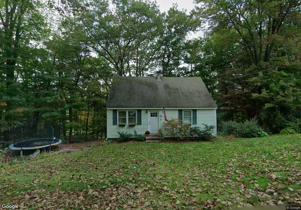
34 Redstone Hill Rd Sterling, MA 01564
Estimated Value: $402,809 - $458,000
3
Beds
2
Baths
1,100
Sq Ft
$394/Sq Ft
Est. Value
About This Home
This home is located at 34 Redstone Hill Rd, Sterling, MA 01564 and is currently estimated at $433,452, approximately $394 per square foot. 34 Redstone Hill Rd is a home located in Worcester County with nearby schools including Wachusett Regional High School and South Lancaster Academy.
Ownership History
Date
Name
Owned For
Owner Type
Purchase Details
Closed on
Jul 13, 2001
Sold by
Est Godfrey Hugh R and Lorenzen Penny A
Bought by
Martin Brian F and Martin Jessica L
Current Estimated Value
Home Financials for this Owner
Home Financials are based on the most recent Mortgage that was taken out on this home.
Original Mortgage
$157,300
Interest Rate
7.2%
Mortgage Type
Purchase Money Mortgage
Create a Home Valuation Report for This Property
The Home Valuation Report is an in-depth analysis detailing your home's value as well as a comparison with similar homes in the area
Home Values in the Area
Average Home Value in this Area
Purchase History
| Date | Buyer | Sale Price | Title Company |
|---|---|---|---|
| Martin Brian F | $162,000 | -- |
Source: Public Records
Mortgage History
| Date | Status | Borrower | Loan Amount |
|---|---|---|---|
| Open | Martin Brian F | $180,000 | |
| Closed | Martin Brian F | $164,000 | |
| Closed | Martin Brian F | $157,300 |
Source: Public Records
Tax History
| Year | Tax Paid | Tax Assessment Tax Assessment Total Assessment is a certain percentage of the fair market value that is determined by local assessors to be the total taxable value of land and additions on the property. | Land | Improvement |
|---|---|---|---|---|
| 2025 | $4,308 | $334,500 | $118,300 | $216,200 |
| 2024 | $4,103 | $308,300 | $118,300 | $190,000 |
| 2023 | $4,237 | $296,300 | $118,300 | $178,000 |
| 2022 | $3,559 | $233,400 | $107,600 | $125,800 |
| 2021 | $8,054 | $216,700 | $107,600 | $109,100 |
| 2020 | $3,436 | $204,400 | $107,600 | $96,800 |
| 2019 | $3,380 | $195,700 | $107,600 | $88,100 |
| 2018 | $180 | $178,400 | $107,500 | $70,900 |
| 2017 | $3,020 | $167,500 | $99,500 | $68,000 |
| 2016 | $2,920 | $159,300 | $99,500 | $59,800 |
| 2015 | $3,057 | $176,800 | $109,600 | $67,200 |
| 2014 | $2,932 | $173,200 | $109,600 | $63,600 |
Source: Public Records
Map
Nearby Homes
- 96 Clinton Rd
- 5 Pine Woods Ln
- 6A Patriots Way Unit 37
- 134 Leominster Rd
- 90 Tuttle Rd
- 15 N Cove Rd
- 4 Jewett Rd Unit B
- 4 Jewett Rd Unit A
- 121 &125 Flanagan Hill Rd
- 223 Worcester Rd
- 2 Turtle Ln Unit 2
- 11 Millie's Way Unit 11
- 54 S Meadow Rd
- 61 Boutelle Rd
- 0 Boutelle Rd
- 2 Lakeview Ave
- 15 Myrtle Ave
- 21 Myrtle Ave
- 43 Trinity Ave
- 37 Sterling St
- 36 Redstone Hill Rd
- 32 Redstone Hill Rd
- 49 Redstone Hill Rd
- 38 Redstone Hill Rd
- 43 Redstone Hill Rd
- 40 Redstone Hill Rd
- 53 Redstone Hill Rd
- 42 Redstone Hill Rd
- 41 Redstone Hill Rd
- 55 Redstone Hill Rd
- 1 Honeycrisp Way Unit 1
- 3 Honeycrisp Way Unit 3
- 21 Redstone Hill Rd
- 44 Redstone Hill Rd
- 7 Honeycrisp Way Unit 7
- 5 Honeycrisp Way Unit 5
- 57 Redstone Hill Rd
- 10 Honeycrisp Way Unit 10
- 8 Honeycrisp Way Unit 8
- 19 Redstone Hill Rd
Your Personal Tour Guide
Ask me questions while you tour the home.