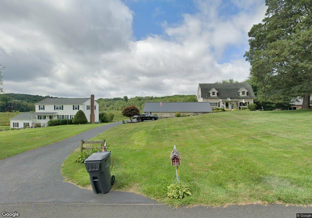
34 Secor Rd Brookfield, CT 06804
Estimated Value: $592,221 - $677,000
4
Beds
3
Baths
2,218
Sq Ft
$288/Sq Ft
Est. Value
About This Home
This home is located at 34 Secor Rd, Brookfield, CT 06804 and is currently estimated at $638,305, approximately $287 per square foot. 34 Secor Rd is a home located in Fairfield County with nearby schools including Center Elementary School, Whisconier Middle School, and Brookfield High School.
Ownership History
Date
Name
Owned For
Owner Type
Purchase Details
Closed on
Dec 30, 2011
Sold by
Heinlein Laura and Heinlein Thomas
Bought by
Mutual Security Cu Inc
Current Estimated Value
Purchase Details
Closed on
Sep 27, 2011
Sold by
Bank Of New York Mello
Bought by
Heinlein Thomas and Heinlein Laura
Purchase Details
Closed on
Feb 7, 1997
Sold by
Turosky Edward and Turosky Jean
Bought by
Grady Daniel and Grady Judith
Purchase Details
Closed on
Nov 2, 1994
Sold by
Fgb Rlty Advisors Inc
Bought by
Alves Jose and Alves Diane
Purchase Details
Closed on
Jul 2, 1987
Sold by
Smith Alan
Bought by
Reed Matthew
Create a Home Valuation Report for This Property
The Home Valuation Report is an in-depth analysis detailing your home's value as well as a comparison with similar homes in the area
Home Values in the Area
Average Home Value in this Area
Purchase History
| Date | Buyer | Sale Price | Title Company |
|---|---|---|---|
| Mutual Security Cu Inc | $25,000 | -- | |
| Mutual Security Cu Inc | $25,000 | -- | |
| Heinlein Thomas | $189,000 | -- | |
| Heinlein Thomas | $189,000 | -- | |
| Grady Daniel | $230,000 | -- | |
| Grady Daniel | $230,000 | -- | |
| Alves Jose | $150,000 | -- | |
| Alves Jose | $150,000 | -- | |
| Reed Matthew | $250,000 | -- |
Source: Public Records
Mortgage History
| Date | Status | Borrower | Loan Amount |
|---|---|---|---|
| Open | Reed Matthew | $100,000 | |
| Closed | Reed Matthew | $85,000 |
Source: Public Records
Tax History Compared to Growth
Tax History
| Year | Tax Paid | Tax Assessment Tax Assessment Total Assessment is a certain percentage of the fair market value that is determined by local assessors to be the total taxable value of land and additions on the property. | Land | Improvement |
|---|---|---|---|---|
| 2025 | $8,897 | $307,530 | $83,690 | $223,840 |
| 2024 | $8,580 | $307,530 | $83,690 | $223,840 |
| 2023 | $8,260 | $307,530 | $83,690 | $223,840 |
| 2022 | $7,959 | $307,530 | $83,690 | $223,840 |
| 2021 | $18,345 | $247,650 | $92,990 | $154,660 |
| 2020 | $7,343 | $247,650 | $92,990 | $154,660 |
| 2019 | $20,318 | $247,650 | $92,990 | $154,660 |
| 2018 | $20,318 | $247,650 | $92,990 | $154,660 |
| 2017 | $6,758 | $247,650 | $92,990 | $154,660 |
| 2016 | $5,488 | $207,870 | $102,140 | $105,730 |
| 2015 | $5,342 | $207,870 | $102,140 | $105,730 |
| 2014 | $5,342 | $207,870 | $102,140 | $105,730 |
Source: Public Records
Map
Nearby Homes
- 2 Autumn's Way
- 510 Copper Square Dr
- 79 Suzie Dr
- 23 Farrell Rd
- 16 Farrell Rd
- 603 Brookside Ct Unit 603
- 433 Brookside Ct Unit 433
- 12 Fieldstone Ct Unit 12
- 8 Fieldstone Ct Unit 8
- 10 Fieldstone Ct Unit 10
- 6 Fieldstone Ct
- 183 Mount Pleasant Rd
- 21 Adams Dr
- 2 Old Grays Bridge Rd
- 6 Violette Rd
- 149 Mount Pleasant Rd
- 14 Sand Hill Rd
- 23 Deepwood Dr
- 20 Chatham Ct Unit 20
- 112 A Stony Hill Rd