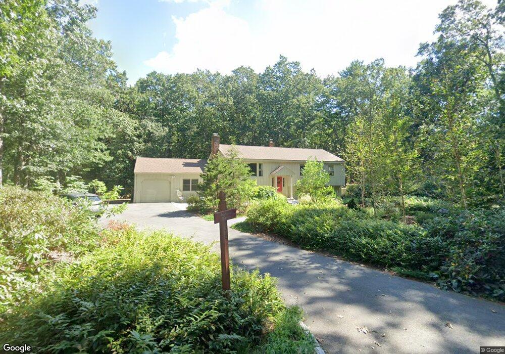
34 Willard Cir Andover, MA 01810
Estimated Value: $800,000 - $935,000
4
Beds
2
Baths
2,520
Sq Ft
$345/Sq Ft
Est. Value
About This Home
This home is located at 34 Willard Cir, Andover, MA 01810 and is currently estimated at $868,176, approximately $344 per square foot. 34 Willard Cir is a home located in Essex County with nearby schools including South Elementary School, Doherty Middle School, and Andover High School.
Ownership History
Date
Name
Owned For
Owner Type
Purchase Details
Closed on
Jun 20, 2013
Sold by
Sherlock Madeline and Rabinowitz Martin D
Bought by
Rabinowitz Sherlock Rt and Rabinowitz Martin D
Current Estimated Value
Purchase Details
Closed on
Aug 1, 1995
Sold by
Rolke William
Bought by
Rabinowitz Martin
Home Financials for this Owner
Home Financials are based on the most recent Mortgage that was taken out on this home.
Original Mortgage
$209,000
Interest Rate
7.56%
Mortgage Type
Purchase Money Mortgage
Purchase Details
Closed on
Aug 28, 1987
Sold by
Reitman Bruce H
Bought by
Rolke William
Create a Home Valuation Report for This Property
The Home Valuation Report is an in-depth analysis detailing your home's value as well as a comparison with similar homes in the area
Purchase History
| Date | Buyer | Sale Price | Title Company |
|---|---|---|---|
| Rabinowitz Sherlock Rt | -- | -- | |
| Rabinowitz Martin | $219,000 | -- | |
| Rolke William | $239,900 | -- |
Source: Public Records
Mortgage History
| Date | Status | Borrower | Loan Amount |
|---|---|---|---|
| Previous Owner | Rolke William | $150,050 | |
| Previous Owner | Rolke William | $196,500 | |
| Previous Owner | Rolke William | $209,000 |
Source: Public Records
Tax History
| Year | Tax Paid | Tax Assessment Tax Assessment Total Assessment is a certain percentage of the fair market value that is determined by local assessors to be the total taxable value of land and additions on the property. | Land | Improvement |
|---|---|---|---|---|
| 2024 | $8,758 | $680,000 | $407,700 | $272,300 |
| 2023 | $8,387 | $614,000 | $368,000 | $246,000 |
| 2022 | $7,756 | $531,200 | $321,000 | $210,200 |
| 2021 | $7,462 | $488,000 | $292,200 | $195,800 |
| 2020 | $7,184 | $478,600 | $285,200 | $193,400 |
| 2019 | $7,134 | $467,200 | $277,000 | $190,200 |
| 2018 | $6,939 | $443,700 | $266,500 | $177,200 |
| 2017 | $6,656 | $438,500 | $261,300 | $177,200 |
| 2016 | $6,522 | $440,100 | $261,300 | $178,800 |
| 2015 | $6,322 | $422,300 | $251,700 | $170,600 |
Source: Public Records
Map
Nearby Homes
- 12 Parkview Terrace
- 5 Colonial Dr Unit B5-6
- 11 Cogswell Rd
- 13 Taylor Cove Dr Unit 31
- 12D Chester Rd
- 12 B Chester Rd Unit D
- 250 Martins Landing Unit 402
- 280 Martins Landing Unit 312
- 260 Martins Landing Unit 508
- 200 Martins Landing Unit 102
- 220 Martins Landing Unit 309
- 320 Martins Landing Unit 401
- 320 Martins Landing Unit 2410
- 320 Martins Landing Unit 502
- 320 Martins Landing Unit 102
- 320 Martins Landing Unit 107
- 320 Martins Landing Unit 404
- 320 Martins Landing Unit 209
- 56 Sunset Rock Rd
- 9 Marie Dr
- 9 Willard Cir
- 7 Willard Cir
- 12 Willard Cir
- 7 Foster Pond Rd
- 14 Willard Cir Unit 16
- 18 Willard Cir
- 8 Willard Cir
- 20 Willard Cir
- 10 Willard Cir
- 25 Hensey Way Unit 25
- 26 Willard Cir
- 2 Willard Cir
- 24 Willard Cir
- 22 Willard Cir
- 29 Hensey Way Unit 29
- 31 Hensey Way Unit 31
- 18 Hensey Way Unit 18
- 16 Hensey Way Unit 16
- 15 Hensey Way Unit 15
- 15 Hensey Way Unit 15
Your Personal Tour Guide
Ask me questions while you tour the home.