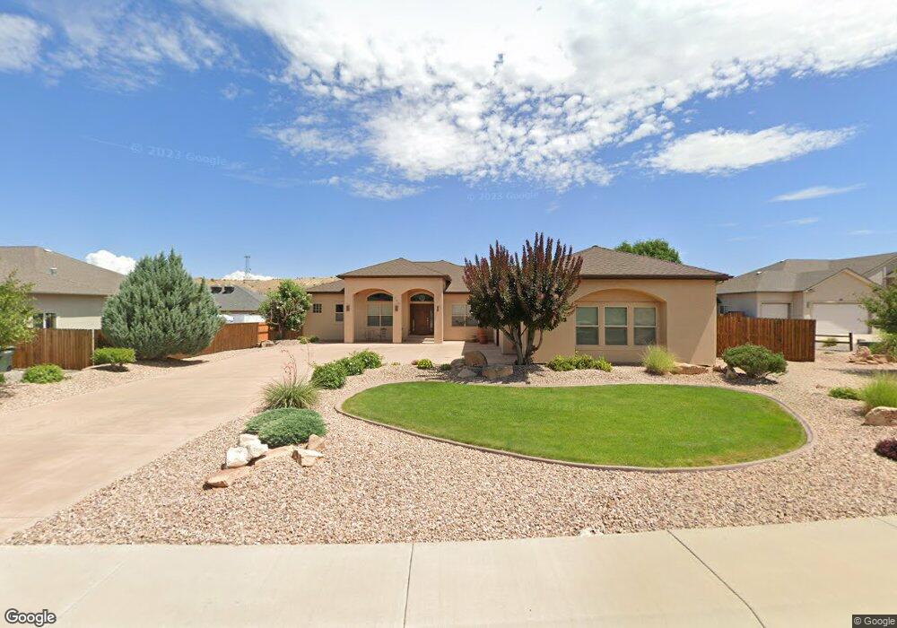
340 Canyon Rim Ct Grand Junction, CO 81507
Redlands NeighborhoodEstimated Value: $795,249 - $875,000
3
Beds
3
Baths
2,461
Sq Ft
$345/Sq Ft
Est. Value
About This Home
This home is located at 340 Canyon Rim Ct, Grand Junction, CO 81507 and is currently estimated at $848,562, approximately $344 per square foot. 340 Canyon Rim Ct is a home located in Mesa County with nearby schools including Wingate Elementary School, Redlands Middle School, and Fruita 8/9 School.
Ownership History
Date
Name
Owned For
Owner Type
Purchase Details
Closed on
Oct 24, 2013
Sold by
Arnold Glenn F and Arnold Helen A
Bought by
Arnold Glenn F and Arnold Helen A
Current Estimated Value
Purchase Details
Closed on
Sep 30, 2009
Sold by
The Arnold Family Trust
Bought by
Arnold Glenn F and Arnold Helen A
Purchase Details
Closed on
Jun 25, 2003
Sold by
Piper Construction Llc
Bought by
The Arnold Family Trust
Purchase Details
Closed on
Mar 13, 2002
Sold by
South Camp Properties Llc
Bought by
Piper Construction Llc
Home Financials for this Owner
Home Financials are based on the most recent Mortgage that was taken out on this home.
Original Mortgage
$54,320
Interest Rate
6.83%
Create a Home Valuation Report for This Property
The Home Valuation Report is an in-depth analysis detailing your home's value as well as a comparison with similar homes in the area
Home Values in the Area
Average Home Value in this Area
Purchase History
| Date | Buyer | Sale Price | Title Company |
|---|---|---|---|
| Arnold Glenn F | -- | None Available | |
| Arnold Glenn F | -- | None Available | |
| The Arnold Family Trust | $79,900 | Meridian Land Title Llc | |
| Piper Construction Llc | $67,900 | First American Heritage Titl |
Source: Public Records
Mortgage History
| Date | Status | Borrower | Loan Amount |
|---|---|---|---|
| Previous Owner | Piper Construction Llc | $54,320 |
Source: Public Records
Tax History Compared to Growth
Tax History
| Year | Tax Paid | Tax Assessment Tax Assessment Total Assessment is a certain percentage of the fair market value that is determined by local assessors to be the total taxable value of land and additions on the property. | Land | Improvement |
|---|---|---|---|---|
| 2024 | $2,477 | $42,590 | $10,170 | $32,420 |
| 2023 | $2,477 | $42,590 | $10,170 | $32,420 |
| 2022 | $1,974 | $35,100 | $8,690 | $26,410 |
| 2021 | $1,983 | $36,110 | $8,940 | $27,170 |
| 2020 | $1,827 | $34,480 | $8,580 | $25,900 |
| 2019 | $1,728 | $34,480 | $8,580 | $25,900 |
| 2018 | $1,770 | $32,710 | $7,560 | $25,150 |
| 2017 | $1,767 | $32,710 | $7,560 | $25,150 |
| 2016 | $1,650 | $34,750 | $7,560 | $27,190 |
| 2015 | $1,674 | $34,750 | $7,560 | $27,190 |
| 2014 | $1,757 | $28,300 | $7,560 | $20,740 |
Source: Public Records
Map
Nearby Homes
- 339 Canyon Rim Ct
- 2223 Canyon Rim Dr
- 358 Canyon Rim Dr
- 356 Canyon Rim Dr
- 2229 Canyon Rim Dr
- 2231 Canyon Rim Dr
- 2195 Canyon Ct E
- 380 Granite Falls Way
- 2280 Red Vista Ct
- 390 Cascada Dr
- 326 Red Point Rd
- 2287 Rock Valley Rd
- 2287 Red Wash Ct
- 2314 Rocky Knoll Ct
- 2310 Rocky Knoll Ct
- 2308 Rocky Knoll Ct
- 2306 Rocky Knoll Ct
- 2302 Trail Ridge Rd
- 2298 Trail Ridge Rd
- 2142 Vista Cascada
- 342 Canyon Rim Ct
- 338 Canyon Rim Ct
- 2217 Canyon Rim Dr
- 344 Canyon Rim Ct
- 341 Canyon Rim Ct
- 0 Canyon Rim Ct Unit 605657
- 0 Canyon Rim Ct Unit 633395
- 0 Canyon Rim Ct Unit 675071
- 354 Canyon Rim Ct
- 336 Canyon Rim Ct
- 2215 Canyon Rim Dr
- 337 Canyon Rim Ct
- 2221 Canyon Rim Dr
- 335 Canyon Rim Ct
- 348 Canyon Rim Ct
- 343 Canyon Rim Ct
- 353 Teegan Ct
- 2218 Canyon Rim Dr
- 2213 Canyon Rim Dr
- 2216 Canyon Rim Dr