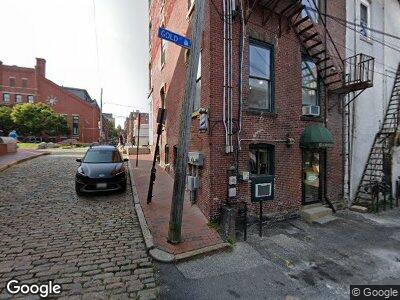
340 Fore St Unit 1 Portland, ME 04101
Downtown Portland NeighborhoodEstimated Value: $355,482 - $502,000
1
Bed
1
Bath
646
Sq Ft
$633/Sq Ft
Est. Value
About This Home
This home is located at 340 Fore St Unit 1, Portland, ME 04101 and is currently estimated at $409,121, approximately $633 per square foot. 340 Fore St Unit 1 is a home located in Cumberland County with nearby schools including Reiche Community School, King Middle School, and Baxter Academy for Tech & Sciences.
Ownership History
Date
Name
Owned For
Owner Type
Purchase Details
Closed on
Jan 11, 2012
Sold by
Bibeau Arthur D
Bought by
Adb Realty Llc
Current Estimated Value
Purchase Details
Closed on
Dec 16, 2010
Sold by
Bibeau Arthur D
Bought by
Adb Realty Llc
Purchase Details
Closed on
Mar 5, 2007
Sold by
Bibeau & Grondin Llc
Bought by
Bibeau Arthur D
Home Financials for this Owner
Home Financials are based on the most recent Mortgage that was taken out on this home.
Original Mortgage
$125,000
Interest Rate
6.27%
Mortgage Type
Unknown
Create a Home Valuation Report for This Property
The Home Valuation Report is an in-depth analysis detailing your home's value as well as a comparison with similar homes in the area
Home Values in the Area
Average Home Value in this Area
Purchase History
| Date | Buyer | Sale Price | Title Company |
|---|---|---|---|
| Adb Realty Llc | -- | -- | |
| Adb Realty Llc | -- | -- | |
| Adb Realty Llc | -- | -- | |
| Bibeau Arthur D | -- | -- |
Source: Public Records
Mortgage History
| Date | Status | Borrower | Loan Amount |
|---|---|---|---|
| Previous Owner | Bibeau Arthur D | $108,750 | |
| Previous Owner | Bibeau Arthur D | $125,000 |
Source: Public Records
Tax History Compared to Growth
Tax History
| Year | Tax Paid | Tax Assessment Tax Assessment Total Assessment is a certain percentage of the fair market value that is determined by local assessors to be the total taxable value of land and additions on the property. | Land | Improvement |
|---|---|---|---|---|
| 2024 | $3,437 | $229,000 | $45,800 | $183,200 |
| 2023 | $3,300 | $229,000 | $45,800 | $183,200 |
| 2022 | $3,117 | $229,000 | $45,800 | $183,200 |
| 2021 | $2,975 | $229,000 | $45,800 | $183,200 |
| 2020 | $2,797 | $120,000 | $24,000 | $96,000 |
| 2019 | $2,797 | $120,000 | $24,000 | $96,000 |
| 2018 | $2,698 | $120,000 | $24,000 | $96,000 |
| 2017 | $2,598 | $120,000 | $24,000 | $96,000 |
| 2016 | $2,533 | $120,000 | $24,000 | $96,000 |
| 2015 | $2,476 | $120,000 | $24,000 | $96,000 |
| 2014 | $2,400 | $120,000 | $24,000 | $96,000 |
Source: Public Records
Map
Nearby Homes
- 10 Exchange St Unit 410
- 150 Middle St Unit 2G
- 711 Chandlers Wharf
- 612 Chandlers Wharf
- 167 Newbury St Unit 506
- 167 Newbury St Unit 206
- 148 Newbury St Unit 2
- 269 Commercial St Unit 5C
- 99 Federal St Unit 201
- 139 Newbury St
- 73 Federal St
- 113 Newbury St Unit 409
- 32 Pleasant St Unit 3
- 21 Chestnut St Unit 305
- 21 Chestnut St Unit 304
- 12 Smith St
- 15 Brown St Unit 205
- 15 Brown St Unit 201
- 11 Smith St
- 68 Pleasant St
- 340 Fore St Unit 3
- 340 Fore St Unit 2
- 340 Fore St Unit 1
- 11 Wharf St
- 3 Gold St
- 10 Wharf St
- 333 Fore St Unit 9
- 333 Fore St Unit 8
- 333 Fore St Unit 7
- 333 Fore St Unit 6
- 333 Fore St Unit 5
- 333 Fore St Unit 4
- 333 Fore St Unit 3
- 333 Fore St Unit 2
- 333 Fore St Unit 1
- 341 Fore St
- 341 Fore St Unit 1
- 341 Fore St Unit 2
- 341 Fore St Unit 6
- 341 Fore St Unit 8