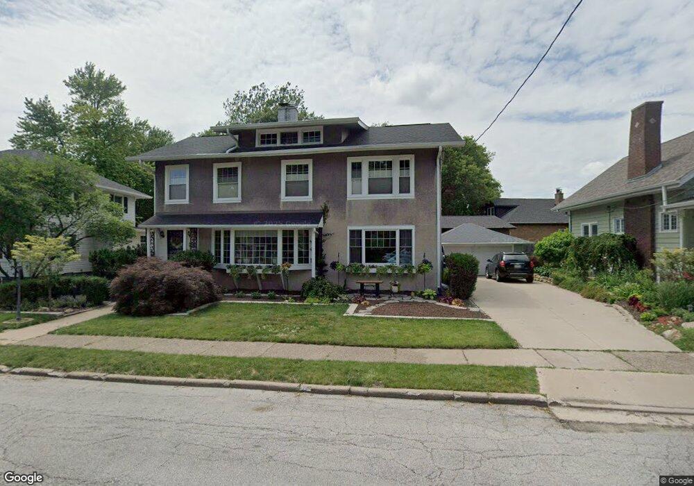
340 Forest Rd Davenport, IA 52803
East End NeighborhoodEstimated Value: $269,000 - $396,000
4
Beds
2
Baths
2,592
Sq Ft
$120/Sq Ft
Est. Value
About This Home
This home is located at 340 Forest Rd, Davenport, IA 52803 and is currently estimated at $311,842, approximately $120 per square foot. 340 Forest Rd is a home located in Scott County with nearby schools including McKinley Elementary School, Sudlow Intermediate School, and Central High School.
Ownership History
Date
Name
Owned For
Owner Type
Purchase Details
Closed on
May 13, 2013
Sold by
Zager Matthew S
Bought by
Sampson Adam R and Sampson Brian R
Current Estimated Value
Purchase Details
Closed on
Nov 8, 2011
Sold by
Ortlieb John T and Ortlieb Aimee M
Bought by
Turner James R and Turner Karen M
Create a Home Valuation Report for This Property
The Home Valuation Report is an in-depth analysis detailing your home's value as well as a comparison with similar homes in the area
Home Values in the Area
Average Home Value in this Area
Purchase History
| Date | Buyer | Sale Price | Title Company |
|---|---|---|---|
| Sampson Adam R | $128,000 | None Available | |
| Turner James R | $6,000 | None Available |
Source: Public Records
Tax History Compared to Growth
Tax History
| Year | Tax Paid | Tax Assessment Tax Assessment Total Assessment is a certain percentage of the fair market value that is determined by local assessors to be the total taxable value of land and additions on the property. | Land | Improvement |
|---|---|---|---|---|
| 2025 | $4,252 | $283,260 | $55,840 | $227,420 |
| 2024 | $4,262 | $261,850 | $55,840 | $206,010 |
| 2023 | $4,854 | $261,850 | $55,840 | $206,010 |
| 2022 | $4,876 | $236,140 | $45,690 | $190,450 |
| 2021 | $4,876 | $236,140 | $45,690 | $190,450 |
| 2020 | $4,692 | $224,740 | $45,690 | $179,050 |
| 2019 | $4,668 | $216,600 | $45,690 | $170,910 |
| 2018 | $4,386 | $216,600 | $45,690 | $170,910 |
| 2017 | $4,546 | $208,470 | $45,690 | $162,780 |
| 2016 | $4,374 | $208,470 | $0 | $0 |
| 2015 | $4,374 | $207,240 | $0 | $0 |
| 2014 | $4,410 | $207,240 | $0 | $0 |
| 2013 | $4,328 | $0 | $0 | $0 |
Source: Public Records
Map
Nearby Homes
- 49 Kenwood Ave
- 1717 Kenwood Ave
- 1806 Forest Rd
- 2905 Middle Rd
- 2950 E 18th St
- 123 Fernwood Ave
- 2704 E High St
- 1704 Jersey Ridge Rd
- 1708 Eastmere Dr
- 46 Hillcrest Ave
- 102 Forest Rd
- 1803 Belle Ave
- 1815 Belle Ave
- 1619 Christie St
- 1709 Christie St
- 1637 Broadlawn Ave
- 2222 E 13th St
- 204 Greenwood Ave
- 1504 Christie St
- 229 Brown St