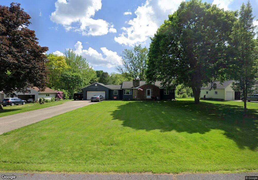
340 N Messner Rd New Franklin, OH 44319
Estimated Value: $212,586 - $258,000
3
Beds
1
Bath
1,252
Sq Ft
$180/Sq Ft
Est. Value
About This Home
This home is located at 340 N Messner Rd, New Franklin, OH 44319 and is currently estimated at $225,897, approximately $180 per square foot. 340 N Messner Rd is a home located in Summit County.
Ownership History
Date
Name
Owned For
Owner Type
Purchase Details
Closed on
Nov 7, 2002
Sold by
Lester Ruth M Trust
Bought by
Soles Kristopher M and Soles Jennifer M
Current Estimated Value
Home Financials for this Owner
Home Financials are based on the most recent Mortgage that was taken out on this home.
Original Mortgage
$123,068
Interest Rate
6.1%
Mortgage Type
FHA
Create a Home Valuation Report for This Property
The Home Valuation Report is an in-depth analysis detailing your home's value as well as a comparison with similar homes in the area
Home Values in the Area
Average Home Value in this Area
Purchase History
| Date | Buyer | Sale Price | Title Company |
|---|---|---|---|
| Soles Kristopher M | $125,000 | Minnesota Title |
Source: Public Records
Mortgage History
| Date | Status | Borrower | Loan Amount |
|---|---|---|---|
| Closed | Soles Kristopher M | $123,068 |
Source: Public Records
Tax History Compared to Growth
Tax History
| Year | Tax Paid | Tax Assessment Tax Assessment Total Assessment is a certain percentage of the fair market value that is determined by local assessors to be the total taxable value of land and additions on the property. | Land | Improvement |
|---|---|---|---|---|
| 2025 | $3,173 | $63,574 | $16,282 | $47,292 |
| 2024 | $3,173 | $63,574 | $16,282 | $47,292 |
| 2023 | $3,173 | $63,574 | $16,282 | $47,292 |
| 2022 | $2,889 | $45,088 | $11,547 | $33,541 |
| 2021 | $2,900 | $45,088 | $11,547 | $33,541 |
| 2020 | $2,849 | $45,090 | $11,550 | $33,540 |
| 2019 | $3,058 | $43,360 | $10,630 | $32,730 |
| 2018 | $2,639 | $43,360 | $10,630 | $32,730 |
| 2017 | $2,564 | $43,360 | $10,630 | $32,730 |
| 2016 | $2,533 | $38,170 | $10,630 | $27,540 |
| 2015 | $2,564 | $38,170 | $10,630 | $27,540 |
| 2014 | $2,544 | $38,170 | $10,630 | $27,540 |
| 2013 | $2,491 | $37,600 | $10,630 | $26,970 |
Source: Public Records
Map
Nearby Homes
- 451 Yager Rd
- 427 Center Rd
- 5776 Harter Home Dr
- 715 Highland Park Dr
- 781 Leeman Dr
- 6407 Southview Dr
- S/L 14,15 Shakes Hotel Dr
- 6090 Manchester Rd Unit 6096
- 899 Loway Dr
- 5892 Woodward Dr
- 6 Shrakes Hotel Dr
- 4 Shrakes Hotel Dr
- 7 Shrakes Hotel Dr
- 5 Shrakes Hotel Dr
- 3 Shrakes Hotel Dr
- 4881 S Main St
- 4944 Coleman Dr
- 4831 Christman Rd
- 1062 Stump Rd
- lot 8 Whyem Dr
- 350 N Messner Rd
- 324 N Messner Rd
- 360 N Messner Rd
- 361 N Messner Rd
- 318 N Messner Rd
- 331 N Messner Rd
- 341 N Messner Rd
- 5617 Dailey Rd
- 5557 Dailey Rd
- 323 N Messner Rd
- 272 N Messner Rd
- 5562 Dailey Rd
- 307 N Messner Rd
- 262 N Messner Rd
- 5582 Dailey Rd
- 5627 Dailey Rd
- 5590 Dailey Rd
- 5552 Dailey Rd
- 5572 Dailey Rd
- 230 W Nimisila Rd