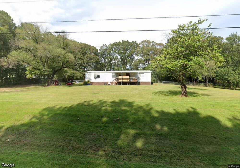
340 Pinecrest Rd Auburn, GA 30011
Estimated Value: $135,936 - $299,000
--
Bed
--
Bath
1,344
Sq Ft
$183/Sq Ft
Est. Value
About This Home
This home is located at 340 Pinecrest Rd, Auburn, GA 30011 and is currently estimated at $245,734, approximately $182 per square foot. 340 Pinecrest Rd is a home with nearby schools including Auburn Elementary School, Westside Middle School, and Apalachee High School.
Ownership History
Date
Name
Owned For
Owner Type
Purchase Details
Closed on
Jul 12, 2022
Sold by
Turnbull Jerry W
Bought by
Swinks Howard Lee
Current Estimated Value
Purchase Details
Closed on
Jan 26, 2013
Sold by
Swinks Katrina D Swinks
Bought by
Turnbull Jerry W
Purchase Details
Closed on
Nov 9, 1998
Sold by
Boggs Donald
Bought by
Swinks Katrina D
Home Financials for this Owner
Home Financials are based on the most recent Mortgage that was taken out on this home.
Original Mortgage
$52,352
Interest Rate
6.58%
Mortgage Type
FHA
Create a Home Valuation Report for This Property
The Home Valuation Report is an in-depth analysis detailing your home's value as well as a comparison with similar homes in the area
Home Values in the Area
Average Home Value in this Area
Purchase History
| Date | Buyer | Sale Price | Title Company |
|---|---|---|---|
| Swinks Howard Lee | -- | -- | |
| Turnbull Jerry W | $12,750 | -- | |
| Swinks Katrina D | $52,000 | -- |
Source: Public Records
Mortgage History
| Date | Status | Borrower | Loan Amount |
|---|---|---|---|
| Previous Owner | Swinks Katrina D | $52,352 |
Source: Public Records
Tax History Compared to Growth
Tax History
| Year | Tax Paid | Tax Assessment Tax Assessment Total Assessment is a certain percentage of the fair market value that is determined by local assessors to be the total taxable value of land and additions on the property. | Land | Improvement |
|---|---|---|---|---|
| 2024 | $247 | $10,200 | $10,000 | $200 |
| 2023 | $293 | $10,200 | $10,000 | $200 |
| 2022 | $333 | $10,200 | $10,000 | $200 |
| 2021 | $340 | $10,200 | $10,000 | $200 |
| 2020 | $305 | $10,200 | $10,000 | $200 |
| 2019 | $346 | $10,200 | $10,000 | $200 |
| 2018 | $333 | $10,200 | $10,000 | $200 |
| 2016 | $326 | $10,200 | $10,000 | $200 |
| 2015 | -- | $10,200 | $10,000 | $200 |
Source: Public Records
Map
Nearby Homes
- 331 Wages Rd
- 335 Wages Rd
- 1778 Wynfield Ln
- 2057 Blackberry Ln
- 60 Wood Chuck Ct
- 70 Wood Chuck Ct
- 1923 Westfall Landing
- 270 E Union Grove Cir
- 2063 Blackberry Ln
- 491 Glen Terrace Rd
- 280 Etheridge Rd
- 494 Courtney Ln Unit 2
- 81 Hills Shop Rd
- 539 Hayes Rd
- 189 Etheridge Rd
- 345 Etheridge Rd
- Chestnut Plan at Kentmere - Single Family Homes
- Coleford Plan at Kentmere - Single Family Homes
- Pembrooke Plan at Kentmere - Single Family Homes
- 0 Pinecrest Rd
- 334 Pinecrest Rd Unit 2
- 334 Pinecrest Rd
- 339 Pinecrest Rd
- 346 Pinecrest Rd
- 1743 Maston Rd
- 1236 Maston Rd
- 1343 Maston Rd
- 1756 Maston Rd
- 1283 Maston Rd
- 1336 Maston Rd
- 1303 Maston Rd
- 1266 Maston Rd
- 1356 Maston Rd
- 1193 Maston Rd
- 1316 Maston Rd
- 1346 Maston Rd
- 1363 Maston Rd
- 1263 Maston Rd
- 63 Arnold Poplar Ln Unit 26