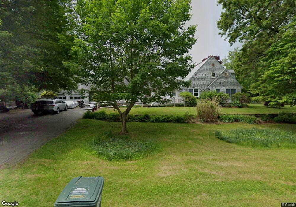
340 River Rd Pawcatuck, CT 06379
Estimated Value: $811,000 - $1,220,000
4
Beds
5
Baths
3,750
Sq Ft
$259/Sq Ft
Est. Value
About This Home
This home is located at 340 River Rd, Pawcatuck, CT 06379 and is currently estimated at $970,767, approximately $258 per square foot. 340 River Rd is a home located in New London County with nearby schools including Stonington Middle School, Stonington High School, and St. Michael School.
Ownership History
Date
Name
Owned For
Owner Type
Purchase Details
Closed on
Apr 7, 2010
Sold by
Fernholz Danielle
Bought by
Fernholz Patrick Francis
Current Estimated Value
Purchase Details
Closed on
Aug 21, 1996
Sold by
Brown William S and Brown Linda B
Bought by
Rybar Stephen J and Rybar Kathleen L
Create a Home Valuation Report for This Property
The Home Valuation Report is an in-depth analysis detailing your home's value as well as a comparison with similar homes in the area
Home Values in the Area
Average Home Value in this Area
Purchase History
| Date | Buyer | Sale Price | Title Company |
|---|---|---|---|
| Fernholz Patrick Francis | -- | -- | |
| Fernholz Patrick Francis | -- | -- | |
| Rybar Stephen J | $205,000 | -- | |
| Rybar Stephen J | $205,000 | -- |
Source: Public Records
Mortgage History
| Date | Status | Borrower | Loan Amount |
|---|---|---|---|
| Open | Rybar Stephen J | $140,000 | |
| Previous Owner | Rybar Stephen J | $490,000 | |
| Previous Owner | Rybar Stephen J | $103,500 |
Source: Public Records
Tax History
| Year | Tax Paid | Tax Assessment Tax Assessment Total Assessment is a certain percentage of the fair market value that is determined by local assessors to be the total taxable value of land and additions on the property. | Land | Improvement |
|---|---|---|---|---|
| 2025 | $8,072 | $421,500 | $123,800 | $297,700 |
| 2024 | $7,726 | $421,500 | $123,800 | $297,700 |
| 2023 | $7,654 | $421,500 | $123,800 | $297,700 |
| 2022 | $8,145 | $332,600 | $105,500 | $227,100 |
| 2021 | $8,212 | $332,600 | $105,500 | $227,100 |
| 2020 | $8,039 | $332,600 | $105,500 | $227,100 |
| 2019 | $8,092 | $332,600 | $105,500 | $227,100 |
| 2018 | $7,819 | $332,600 | $105,500 | $227,100 |
| 2017 | $7,499 | $314,300 | $110,300 | $204,000 |
| 2016 | $7,248 | $314,300 | $110,300 | $204,000 |
| 2015 | $6,937 | $314,300 | $110,300 | $204,000 |
| 2014 | $6,657 | $314,300 | $110,300 | $204,000 |
Source: Public Records
Map
Nearby Homes
- 16 Green Ave
- 417 River Rd
- 0 Green Ave
- 23 Summertime Cir
- 22 Summertime Cir
- 45 Summertime Cir
- 38 Summertime Cir
- 25 Summertime Cir
- 39 Summertime Cir
- 18 Timothy Dr
- 60 Avondale Rd
- 4 Shore Rd
- 4 Quail Run
- 9 Champlin Dr
- 10 Tristam St
- 24 Abbey Ln Unit 13
- 23 Abbey Ln Unit 12
- 20 Browning Rd
- 2 Pawcatuck Ave
- 60 Margin St Unit 102
Your Personal Tour Guide
Ask me questions while you tour the home.