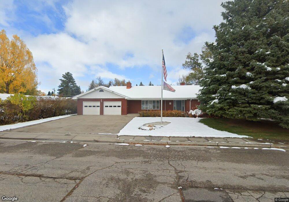
340 Shoshone St Lander, WY 82520
Estimated Value: $520,000 - $719,000
3
Beds
3
Baths
2,566
Sq Ft
$246/Sq Ft
Est. Value
About This Home
This home is located at 340 Shoshone St, Lander, WY 82520 and is currently estimated at $630,796, approximately $245 per square foot. 340 Shoshone St is a home located in Fremont County with nearby schools including Lander Valley High School and Lander Christian Academy.
Ownership History
Date
Name
Owned For
Owner Type
Purchase Details
Closed on
Aug 24, 2024
Sold by
Buck Marceleen Joy
Bought by
Lew Buck Revocable Trust and Buck
Current Estimated Value
Purchase Details
Closed on
Nov 10, 2010
Sold by
Buck Lew
Bought by
Buck Lew and The Lew Buck Revocable Trust
Purchase Details
Closed on
Sep 15, 2008
Sold by
Buck Joy and Joy Buck Living Trust
Bought by
Buck Lew and Lew Buck Revocable Trust
Purchase Details
Closed on
Sep 11, 2008
Sold by
Buck Joy and Joy Buck Rovocable Trust
Bought by
Buck Lew and Lew Buick Revocable Trust
Purchase Details
Closed on
Oct 11, 2007
Sold by
Buck Joy and Joy Buck Living Trust
Bought by
Buck Joy and Joy Buck Revocable Trust
Create a Home Valuation Report for This Property
The Home Valuation Report is an in-depth analysis detailing your home's value as well as a comparison with similar homes in the area
Home Values in the Area
Average Home Value in this Area
Purchase History
| Date | Buyer | Sale Price | Title Company |
|---|---|---|---|
| Lew Buck Revocable Trust | -- | None Listed On Document | |
| Lew Buck Revocable Trust | -- | None Listed On Document | |
| Buck Lew | -- | Fremont County Title | |
| Buck Lew | -- | Fremont County Title | |
| Buck Lew | -- | Fremount County Title | |
| Buck Joy | -- | None Available |
Source: Public Records
Tax History Compared to Growth
Tax History
| Year | Tax Paid | Tax Assessment Tax Assessment Total Assessment is a certain percentage of the fair market value that is determined by local assessors to be the total taxable value of land and additions on the property. | Land | Improvement |
|---|---|---|---|---|
| 2025 | $4,169 | $45,292 | $4,377 | $40,915 |
| 2024 | $4,169 | $57,011 | $5,835 | $51,176 |
| 2023 | $3,959 | $54,705 | $5,295 | $49,410 |
| 2022 | $3,494 | $46,640 | $5,295 | $41,345 |
| 2021 | $3,135 | $40,498 | $5,092 | $35,406 |
| 2020 | $3,020 | $39,091 | $5,092 | $33,999 |
| 2019 | $2,989 | $38,070 | $5,092 | $32,978 |
| 2018 | $2,665 | $36,582 | $5,092 | $31,490 |
| 2017 | $2,604 | $35,726 | $5,092 | $30,634 |
| 2016 | $2,256 | $31,393 | $5,092 | $26,301 |
| 2015 | $2,426 | $33,881 | $5,092 | $28,789 |
| 2014 | $2,190 | $30,917 | $5,092 | $25,825 |
Source: Public Records
Map
Nearby Homes
- 333 Cascade St
- 275 Cascade St
- 975 S 2nd St
- 230 Capitol St
- 108 Canyon St
- 400 S 1st St
- 605 Cliff St
- 685 Cedar St
- 200 Sweetwater St
- 824 Vance Dr
- 617 Main St Unit LotWP001
- 120 Roaring Fork Ct
- 791 Garner Dr
- 796 Welch Blvd
- 835 Garfield St
- 960 Dabich Ave
- 1520 Rodeo Dr
- 180 S 10th St
- 442 Eugene St
- 385 Wood St