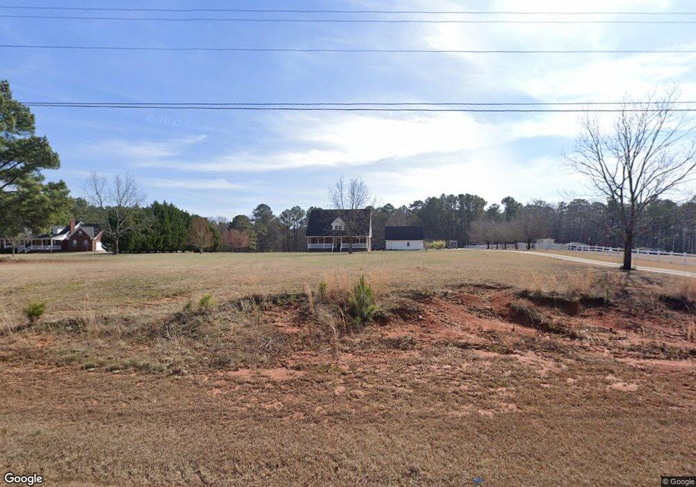
340 Starrsville Rd Covington, GA 30014
Estimated Value: $364,369 - $431,000
--
Bed
2
Baths
2,218
Sq Ft
$181/Sq Ft
Est. Value
About This Home
This home is located at 340 Starrsville Rd, Covington, GA 30014 and is currently estimated at $401,092, approximately $180 per square foot. 340 Starrsville Rd is a home located in Newton County with nearby schools including East Newton Elementary School, Indian Creek Middle School, and Eastside High School.
Ownership History
Date
Name
Owned For
Owner Type
Purchase Details
Closed on
Oct 24, 2008
Sold by
Pruitt Gordon G
Bought by
Pruitt Gordon G and Pruitt Diane P
Current Estimated Value
Home Financials for this Owner
Home Financials are based on the most recent Mortgage that was taken out on this home.
Original Mortgage
$158,400
Outstanding Balance
$101,990
Interest Rate
5.78%
Mortgage Type
New Conventional
Estimated Equity
$299,102
Purchase Details
Closed on
Aug 16, 2001
Sold by
Joyner Mrtin R and Joyner Jacqueline C
Bought by
Pruitt Gordon D
Home Financials for this Owner
Home Financials are based on the most recent Mortgage that was taken out on this home.
Original Mortgage
$133,200
Interest Rate
7.08%
Mortgage Type
New Conventional
Create a Home Valuation Report for This Property
The Home Valuation Report is an in-depth analysis detailing your home's value as well as a comparison with similar homes in the area
Home Values in the Area
Average Home Value in this Area
Purchase History
| Date | Buyer | Sale Price | Title Company |
|---|---|---|---|
| Pruitt Gordon G | -- | -- | |
| Pruitt Gordon D | $166,500 | -- |
Source: Public Records
Mortgage History
| Date | Status | Borrower | Loan Amount |
|---|---|---|---|
| Open | Pruitt Gordon G | $158,400 | |
| Previous Owner | Pruitt Gordon D | $133,200 |
Source: Public Records
Tax History Compared to Growth
Tax History
| Year | Tax Paid | Tax Assessment Tax Assessment Total Assessment is a certain percentage of the fair market value that is determined by local assessors to be the total taxable value of land and additions on the property. | Land | Improvement |
|---|---|---|---|---|
| 2024 | $2,273 | $131,320 | $12,480 | $118,840 |
| 2023 | $2,203 | $110,200 | $12,480 | $97,720 |
| 2022 | $2,062 | $105,000 | $12,480 | $92,520 |
| 2021 | $2,551 | $88,000 | $9,600 | $78,400 |
| 2020 | $2,500 | $78,320 | $19,200 | $59,120 |
| 2019 | $2,567 | $79,160 | $19,200 | $59,960 |
| 2018 | $2,502 | $76,760 | $19,200 | $57,560 |
| 2017 | $2,186 | $67,560 | $15,200 | $52,360 |
| 2016 | $1,814 | $55,720 | $7,200 | $48,520 |
| 2015 | $1,656 | $52,120 | $7,200 | $44,920 |
| 2014 | $1,635 | $51,640 | $0 | $0 |
Source: Public Records
Map
Nearby Homes
- 25 Abelia Dr
- 70 Graystone Dr
- 115 Rose Creek Dr
- 645 5th Ave
- 25 Caseys Way
- 70 Alcovy Reserve Way
- 90 Alcovy Reserve Way
- 160 Rose Creek Dr
- 150 Alcovy Reserve Way
- 155 Rose Creek Dr
- 95 Cambridge Dr
- 0 Briarpatch Dr Unit 7614077
- 0 Briarpatch Dr Unit 10562648
- 25 Hornbeam Way
- 30 Hollyhock Ln
- 30 Snapdragon Ln
- 20 Mariposa Place
- 20 Kestrel Cir
- 685 Egrets Landing Unit 58
- 20 Balfour Dr
- 356 Starrsville Rd
- 294 Starrsville Rd
- 387 Chester Piper Rd
- 440 Starrsville Rd
- 403 Chester Piper Rd Unit 7
- 458 Starrsville Rd
- 855 Highway 213
- 474 Starrsville Rd
- 353 Chester Piper Rd
- 490 Starrsville Rd
- 127 Old Starrsville Rd
- 506 Starrsville Rd
- 101 Old Starrsville Rd
- 65 Meadow Wood Dr
- 75 Meadow Wood Dr
- 356 Chester Piper Rd
- 55 Meadow Wood Dr
- 85 Meadow Wood Dr
- 45 Meadow Wood Dr
- 95 Meadow Wood Dr