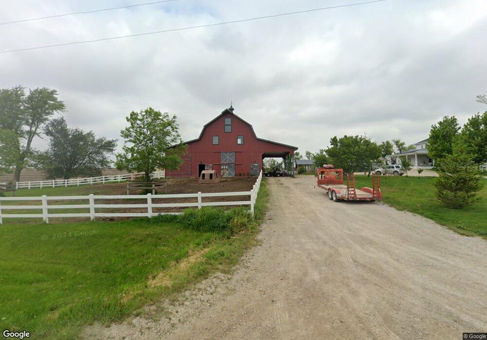
3400 Walford Rd Swisher, IA 52338
Estimated Value: $1,123,000 - $1,188,181
4
Beds
1
Bath
3,357
Sq Ft
$343/Sq Ft
Est. Value
About This Home
This home is located at 3400 Walford Rd, Swisher, IA 52338 and is currently estimated at $1,151,060, approximately $342 per square foot. 3400 Walford Rd is a home with nearby schools including Prairie Crest Elementary School, Prairie Heights Elementary School, and Prairie View Elementary School.
Ownership History
Date
Name
Owned For
Owner Type
Purchase Details
Closed on
Jan 11, 2024
Sold by
Hynek Paul E and Hynek Nicole
Bought by
Cedar Rapids Airport Commission
Current Estimated Value
Purchase Details
Closed on
May 22, 2015
Sold by
Wittrock Farms Inc
Bought by
Hynek Paul E and Hynek Nicole
Home Financials for this Owner
Home Financials are based on the most recent Mortgage that was taken out on this home.
Original Mortgage
$25,500
Interest Rate
3.65%
Mortgage Type
Stand Alone Second
Create a Home Valuation Report for This Property
The Home Valuation Report is an in-depth analysis detailing your home's value as well as a comparison with similar homes in the area
Home Values in the Area
Average Home Value in this Area
Purchase History
| Date | Buyer | Sale Price | Title Company |
|---|---|---|---|
| Cedar Rapids Airport Commission | $1,100,000 | None Listed On Document | |
| Cedar Rapids Airport Commission | $1,100,000 | None Listed On Document | |
| Hynek Paul E | $150,000 | None Available |
Source: Public Records
Mortgage History
| Date | Status | Borrower | Loan Amount |
|---|---|---|---|
| Previous Owner | Hynek Paul E | $25,500 |
Source: Public Records
Tax History Compared to Growth
Tax History
| Year | Tax Paid | Tax Assessment Tax Assessment Total Assessment is a certain percentage of the fair market value that is determined by local assessors to be the total taxable value of land and additions on the property. | Land | Improvement |
|---|---|---|---|---|
| 2025 | $9,722 | $764,400 | $70,000 | $694,400 |
| 2024 | $6,266 | $770,000 | $70,000 | $700,000 |
| 2023 | $6,266 | $768,100 | $70,000 | $698,100 |
| 2022 | $6,166 | $425,400 | $70,000 | $355,400 |
| 2021 | $2,062 | $425,400 | $70,000 | $355,400 |
| 2020 | $2,062 | $161,300 | $44,600 | $116,700 |
| 2019 | $2,288 | $161,300 | $44,600 | $116,700 |
| 2018 | $2,320 | $155,400 | $44,600 | $110,800 |
| 2017 | $1,994 | $135,200 | $44,600 | $90,600 |
| 2016 | $1,838 | $122,200 | $44,600 | $77,600 |
| 2015 | $1,922 | $128,400 | $44,600 | $83,800 |
| 2014 | $1,922 | $128,400 | $44,600 | $83,800 |
| 2013 | $1,806 | $128,400 | $44,600 | $83,800 |
Source: Public Records
Map
Nearby Homes
- 0 Lawrence Drive West SW Unit C
- 0 Lawrence Drive East SW Unit A 2502372
- 0 Lawrence Drive East SW Unit B 2502371
- 260 Howard Ave NW
- 241 Howard Ave NW
- 230 Howard Ave NW
- 170 Pleasant Hill Dr NW
- 160 Pleasant Hill Dr NW
- 8905 6th St SW Unit Land Lease
- 2538 120th St NW
- 75 Jefferson Ave SW
- 110 Division St NE
- 1065 Highway 965 NW
- 79 3rd St SE
- 527 Swisher View Dr SW
- Lot 5 Joco 50 Subdivision
- Lot
- 115 Benesh Ln
- Lot
- 0 6th St & 76th Ave SW Unit 202505956