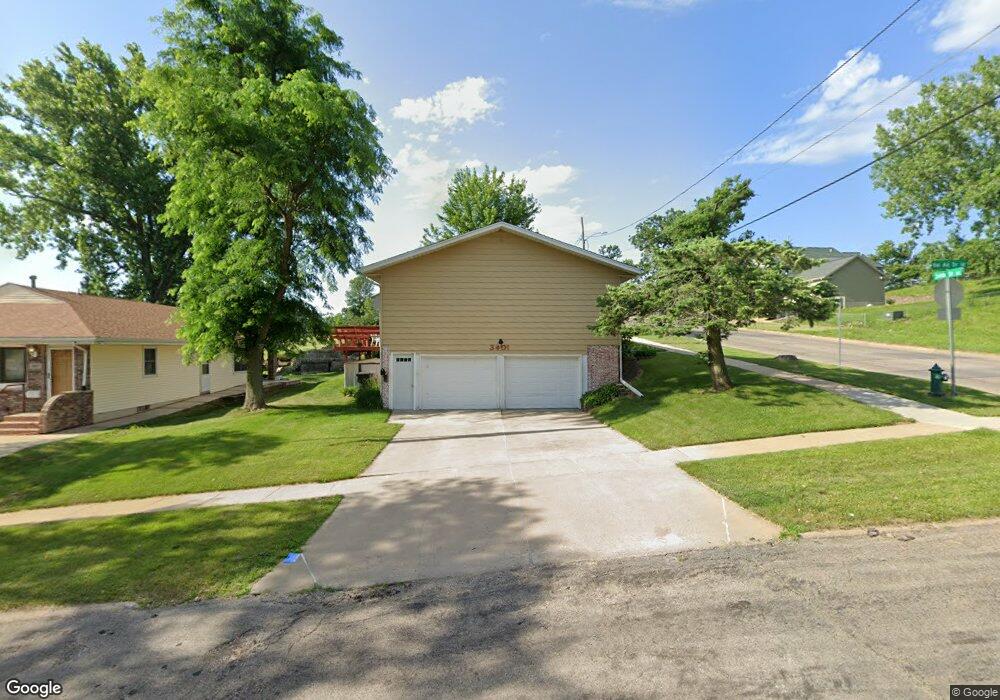
3401 Bel Air Dr SE Cedar Rapids, IA 52403
Estimated Value: $176,000 - $211,000
3
Beds
2
Baths
1,176
Sq Ft
$163/Sq Ft
Est. Value
About This Home
This home is located at 3401 Bel Air Dr SE, Cedar Rapids, IA 52403 and is currently estimated at $191,495, approximately $162 per square foot. 3401 Bel Air Dr SE is a home located in Linn County with nearby schools including Summit Elementary School, Erskine Elementary School, and McKinley STEAM Academy.
Ownership History
Date
Name
Owned For
Owner Type
Purchase Details
Closed on
Feb 9, 2024
Sold by
Dlouhy Jodi L
Bought by
Jodi L Dlouhy Revocable Trust and Dlouhy
Current Estimated Value
Purchase Details
Closed on
Sep 9, 2022
Sold by
Montgomery Diane M
Bought by
Dlouhy Jodi L
Create a Home Valuation Report for This Property
The Home Valuation Report is an in-depth analysis detailing your home's value as well as a comparison with similar homes in the area
Home Values in the Area
Average Home Value in this Area
Purchase History
| Date | Buyer | Sale Price | Title Company |
|---|---|---|---|
| Jodi L Dlouhy Revocable Trust | -- | None Listed On Document | |
| Dlouhy Jodi L | $1,000 | -- |
Source: Public Records
Tax History Compared to Growth
Tax History
| Year | Tax Paid | Tax Assessment Tax Assessment Total Assessment is a certain percentage of the fair market value that is determined by local assessors to be the total taxable value of land and additions on the property. | Land | Improvement |
|---|---|---|---|---|
| 2025 | $2,986 | $187,900 | $32,800 | $155,100 |
| 2024 | $2,972 | $182,600 | $32,800 | $149,800 |
| 2023 | $2,972 | $168,700 | $29,800 | $138,900 |
| 2022 | $2,784 | $153,200 | $26,800 | $126,400 |
| 2021 | $2,800 | $146,800 | $26,800 | $120,000 |
| 2020 | $2,800 | $138,800 | $20,900 | $117,900 |
| 2019 | $2,606 | $132,700 | $20,900 | $111,800 |
| 2018 | $2,470 | $132,700 | $20,900 | $111,800 |
| 2017 | $2,476 | $122,200 | $20,900 | $101,300 |
| 2016 | $2,551 | $120,000 | $20,900 | $99,100 |
| 2015 | $2,591 | $121,795 | $20,872 | $100,923 |
| 2014 | $2,406 | $121,795 | $20,872 | $100,923 |
| 2013 | $1,140 | $121,795 | $20,872 | $100,923 |
Source: Public Records
Map
Nearby Homes
- 3510 Pioneer Ave SE
- 3535 Pioneer Ave SE
- 3600 Bel Air Dr SE
- 1331 34th St SE
- 1401 Harold Dr SE
- 1521 Oak Ridge Ln SE Unit 3
- 2861 Seely Ave SE
- 1241 38th St SE
- 1111 Brockman Dr SE
- 1013 36th St SE
- 1425 42nd St SE
- 1135 Crestview Dr SE
- 1158 28th St SE
- 3630 Mt Vernon Rd SE Unit 6
- 1310 42nd St SE
- 1310 42nd St SE Unit LotWP001
- 1117 Crestview Dr SE
- TBD 42nd St SE
- Tbd 42nd St SE
- Tbd 42nd St SE
- 3407 Bel Air Dr SE
- 1520 34th St SE
- 3413 Bel Air Dr SE
- 1528 34th St SE
- 1511 34th St SE
- 3330 Pioneer Ave SE
- 1438 34th St SE
- 3419 Bel Air Dr SE
- 3412 Bel Air Dr SE
- 1503 34th St SE
- 3504 Pioneer Ave SE Unit 3504
- 3502 Pioneer Ave SE Unit 3502
- 3425 Bel Air Dr SE
- 3418 Bel Air Dr SE
- 1433 34th St SE
- 1427 34th St SE
- 1424 34th St SE
- 3501 Bel Air Dr SE
- 3424 Bel Air Dr SE
- 1602 34th St SE Unit 1602