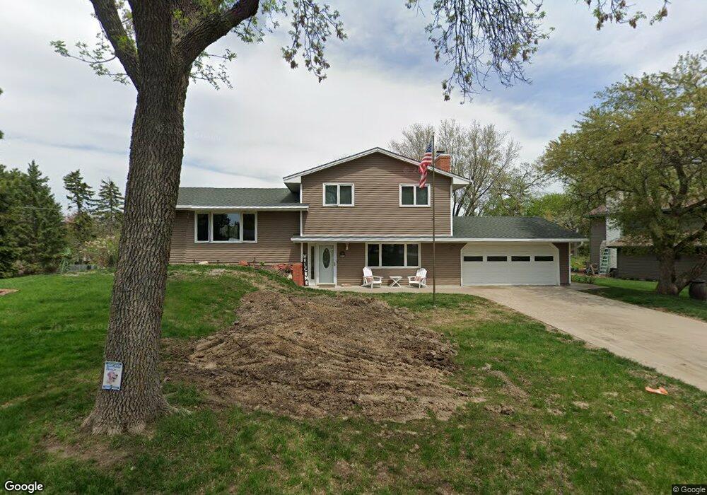
3402 Perrot Ln Burnsville, MN 55337
Estimated Value: $391,554 - $428,000
3
Beds
3
Baths
1,750
Sq Ft
$233/Sq Ft
Est. Value
About This Home
This home is located at 3402 Perrot Ln, Burnsville, MN 55337 and is currently estimated at $407,389, approximately $232 per square foot. 3402 Perrot Ln is a home located in Dakota County with nearby schools including William Byrne Elementary School, Burnsville High School, and Gateway STEM Academy.
Ownership History
Date
Name
Owned For
Owner Type
Purchase Details
Closed on
Aug 30, 2011
Sold by
Sass Eldona O
Bought by
Wesley William H and Wesley Heidi L
Current Estimated Value
Home Financials for this Owner
Home Financials are based on the most recent Mortgage that was taken out on this home.
Original Mortgage
$133,500
Outstanding Balance
$92,805
Interest Rate
4.58%
Mortgage Type
New Conventional
Estimated Equity
$314,584
Create a Home Valuation Report for This Property
The Home Valuation Report is an in-depth analysis detailing your home's value as well as a comparison with similar homes in the area
Home Values in the Area
Average Home Value in this Area
Purchase History
| Date | Buyer | Sale Price | Title Company |
|---|---|---|---|
| Wesley William H | $183,500 | Midwest Guaranty Title Co |
Source: Public Records
Mortgage History
| Date | Status | Borrower | Loan Amount |
|---|---|---|---|
| Open | Wesley William H | $133,500 |
Source: Public Records
Tax History Compared to Growth
Tax History
| Year | Tax Paid | Tax Assessment Tax Assessment Total Assessment is a certain percentage of the fair market value that is determined by local assessors to be the total taxable value of land and additions on the property. | Land | Improvement |
|---|---|---|---|---|
| 2024 | $3,812 | $363,900 | $83,900 | $280,000 |
| 2023 | $3,812 | $365,600 | $83,900 | $281,700 |
| 2022 | $3,154 | $357,600 | $83,700 | $273,900 |
| 2021 | $3,232 | $301,100 | $72,800 | $228,300 |
| 2020 | $3,192 | $293,100 | $69,300 | $223,800 |
| 2019 | $3,077 | $279,900 | $66,000 | $213,900 |
| 2018 | $2,951 | $258,700 | $62,900 | $195,800 |
| 2017 | $2,697 | $242,300 | $59,900 | $182,400 |
| 2016 | $2,721 | $220,500 | $57,100 | $163,400 |
| 2015 | $2,539 | $196,347 | $50,759 | $145,588 |
| 2014 | -- | $191,006 | $49,621 | $141,385 |
| 2013 | -- | $168,770 | $44,470 | $124,300 |
Source: Public Records
Map
Nearby Homes
- 4427 Cinnamon Ridge Cir
- 4463 Cinnamon Ridge Cir
- 4425 Cinnamon Ridge Cir
- 3017 Mcleod St
- 4413 Slater Rd
- 11459 Galtier Dr
- 4632 Westwood Ln
- 3309 Red Oak Cir N
- 11902 River Hills Cir
- 11921 Baypoint Dr
- 4370 Nicols Rd
- 2123 Cliffhill Ln
- 4774 Slater Rd
- 11900 Highland View Cir
- 10934 Southview Dr
- 2115 Cliffview Dr
- 11036 27th Ave S
- 11017 27th Ave S
- 319 River Woods Ln
- 2081 Copper Ln
- 3404 Perrot Ln
- 11601 Galtier Dr
- 11605 Galtier Dr
- 11521 Galtier Dr
- 4503 Slater Rd
- 3406 Selkirk Dr
- 3407 Selkirk Dr
- 4505 Slater Rd
- 11613 Galtier Dr
- 4501 Slater Rd
- 11519 Galtier Dr
- 4537 Cinnamon Ridge Trail
- 4533 Cinnamon Ridge Trail
- 4541 Cinnamon Ridge Trail
- 11617 Galtier Dr
- 4539 Cinnamon Ridge Trail
- 4507 Slater Rd
- 4499 Slater Rd
- 11517 Galtier Dr
- 11600 Galtier Dr