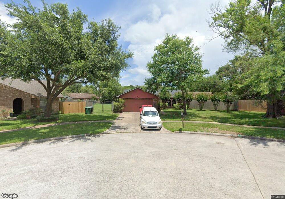
3402 Pine Ridge Ln Houston, TX 77088
Greater Inwood NeighborhoodEstimated Value: $202,000 - $236,000
3
Beds
2
Baths
1,357
Sq Ft
$156/Sq Ft
Est. Value
About This Home
This home is located at 3402 Pine Ridge Ln, Houston, TX 77088 and is currently estimated at $212,029, approximately $156 per square foot. 3402 Pine Ridge Ln is a home located in Harris County with nearby schools including Stovall School, Caraway Intermediate School, and Caraway Elementary School.
Ownership History
Date
Name
Owned For
Owner Type
Purchase Details
Closed on
Oct 20, 1999
Sold by
Fredrickson Mark T
Bought by
Usher Dale W and Usher Patricia E
Current Estimated Value
Home Financials for this Owner
Home Financials are based on the most recent Mortgage that was taken out on this home.
Original Mortgage
$56,700
Outstanding Balance
$17,042
Interest Rate
7.77%
Estimated Equity
$194,987
Purchase Details
Closed on
Mar 27, 1996
Sold by
Lowe James R
Bought by
Inwood Pine Forest Environmental Trust
Purchase Details
Closed on
Feb 5, 1996
Sold by
Jackson Dyetra Y
Bought by
Lowe James R
Create a Home Valuation Report for This Property
The Home Valuation Report is an in-depth analysis detailing your home's value as well as a comparison with similar homes in the area
Home Values in the Area
Average Home Value in this Area
Purchase History
| Date | Buyer | Sale Price | Title Company |
|---|---|---|---|
| Usher Dale W | -- | American Title Co | |
| Inwood Pine Forest Environmental Trust | -- | -- | |
| Lowe James R | -- | -- |
Source: Public Records
Mortgage History
| Date | Status | Borrower | Loan Amount |
|---|---|---|---|
| Open | Usher Dale W | $56,700 | |
| Closed | Lowe James R | $0 | |
| Closed | Usher Dale W | $52,700 |
Source: Public Records
Tax History Compared to Growth
Tax History
| Year | Tax Paid | Tax Assessment Tax Assessment Total Assessment is a certain percentage of the fair market value that is determined by local assessors to be the total taxable value of land and additions on the property. | Land | Improvement |
|---|---|---|---|---|
| 2025 | $2,525 | $196,551 | $50,157 | $146,394 |
| 2024 | $2,525 | $199,213 | $50,157 | $149,056 |
| 2023 | $2,525 | $217,722 | $50,157 | $167,565 |
| 2022 | $3,466 | $187,035 | $42,090 | $144,945 |
| 2021 | $3,300 | $154,372 | $35,075 | $119,297 |
| 2020 | $3,152 | $142,554 | $35,075 | $107,479 |
| 2019 | $3,004 | $114,202 | $18,239 | $95,963 |
| 2018 | $1,058 | $105,694 | $18,239 | $87,455 |
| 2017 | $2,380 | $105,694 | $18,239 | $87,455 |
| 2016 | $2,164 | $105,694 | $18,239 | $87,455 |
| 2015 | $1,425 | $90,478 | $18,239 | $72,239 |
| 2014 | $1,425 | $76,528 | $18,239 | $58,289 |
Source: Public Records
Map
Nearby Homes
- 7726 Ashmole Ln
- 3522 Almington Ln
- 8510 Woodcamp Dr
- 7610 Alperton Dr
- 7702 Inwood Hills Ln
- 8337 Sunnyhill St
- 8518 Wild Basin Dr
- 2819 Rigel Rd
- 7709 Inwood Hills Ln
- 7717 Inwood Hills Ln
- 2923 Ellington St
- 7814 Inwood Grove Ln
- DOVE Plan at Alaia Crossing
- CEDAR Plan at Alaia Crossing
- BOXWOOD Plan at Alaia Crossing
- 7712 Inwood Grove Ln
- 7716 Inwood Grove Ln
- 7816 Inwood Grove Ln
- 7718 Inwood Grove Ln
- 7800 Sand St
- 3406 Pine Ridge Ln
- 7743 Ashmole Ln
- 7747 Ashmole Ln
- 3403 Pine Ridge Ln
- 7739 Ashmole Ln
- 3419 Abinger Ln
- 3415 Abinger Ln
- 3410 Pine Ridge Ln
- 3423 Abinger Ln
- 3407 Pine Ridge Ln
- 3411 Abinger Ln
- 7735 Ashmole Ln
- 3427 Abinger Ln
- 3411 Pine Ridge Ln
- 3414 Pine Ridge Ln
- 3406 Mckinley Ln
- 7731 Ashmole Ln
- 3431 Abinger Ln
- 3402 Mckinley Ln
- 3415 Pine Ridge Ln