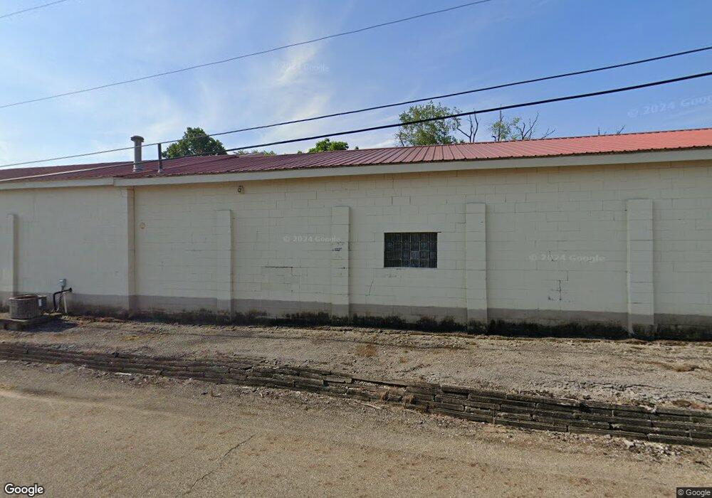
3405 Middlebranch Ave NE Canton, OH 44705
Plain Township NeighborhoodEstimated Value: $222,520
--
Bed
1
Bath
5,960
Sq Ft
$37/Sq Ft
Est. Value
About This Home
This home is located at 3405 Middlebranch Ave NE, Canton, OH 44705 and is currently estimated at $222,520, approximately $37 per square foot. 3405 Middlebranch Ave NE is a home located in Stark County with nearby schools including Frazer Elementary School, Glenwood Intermediate School, and GlenOak High School.
Ownership History
Date
Name
Owned For
Owner Type
Purchase Details
Closed on
Jan 3, 2006
Sold by
Deckerd Daniel K and Deckerd Nancy L
Bought by
S & A Venture Ltd
Current Estimated Value
Purchase Details
Closed on
Apr 10, 2002
Sold by
Shimko Marie L and Shimko Diana M
Bought by
Deckerd Daniel K
Home Financials for this Owner
Home Financials are based on the most recent Mortgage that was taken out on this home.
Original Mortgage
$65,680
Interest Rate
6.82%
Mortgage Type
Commercial
Create a Home Valuation Report for This Property
The Home Valuation Report is an in-depth analysis detailing your home's value as well as a comparison with similar homes in the area
Home Values in the Area
Average Home Value in this Area
Purchase History
| Date | Buyer | Sale Price | Title Company |
|---|---|---|---|
| S & A Venture Ltd | $120,000 | -- | |
| Deckerd Daniel K | $83,500 | -- |
Source: Public Records
Mortgage History
| Date | Status | Borrower | Loan Amount |
|---|---|---|---|
| Previous Owner | Deckerd Daniel K | $65,680 |
Source: Public Records
Tax History Compared to Growth
Tax History
| Year | Tax Paid | Tax Assessment Tax Assessment Total Assessment is a certain percentage of the fair market value that is determined by local assessors to be the total taxable value of land and additions on the property. | Land | Improvement |
|---|---|---|---|---|
| 2025 | -- | $65,280 | $24,400 | $40,880 |
| 2024 | -- | $65,280 | $24,400 | $40,880 |
| 2023 | $3,333 | $54,400 | $24,400 | $30,000 |
| 2022 | $3,356 | $54,400 | $24,400 | $30,000 |
| 2021 | $3,392 | $54,400 | $24,400 | $30,000 |
| 2020 | $3,188 | $49,460 | $22,190 | $27,270 |
| 2019 | $3,156 | $49,460 | $22,190 | $27,270 |
| 2018 | $3,141 | $49,460 | $22,190 | $27,270 |
| 2017 | $3,168 | $44,360 | $17,640 | $26,720 |
| 2016 | $3,186 | $44,360 | $17,640 | $26,720 |
| 2015 | $3,107 | $44,360 | $17,640 | $26,720 |
| 2014 | $1,009 | $42,260 | $16,840 | $25,420 |
| 2013 | $1,489 | $42,260 | $16,840 | $25,420 |
Source: Public Records
Map
Nearby Homes
- 1644 33rd St NE
- 3022 Taft Ave NE
- 1601 33rd St NE
- 1902 39th St NE
- 1428 35th St NE
- 1912 40th St NE
- 0 St Elmo Ave NE Unit 5159780
- 0 St Elmo Ave NE Unit 5089961
- 2017 28th St NE
- 3305 Regent Ave NE
- 3606 Rowland Ave NE
- 4015 Pelham St NE Unit 3A
- 3619 Rowland Ave NE
- 1306 Milford St NE
- 1638 Warrick Place NE
- 000 Rowland Ave NE
- 3321 Martindale Rd NE
- 1610 Colonial Blvd NE
- 4123 Regentview St NE
- 1417 Colonial Blvd NE
- 3325 Middlebranch Ave NE
- 3413 Middlebranch Ave NE
- 3315 Middlebranch Ave NE
- 3307 Middlebranch Ave NE
- 3402 Middlebranch Ave NE
- 3303 Middlebranch Ave NE
- 3414 Middlebranch Ave NE
- 3406 Middlebranch Ave NE
- 3410 Middlebranch Ave NE
- 3316 Middlebranch Ave NE
- 3312 Middlebranch Ave NE
- 3411 Middlebranch Ave NE
- 3224 Kuemerle Ct NE
- 3225 Middlebranch Ave NE
- 3300 Middlebranch Ave NE
- 3304 Middlebranch Ave NE
- 2121 34th St NE
- 0 34th St NE Unit 3025037
- 2120 34th St NE
- 3228 Middlebranch Ave NE